The dramatic events that triggered war between France and China!
The Ambush at Bắc Lệ in June 1884 marked a turning point in the escalating tensions between France and China in northern Tonkin. In June 1884, a French column under Lieutenant Colonel Alphonse Dugenne, comprised of about 465 French troops and 284 Tonkinese auxiliaries, with a supply column of local ‘coolies’ and baggage mules, was ambushed by a much larger Chinese regular force near Bắc Lệ, on the road from Phủ Lạng Thương to Lạng Sơn. The attack was the catalyst for the Sino-French war of 1884-85 that saw French forces of the Tonkin Expeditionary Corps engaged in combat with Chinese forces across northern Vietnam, mainland China, and Formosa (now Taiwan).
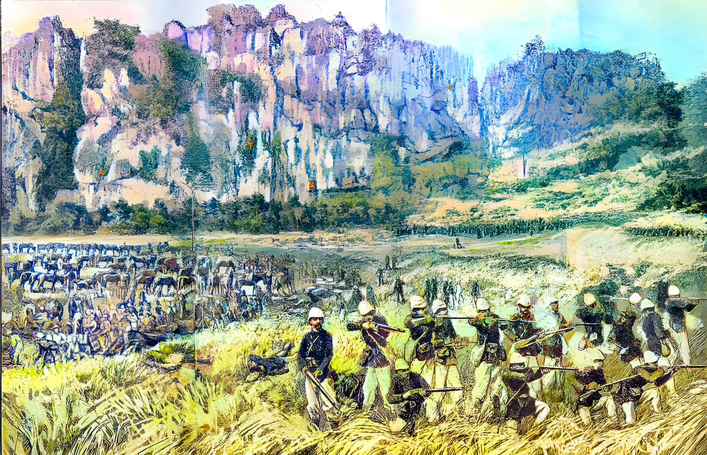
Key facts
You may also be interested in these firsthand battlefield studies covering the Tonkin Campaign and Sino-French War: Tonkin Campaign / Sino-French War (1883-86) ♦ Sơn Tây Campaign (1883) ♦ Bắc Lệ Ambush (1884) ♦ Siege of Tuyên Quang (1884-85) ♦ Battle of Hòa Mộc (1885)
Google Map location of the Bắc Lệ ambush
🎧 Prefer to listen? This article is also available as a 45-minute podcast
Tip: If Podbean overlay appears after pausing, click the × in the top-right corner to return to the player controls.
🧭🥾 Walking the Battlefield
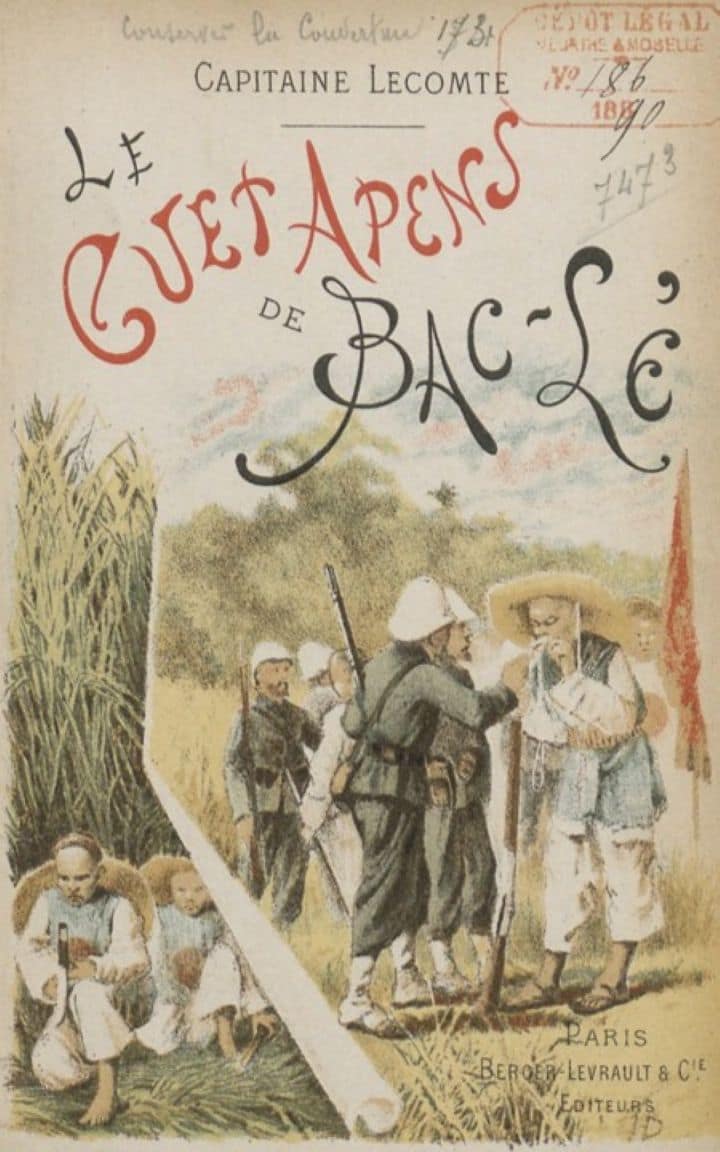
I explored the site of the Bắc Lệ ambush in April 2025. equipped with unit histories, French and Vietnamese accounts, sketches, maps, and GIS overlays. Nothing remains of the Chinese forts, and the events of 1884 are not taught in Vietnam–a war between the former colonial power and Vietnam’s neighbour, China, is too sensitive a subject to be remembered. Very little has been written about the Bắc Lệ ambush, and most of the available information merely reiterates earlier secondary sources. The exception is an 1890 publication by Capitaine (later Général de Division) Jean François Alphonse Lecomte; an officer of the French Army Topographical Service. Capitaine Lecomte was the reconnaissance officer for the Dugenne column and was tasked with mapping the hitherto uncharted route to Lang Son and Cao Bang.
Table of Contents
- Historical Context: researching the Ambush at Bắc Lệ
- Strategic context: The Tonkin Campaign
- French plan for the occupation of the border
- 🔒The march to Lang Son
- 🔒Chinese troops open fire on the column
- 🔒The ambush on 23 June 1884
- 🔒24 June – the battle continues
- 🔒The column regroups at Bắc Lệ
- 🔒Arrival of General de Negrier’s relief force
- 🔒France and China seek a diplomatic solution to the crisis
- 🔒Aftermath of the Bắc Lệ ambush
- 🔒Assessment of the French performance during the ambush at Bắc Lệ
- 🔒Additional images of the Bắc Lệ battle site
- 🔒Sources
- 📚 Further Reading
- 🧭 Battlefield Travel Guide: Ambush at Bắc Lệ (1884)
- FAQ: Ambush at Bac Le (1884)
Historical Context: researching the Ambush at Bắc Lệ
Capitaine Lecomte’s account
Capitaine Lecomte wrote a very detailed account of the journey and the battle. The account was published in Paris as ‘Le guet-apens de Bac-Lé’ (The Bắc Lệ Ambush) in 1890, accompanied by detailed mapping and sketches.
To understand the battlefield and write this article, I translated Lecomte’s book into English (with Google Translate assistance) and superimposed his sketches and maps over the current real-world data. The mapping, combined with narrative descriptions, enabled me to accurately identify the battlefield’s physical features, explore the battle sites in April 2025, and gain a comprehensive understanding of what occurred there. I suspect that I am the first to review this work in English for a very long time, and perhaps the first to walk the battlefield enabled by such detailed terrain analysis.
Strategic context: The Tonkin Campaign
French incursions in Tonkin
France had colonised southern Vietnam (Cochin China) between 1862 and 1867. In 1873, French forces under Lieutenant Francis Garnier briefly conquered Hanoi in Tonkin (northern Vietnam) but withdrew under a diplomatic settlement. In 1881, Admiral Henri Rivière led a second, much larger, expedition into Tonkin. Rivière’s forces bombarded and captured the Imperial Citadel, forcing the Nguyen Emperor to accede to French demands for access.
This European intrusion into what had traditionally been a Chinese client state caused great concern in the Qing court. With covert Chinese support, the French faced opposition from Liu Yongfu’s mercenary ‘Black Flag Army’ and Vietnamese forces.
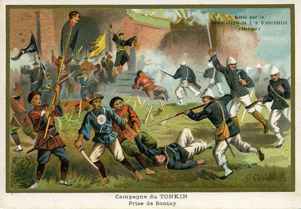
At Son Tay in December 1883, a French force of about 9,000 troops defeated a combined Black Flag/Vietnamese/Chinese regular Guanxi army of some 12,000 soldiers. In March 1884, a French force under General Mallot routed the Chinese Guangxi Army at their stronghold of Bắc Ninh. Further French victories at Hưng Hóa, Thái Nguyên, and Tuyen Quang secured the Red River Delta region and largely eliminated the threat from the Black Flag Army and Vietnamese forces.
The Treaty of Tientsin
On 11 May 1884, the same day as the French victory at Thái Nguyên, Chinese and French representatives signed the Treaty of Tientsin. The treaty stipulated the immediate evacuation of Chinese forces from Tonkin, China’s recognition of the French protectorate over Tonkin, recognition of prior French treaties with the Vietnamese court at Hue, and the establishment of a free-trade agreement along the Chinese-Tonkinese border. In return, the French guaranteed security along the border, relinquished their demands for indemnity, and guaranteed not to demean the Celestial Court in any future treaty negotiations. The treaty included an additional clause, agreed by Li-Hung-Chang, the Chinese representative, and by Frigate Captain Fournier, the French representative.
“China undertakes to immediately withdraw the Chinese garrisons in Tonkin to the borders.” After a period of twenty days, that is to say, on June 6 , French troops will be able to occupy Lang-Son, Cao-Bang, That-Ké and all the places in Tonkin territory backing onto the borders of Quang-Tong and Quang-Si; on the same date, naval stations will be able to be established along the entire coast of Tonkin. “After a period of 40 days, that is to say, on June 26, French troops will be able to occupy Lao-Kai and all the places in Tonkin backing onto the Yun-Nan border. Once these periods have expired, the Chinese garrisons lingering on the territory of Tonkin will be summarily expelled.”
Extract from the Treaty of Tientsin
While the Qing Court negotiated and signed the treaty, the ‘war faction’ within the court, led by Zhang Zhidong, opposed the treaty and was determined to resist further French incursions. The ongoing influence of these hawkish leaders played a significant part in the events that followed.
French plan for the occupation of the border
Rapid follow-up of the Chinese retreat
With the Tientsin Treaty in place, the French sought to follow closely behind the Chinese forces as they withdrew from northern Tonkin. This would prevent local warlords and brigands from filling the security vacuum, and ensure Chinese forces did not destroy infrastructure as they departed.
The priority for the French was to secure key posts along the Tonkin/China border, including Lang-Son, That-Ké, and Cao-Bang (these locations would feature again 65 years later in the Battle for Route Coloniale No. 4). For mapping, the French had only a crudely constructed Annamite map they had captured from the Black Flags, although it did provide information on the route and strategic locations.
Forming the Dugenne Column
General Millot formed a column of troops for the occupation of the border. Lieutenant Colonel Alphones Dugenne was designated commander and assigned a force comprising marine infantry, Tonkinese riflemen, cavalry, pontonniers (bridge engineers), medical staff, a signals detachment, a photographer, and coolies (native porters). Mules and oxen would carry additional supplies. Dugenne’s column would also undertake a topographical survey along the route.
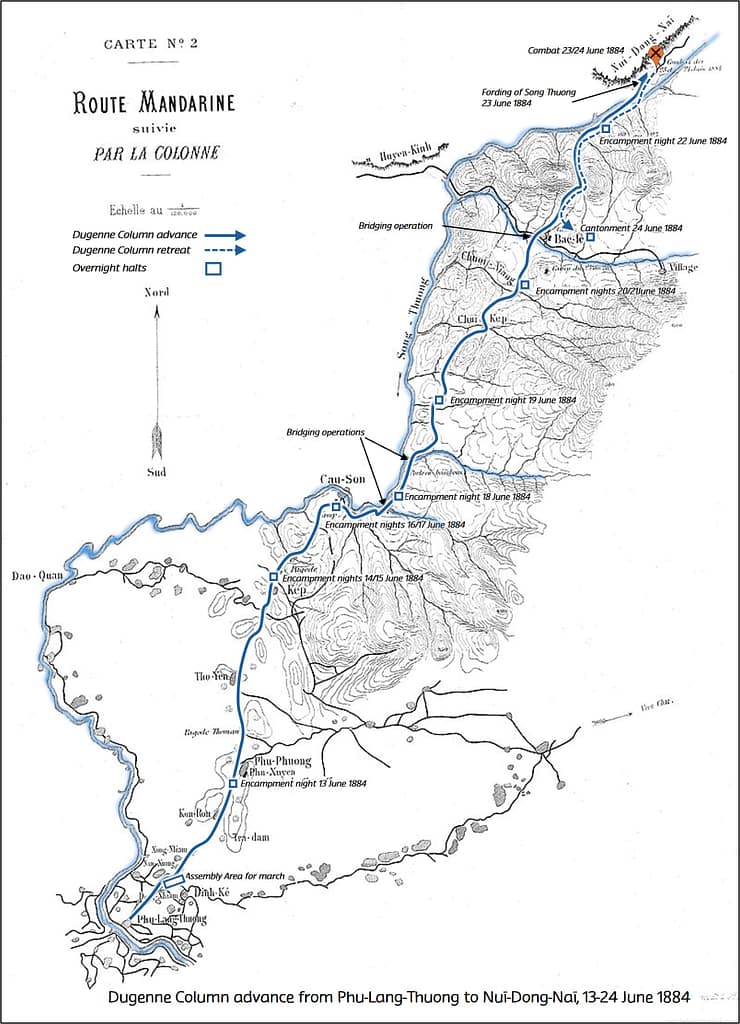
The assembly area for the column was designated as Phủ Lạng Thương (now Bắc Giang). Some elements of the column moved over land, while much of the heavy equipment was moved by barge from Hanoi to Phủ Lạng Thương. By 12 June 1884, the preparations were complete, and the column commenced its march at 0330hrs on 13 June.
The ‘Mandarin Road’ to Lang Son
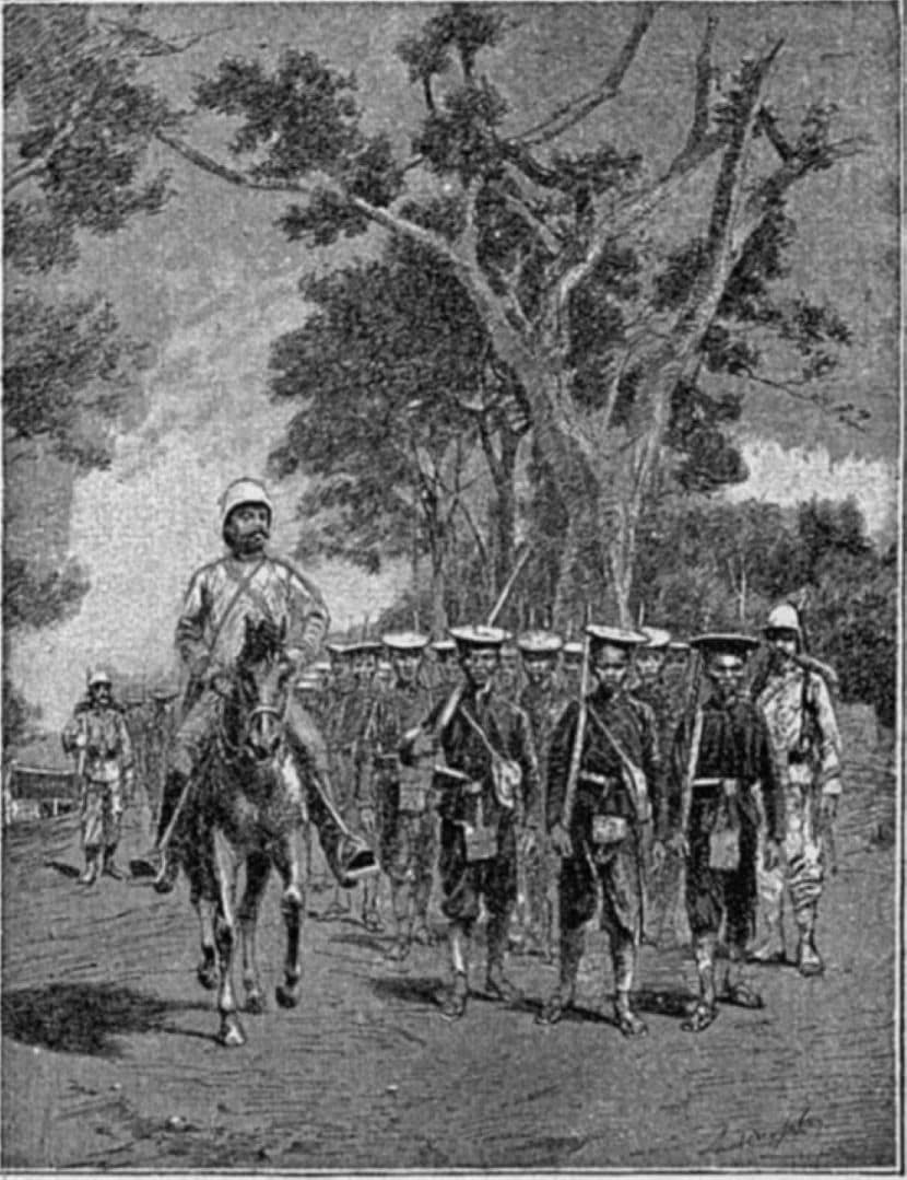
The road to Lang-Son was known as the ‘Mandarin Road’, serving both as a means of communication between China and Tonkin and as an invasion route from China over previous centuries. The only information the French had on the route was from the translated Annamite map previously discussed, a previous military expedition that had advanced over the first 22km to Cau Son, and notes from two previous travellers to Lang-Son a few years earlier: M. Aumoitte, then chancellor of the consulate of France in Hanoi, and Father Luentès, a Spanish missionary. According to their accounts, the journey to Lang-Son could be completed in five days.
• Day 1, Phủ Lạng Thương to Lang-Kep;
• Day 2, Lang -Kep to Bắc Lệ;
• Day 3, Bắc Lệ to Tanh-Mo or Phu-Truong -Kanh;
• Day 4, Tanh-Moï to Cut;
• Day 5, Cut to Lang-Son.
The distance to be covered was about 100 kilometres. For a person travelling alone, during the extreme heat of the rainy season, this rate of movement would have been difficult. For a military column escorting a heavy supply column and having to bridge multiple streams each day, this rate of movement was not achievable.
Composition of the column
The force composition for the march is shown in Table 1. Dugenne had the option of taking a battery of four artillery pieces, but lacked the manpower and equipment to haul them, so he decided to leave the guns behind. The guns would be brought forward after the column reached Lang Son. Lecomte later noted that, if the guns had been present during the battle, they would have been swiftly eliminated in close-range combat.
| Corps | Officers | Troops |
|---|---|---|
| 3rd Regiment, Infanterie de Marine (Colonial Infantry) | 7 | 281 |
| 1st Battalion, Tirailleurs Tonkinois (local auxiliaries) | 4 | 284 |
| Half-Squadron Chasseurs d’Afrique (light cavalry) | 3 | 38 |
| Company, 2nd Battalion, African Light Infantry (penal) | 2 | 77 |
| Engineer and Pontoon Section | 1 | 55 |
| Gendarmerie (Military Police) | 0 | 5 |
| Optical Telegraphy Section (using signal lamps by night) | 1 | 6 |
| Train (supply wagons and mules) | 4 | 219 |
| Ambulance (Doctor, medical orderlies, ambulance) | 3 | 0 |
| Other officers (Diplomats, Photographer, etc) | 5 | 0 |
| Total military | 30 | 965 |
| Plus locally engaged porters ‘Coolies’ | 900 |
Plan for the Occupation of the border posts
When the column reached Lang Son, they would occupy the town with a marine infantry company, the cavalry detachment, a 100-man platoon of the 12th Tonkinese rifle company, 200 mules of the convoy and their drivers, and half of the porters.
From Lang Son, the rest of the column would continue to That-Ké (three days’ march). From That-Ké, a marine infantry company and a platoon of Tonkinese riflemen (100 men) would continue to occupy Cao-Bang (another three days’ march).
👉 Continue reading — this article is part of the BattlefieldTravels Deep Research Collection. The full 6,719-word analysis draws on eyewitness accounts of the 1884 Bắc Lệ Ambush, extensive GIS terrain analysis, firsthand fieldwork on the battlefield, and engagement with the local community around the ambush site. Primary source examination, tactical conclusions, and notes & references that exist nowhere else in English. Try membership free for 7 days.
📚 Further Reading
This battle study nests within the broader analytical framework explored in the Research Hub, where operational methods, operating environments, armies, commanders, and weapons are examined across conflicts and eras. The links below connect related studies across the wider body of battlefield analysis on the BattlefieldTravels site.
⚔️ Explore all battle studies from the Tonkin Campaign 1883-1886
⚔️ Explore all battle studies involving the French Foreign Legion
🏛️Explore the museum of French colonial war historic artefacts
🗞️ For updates on new battlefield studies and research insights, you can subscribe to the Newsletter.
Related Battle Studies, Museum Pieces & Reading Resources
 ⚔️🔒Son Tay Campaign, Tonkin,
11-17 December 1883
 ⚔️ 1883–1886 Tonkin Campaign/ Sino-French War, Battle Studies
 🏛️ French Colonial Wars (1830–1940 ) Weapons and Equipment
 ⚔️🔒Battle of Hòa Mộc, Tonkin, 2-3 March 1885
 ⚔️🔒Siege of Tuyên Quang, Tonkin, 24 Nov 1884 – 3 March 1885
 📚 Tonkin Campaign/Sino-French War (1883–1886),
Recommended Reading
🧭 Battlefield Travel Guide: Ambush at Bắc Lệ (1884)
Getting There
- Nearest City: Lạng Sơn, about 160 km northeast of Hanoi, Vietnam.
- Transport: From Hanoi, buses and private cars reach Lạng Sơn in 3–4 hours. Bắc Lệ lies on Route 1B between Lạng Sơn and Thái Nguyên.
- Parking: Roadside stops and village areas near Bắc Lệ Temple offer space for vehicles.
Site Orientation
- Main Battlefield: The wooded hills and valleys near Bắc Lệ village, where French forward detachments were caught in a prepared ambush by Chinese Guangxi troops.
- Key Features: The Bắc Lệ Temple area, Route 1B, and the surrounding ridges give a good sense of the confined, forested terrain.
- Best Vantage Points: Hill tracks overlooking the road and river crossings that highlight the vulnerability of the French column.
Museums & Visitor Centres
- Lạng Sơn Provincial Museum: Contains exhibits on the Sino-French War of 1884–85.
- Vietnam Military History Museum (Hanoi): Provides background on French colonial campaigns, including Bắc Lệ.
- Local Monuments: Memorial markers occasionally reference French–Chinese fighting in the area.
On-Site Experience
- Interpretive Signage: Limited; most information must be drawn from historical accounts.
- Atmosphere: The forested terrain still feels close and ambush-prone, echoing the events of June 1884.
- Walking Routes: Trails near Bắc Lệ Temple and the old road alignments suggest the ground over which the French marched.
Nearby Points of Interest
- Bắc Lệ Temple: A cultural site that anchors visits to the battlefield area.
- Lạng Sơn Citadel: Site of subsequent Franco-Chinese fighting in 1885.
- Đồng Đăng Border Town: Historically significant as a frontier post on the Sino-Vietnamese border.
Practical Tips
- When to Visit: Dry months (Oct–Mar) are best for exploring rural terrain.
- Facilities: Shops, small eateries, and accommodations available in Lạng Sơn town.
- Special Considerations: Historical markers are scarce — best to bring detailed campaign maps and research material.
FAQ: Ambush at Bac Le (1884)
A clash in June 1884 between French forces and Chinese Guangxi Army troops, sparking the Sino-French War.
Near Bac Le, in northern Tonkin (modern Vietnam).
A French column under Colonel Dugenne was attacked by Chinese regulars, despite ongoing peace negotiations.
The French force retreated in good order after sustaining heavy casualties. The incident escalated into full-scale war.
Yes, the Bac Le area can be reached from Lang Son. Terrain features like the Nuï-Dong-Naï cliffs still exist.
Subscribe to Battlefield Travels and receive a free E-Book Battlefield Guide
Unlock expert battlefield analysis, campaign reconstructions, and historical insights drawn from firsthand exploration and primary sources.
🗺️ You’ll receive:
🎖️ Exclusive historical insights you won’t find elsewhere
📘 A free eBook: 10 Tips for Exploring Historic Battlefields
📰 New battlefield studies straight to your inbox as they are published

⚔️ Go deeper — Members get exclusive access to the Deep Research Collection, Field Notes, and monthly Research Dispatches. Try membership free for 7 days, cancel anytime. From $9/month.