From retreat to annihilation—France’s colonial catastrophe on the Cao Bang Ridge
The Cao Bang Ridge Disaster was one of the worst military defeats in the history of colonial wars. A French force of about 6,000 troops was destroyed, and several units, including the 1st Foreign Legion Parachute Battalion, were almost wiped out. I explored the battlefields along Route Coloniale No. 4 (RC4) in April 2025. I have been reading about the events on RC4 since I was in primary school, so it was definitely a moving experience to visit these locations.
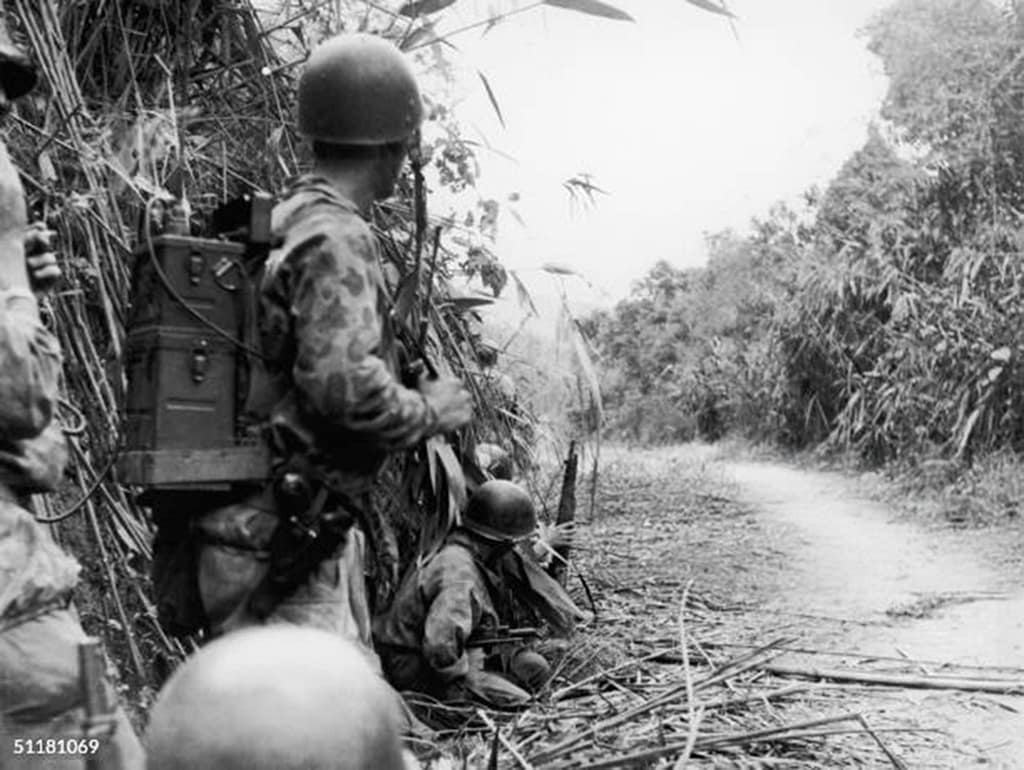
Key facts
🗺️ Battle of Route Coloniale No. 4, 16 September – 18 October 1950
⚔️ French Indochina War 1946–54
🪖 ~6,000 French Union troops vs ~30,000 Viet Minh troops
🎯 French attempt to evacuate isolated outposts along Cao Bang Ridge
Visit the virtual museum of weapons, uniforms and equipment of the French Indochina War
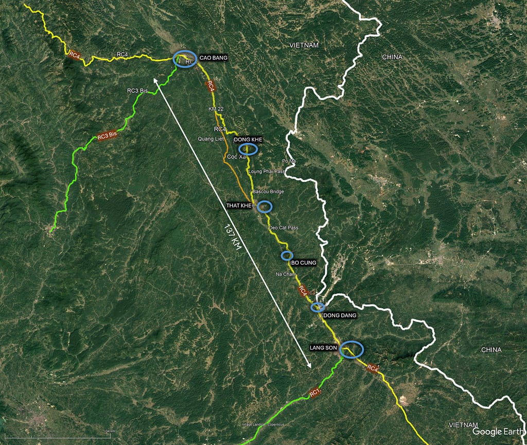
Google Earth map – location of the Route Coloniale No. 4 battlefield
🎧 Prefer to listen? This article is available as a 65-minute podcast
Tip: If Podbean overlay appears after pausing, click the × in the top-right corner to return to the player controls.
🧭🥾 Walking the Battlefield
I explored the battlefields along Route Coloniale No. 4 (RC4) in April 2025, equipped with unit histories, the memoirs of Lieutenant Colonels Charton and Lepage, French and Vietnamese accounts, photographs, maps, period diagrams, and GIS overlays. The fighting unfolded along a 137 km stretch of RC4 between Lạng Sơn and Cao Bằng, with the heaviest actions centred around Đông Khê and the rugged terrain to its west.
Little remains of the French forts along RC4, but the terrain described by survivors is largely unchanged. The steep hills and near-vertical limestone cliffs around Cốc Xá and Hill 477 mark the killing grounds where both French columns were annihilated in early October 1950.
This battlefield study is grounded in personal, on-site exploration — combining detailed terrain analysis with contemporary documents to better understand how the campaign unfolded.
Table of Contents
- Overview
- Strategic Context: Indochina War situation in 1950
- Prelude to the Battle of Route Coloniale No. 4
- French decision to evacuate Cao Bang
- Giap moves against RC4
- 🔒Operation BAYARD: French preliminary moves
- 🔒Lepage column advance from Lang Son
- 🔒Operation TIZNIT – mission to recapture Dong Khé
- 🔒Operation THERESE – evacuation of Cao Bang
- 🔒Disaster at Coc Xa basin
- 🔒Breakout attempt
- 🔒Evacuation of Thất Khê
- 🔒Evacuation of Lang Son
- 🔒Consequences of the French defeat
- 🔒What went wrong on Route Coloniale No. 4?
- 🔒Images of Route Coloniale 4: Lang Son to Cao Bang
- 🔒Sources
- 📚 Further Reading
- 🧭 Battlefield Travel Guide: Route Coloniale 4 (1950)
- FAQ: RC4 – Route Coloniale 4 (Cao Bằng Ridge Disaster)
Overview
October 1950. The atmosphere at the Hanoi Citadel, home to the Tonkin forces headquarters, is reminiscent of June 1940. Panic has gripped everyone. A Viet Minh attack was expected on the city. Defenses have been hastily erected in front of the Doumer bridge. Families began to evacuate, and archives and equipment were transported to the port of Haïphong.
On RC4, the victorious Army of 1945, the Legion and the Tabors, had just suffered their first setback and tasted the bitterness of the war of decolonization. General Juin, prestigious head of Italy’s CEF, and General Valluy, former commander of the 9th Colonial Division and Indochina forces, hastily dispatched to investigate events on the Chinese border, are stunned by the extent of the material and moral disaster.
Metropolitan France suddenly discovered that beyond the seas, a French Army was still fighting on the steps of the Empire. Accounts of the Dantean battles along the RC4 shook public opinion all the more, as another war had just broken out in the Far East, further north in Korea. Everyone, civilian or military, governing or governed, is wondering how all this could have happened.
Colonel Pierre Charton, foreword to his 1975 memoir RC4 : Indochine 1950, la tragédie de l’évacuation de Cao Bang
This post will be longer than usual as the battle was complex, involving multiple force elements across a vast expanse of northern Tonkin, and spanning several weeks of manoeuvre and combat.
In brief summary, the Battle of Route Coloniale No. 4 took place over nearly a month along a 137km section of RC4 near the Chinese border between Lang Son in the south and Cao Bang in the north. With a growing threat from the Viet Minh, the French decided to evacuate their garrison from Cao Bang and other small posts along RC4. To assist in the evacuation, a strong force was dispatched from Lang Son to meet the Cao Bang garrison around Dong Khé and escort them back to Lang Son. The relief column was surrounded and destroyed in the jungle-covered mountains west of Dong Khé. Soon afterwards, the retreating garrison from Cao Bang was also overwhelmed and largely destroyed. The main clashes occurred roughly around the midpoint of the road between Thất Khê and Dong Khé, and to the west of Dong Khé, near Coc Xa.
Strategic Context: Indochina War situation in 1950
By late 1950, the First Indochina War had been raging for four years. The French Far East Expeditionary Corps was fighting to maintain control over France’s colonial territories, while the Viet Minh, led by Ho Chi Minh and General Vo Nguyen Giap, aimed to achieve full independence for Vietnam. The Viet Minh had grown from a largely guerilla force in 1946 to a multi-division regular force capable of complex assaults on French fortified positions. The Viet Minh demonstrated this growing level of proficiency in their assault on Phu Thong Hoa in 1948.
In October 1949, Mao Zedong’s Chinese Communists defeated Chiang Kai-shek’s Nationalist Chinese forces, significantly altering the balance of power along Vietnam’s northern border region. With Mao Zedong’s support, the Viet Minh now had a secure northern supply line, access to training facilities, and a conduit for arms and ammunition from the Communist Bloc. The Viet Minh’s ability to conduct large-scale military operations was greatly enhanced.
Route Coloniale No. 4
Route Colonial No. 4, or RC4, (now Quốc lộ 4A – National Highway 4A), runs parallel with the Chinese border for more than 200 km. RC4 commences at Mong Cai on the Gulf of Tonkin and passes through Tien Yen and Lang Son on the way to Cao Bang. French colonial engineers had constructed the road in the early 20th century to link the towns and border posts. For most of its length it was a single-lane road, about four metres across, with jungle and steep cliffs butted against the edge of the road on both sides.
RC4 allowed resupply of the garrisons of Lang Son, Na Cham, Thất Khê, Bascou Bridge, Dong Khê, Cao Bang and many other minor posts. At Lang Son, RC4 intersects with RC1 and connects it with Hanoi, the capital of Tonkin. The French relied on RC4 for resupply, but its treacherous terrain made it vulnerable to ambushes.
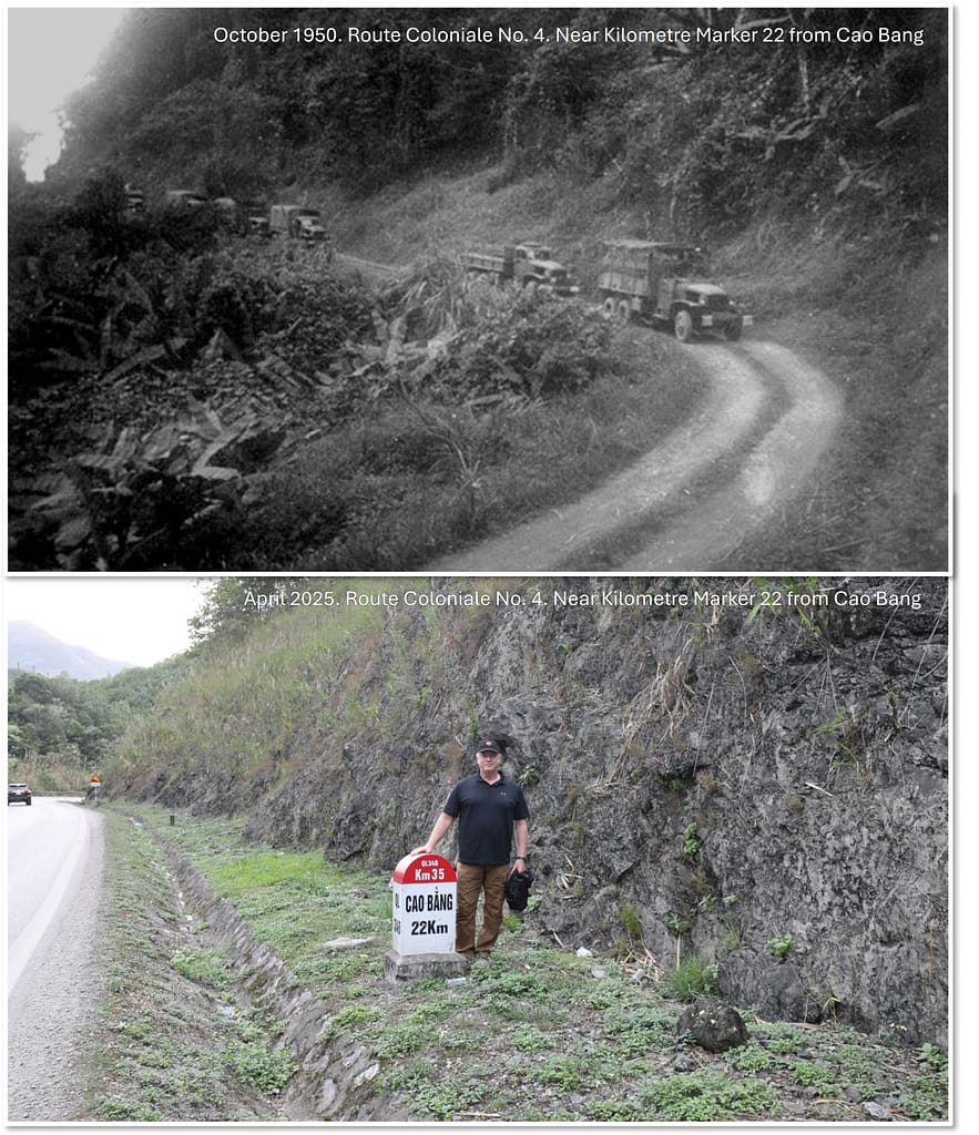
Control over RC4 was critical for maintaining French dominance in the region. As the Viet Minh gained strength with Chinese support, the entire border region was increasingly under threat. Remote garrisons were constantly attacked, and convoys moving along RC4 were routinely ambushed. A French convoy could typically expect to pass unscathed from Lang Son to Loung Phai Pass, about 60km north. From the Loung Phai pass onwards, they were subjected to constant ambushes and attacks.
RC4 became known to the French as the ‘Road of Death’ as so many convoys had been lost to ambushes. Destroyed trucks littered the sides of the road, especially from Loung Phai pass northwards. The Viet Minh posted banners above the road: ‘RC4 – Route de la Mort‘ or ‘A corpse every ten meters‘ or ‘Legionnaires, surrender before it’s too late‘.
The Revers Report
The French, recognising the growing threat, were faced with the dilemma of whether to continue to expend effort and resources in securing the border, or to evacuate the threatened garrisons along RC4. In May and June 1949, General Georges Revers, Chief of Staff of the French Army, conducted a review of the situation in Indochina, including visits to the RC4 outposts and consultations with key leaders. Amongst other broader recommendations, the ‘Revers Report’ recommended the abandonment of the military outposts along RC4 and the creation of a new Vietnamese National Army. In what became known as ‘The General’s Affair’, copies of the report were leaked to the press and into the hands of the Viet Minh. Despite Revers’ strong recommendations, more than 15 months subsequently passed before the evacuation of Cao Bang Ridge was commenced.
Prelude to the Battle of Route Coloniale No. 4
Since 1946, the Viet Minh forces under General Vo Nguyen Giap had steadily developed their ability to conduct complex military operations. By late 1950, the Viet Minh were capable of executing multi-regiment level operations, integrated with artillery support. However, the Viet Minh logistic staff were inexperienced, their resupply system was rudimentary, and they lacked heavy weapons. The French, by contrast, had a modern mechanised force and a logistic system to match. The problem for the French was that, in a land with few roads but plentiful mountains and jungle, the Viet Minh had a distinct mobility advantage.
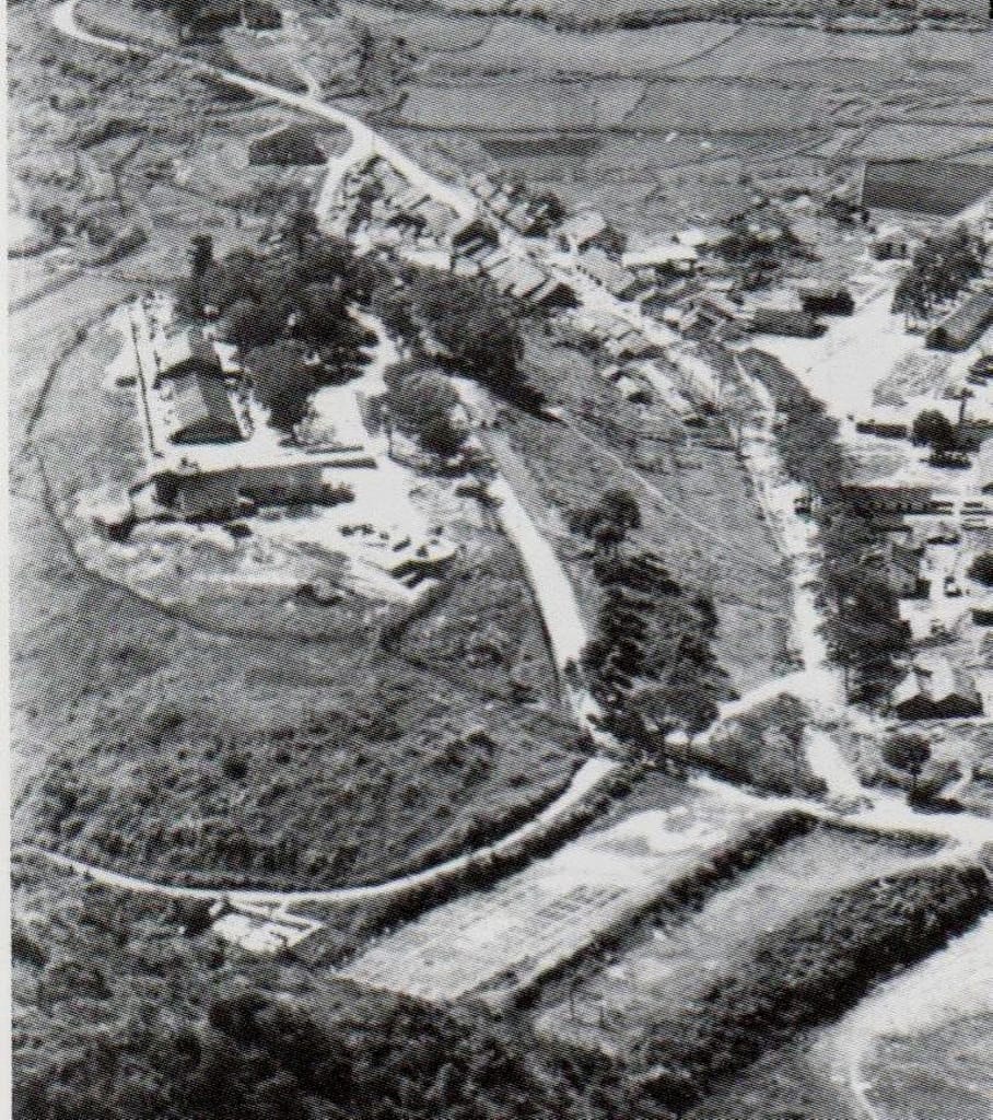
Giap’s first major attack on RC4 was against the outpost of Dong Khé, about 30km south of Cao Bang. Dong Khé was manned by Moroccan troops from 8th Moroccan Rifle Regiment (8e RTM – Regiment Tirailleur Morocain). On 25 May 1950, about 2,500 Viet Minh troops overwhelmed Dong Khé, cutting RC4 between Lang Son and Cao Bang. The Moroccans were rapidly overrun and were surprised by the Viet Minh’s use of American-made 75 mm pack howitzers. Only a few Moroccan troops survived.
The French responded aggressively by dropping 3rd Colonial Parachute Commando Battalion (3rd BCCP – Bataillon Colonial de Commandos Parachutistes) almost on top of the Dong Khé position. 3rd BCCP’s bold action drove the Viet Minh out of Dong Khé and back into the jungle. The French retained control of Dong Khé. For now.
French decision to evacuate Cao Bang
By mid-1950, the French High Command in Indo-China, led by General Marcel Carpentier, recognised that holding Cao Bang was no longer tenable. General Carpentier now had to make a decision on how to extract the Cao Bang garrison. His options included air evacuation or a cross-country breakout by the garrison. At that crucial moment, Carpentier wavered and lost valuable time before finally deciding to evacuate Cao Bang. He may have underestimated the size and capabilities of Giap’s forces, and almost certainly overestimated his own force’s capabilities.
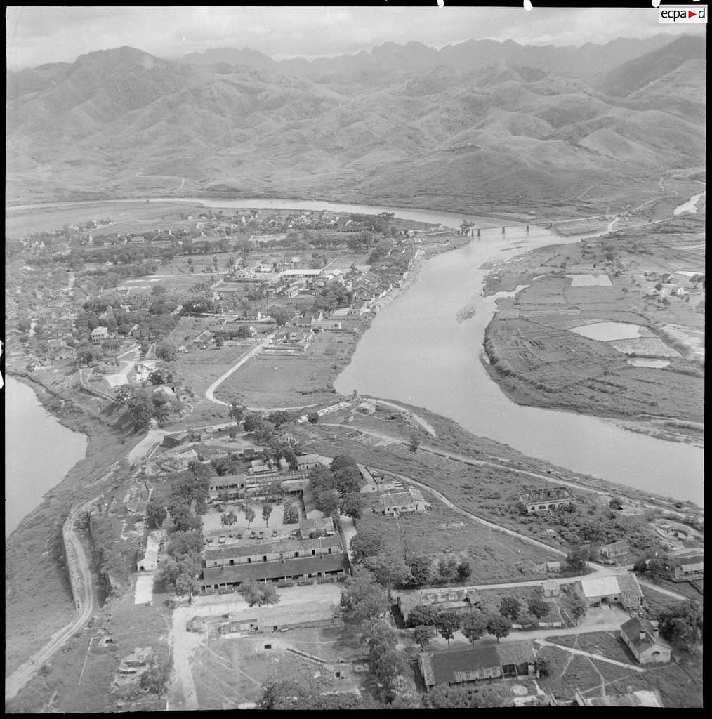
The top-secret plan was to firstly consolidate the 30+ small garrisons along RC4 and its branches, then deploy a relief force northwards from Lang Son to Dong Khé to cover the withdrawal. When the relief force was in place, the Cao Bang garrison would evacuate southwards along RC4 to marry-up with the relief force at Dong Khé. The combined force would then withdraw to Lang Son, collecting the many small garrisons along RC4 as they withdrew. Concurrent with the evacuation, a separate offensive operation would be launched against Thai Nguyen, to draw away Viet Minh reserves from the border region.
The French began to dismantle small outposts along RC4 and concentrate the garrisons in Cao Bang, Dong Khé and Thất Khê. On 16 September 1950, General Carpentier’s top-secret special order No. 46 was issued to commence the evacuation of Cao Bang:
“I have decided to withdraw all outposts in Cao Bang and Dong Khé. Cao Bang city will be completely withdrawn once the offensive campaign on Thai Nguyen begins on a day as close to October 1 as possible… The date of the withdrawal from Cao Bang will be decided by the commander of the Northern region according to the general situation and no later than October 15…”. General Marcel Carpentier
Giap moves against RC4
‘Lê Hồng Phong 2’ Campaign
While the French high command vacillated on a decision to evacuate Cao Bang, the Viet Minh commander, General Vo Nguyen Giap, planned a campaign to open a ‘bridge’ between the Viet Bac (secure zone) to the Vietnam-China border. By eliminating the already vulnerable French outposts along RC4, the ‘Le Hong Phong 2’ campaign would allow aid to flow from China, and would allow a cross-border sanctuary for the Viet Minh.
Giap planned a large-scale offensive, assembling more than 30,000 troops. Viet Minh forces were pre-deployed at key points along RC4, particularly around Dong Khé and the surrounding ridges. Giap’s plan was to overrun the garrison at Dong Khé and then reposition his forces astride RC4, fully aware that the Cao Bang garrison would have to come this way when it evacuated and that the French would likely send a relief force.
Viet Minh forces arrayed against the Cao Bang Ridge sector
General Vo Nguyen Giap’s force comprised:
- 308 Division comprised of Regiments 36, 88, 102, and Battalion 11.
- Two main force regiments: 174 and 209.
- Three independent battalions: 426, 428 of Viet Bac Inter-zone; Battalion 888 of Lang Son Province.
- Artillery: Four mountain artillery companies, including twenty 75mm guns
- Engineers: Five companies.
- Total force available: 29,500 troops
- Additionally, Giap could call upon a number of local guerilla companies in the provinces of Cao Bang and Lang Son
Giap’s units had received some military training in China from April to July 1950, and had gained experience in siege techniques. However, the Viet Minh had little experience in large-scale combat and almost no experience in the kind of combined arms tactics required to attack the fortified French positions. This was also the first time they had faced the logistical challenges of keeping a large army in the field. Throughout the campaign, Viet Minh forces alternated between their operational missions and foraging and resupply operations to sustain themselves.
Fall of Dong Khé (16-18 September, 1950)
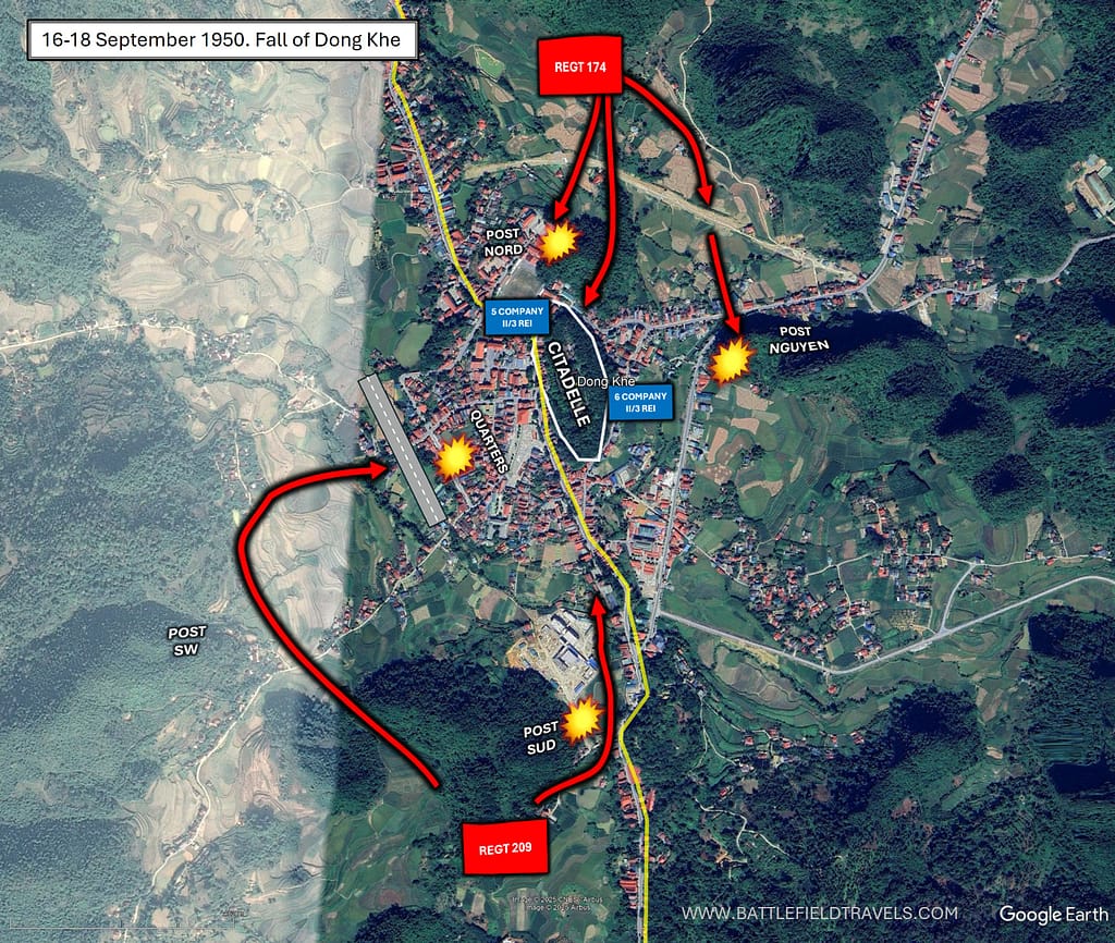
After its loss and recapture in May 1950, Dong Khé was reinforced with a French garrison of about 350 troops from 5th and 6th Companies of the 2nd Battalion 3rd Foreign Legion Infantry Regiment (II/3e REI – Regiment Entranger Infanterie). The life of the units that took turns occupying the Dong Khê post was described by Lieutenant Jaubert of the 8th Moroccan Rifle Regiment in his memoirs:
“Dong Khê is a town about ten kilometres from China, at the crossroads of a road leading to it with the RC4 which runs along the border. There is a citadel from the colonial era, less imposing than in Cao Bang, but very useful. We are still in a basin, surrounded by threatening limestone where there will be just enough room to install a small airstrip for the evacuation Morane [a light fixed-wing aircraft] for the wounded.
Since there were no more convoys, requiring too many people for their protection, we got used to the daily parachute drops of 2 or 3 planes. Everything that is not fragile (clothes, rolls of barbed wire, tobacco, sack of rice, etc.) is dropped without a parachute as close as possible to the ground. Everything else is parachuted, and paper parachutes will even be used (!). Sheep for Muslim holidays will be parachuted alive, as well as pigs for the partisans, as well as ducks and chickens in baskets stacked on top of each other.
Lieutenant Jaubert, 8th RTM
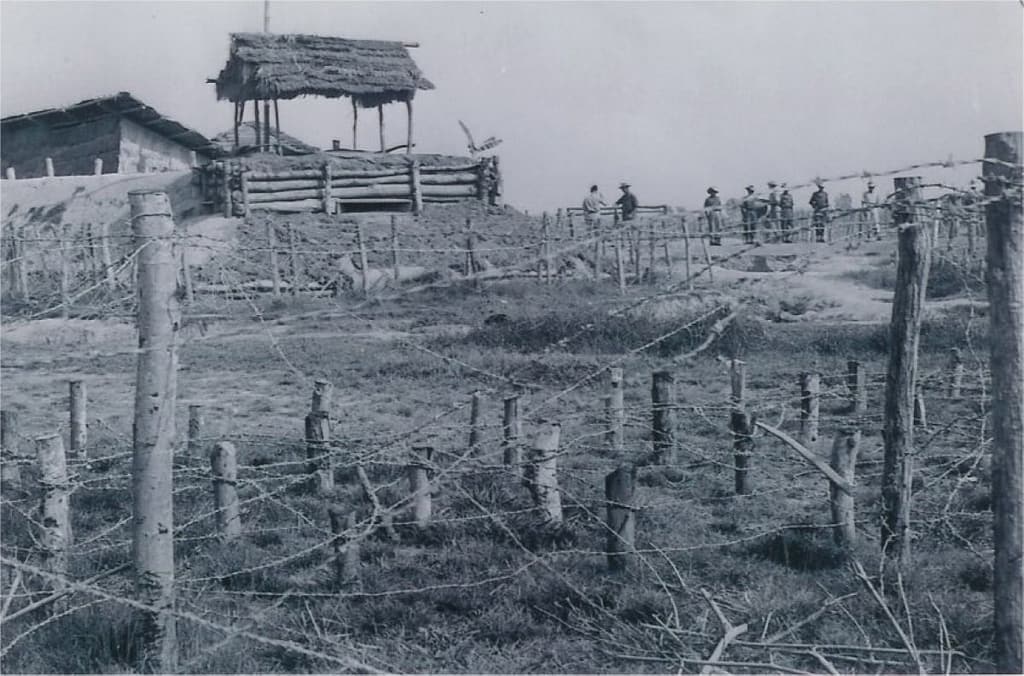
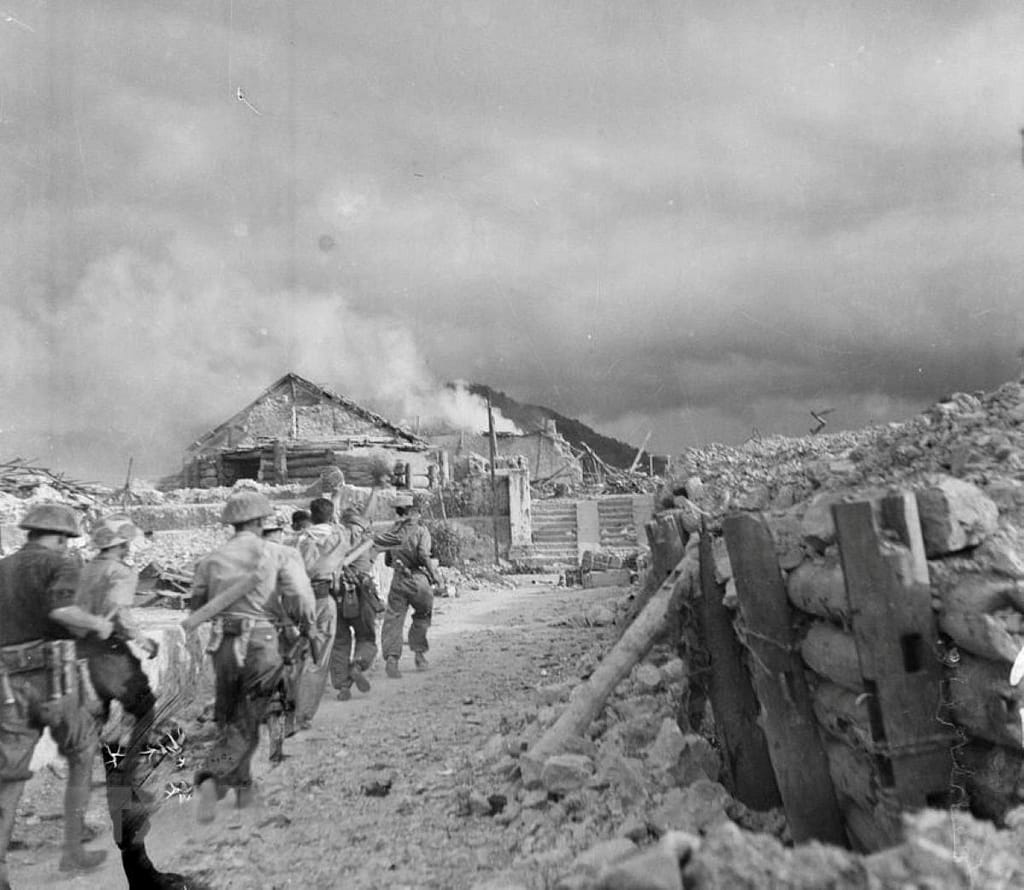
On 16 September 1950, the Viet Minh launched a full-scale assault on Dong Khé with Regiment 174, Regiment 209 and one heavy weapon battalion, commanded by Major General Hoang Van Thai. Regiment 36 of 308 Division was positioned southeast of Dong Khé to block any French relief effort and cutoff any French retreat from Dong Khé. The French defenders comprised two companies of II/3rd REI, along with artillery and mortars, totalling approximately 350 troops. By 18 September, after 54 hours of fighting, the French garrison at Dong Khé had been overrun, thereby cutting off RC4 to Cao Bang. Of the ~350 defenders, 150 were taken prisoner, about 160 killed, and only ~20 made it to safety at Thất Khê, 25km to the south.
For the first time, the Viet Minh had successfully applied regimental-level siege tactics against a fortified French position. Further south, local Viet Minh guerrillas cut RC4 in several places, destroying bridges and sections of road, thereby hampering any French attempt to relieve or recapture Dong Khé.
👉 Continue reading — this article is part of the BattlefieldTravels Deep Research Collection. The full 12,749 word analysis draws on eyewitness accounts of the October 1950 Battle of Route Coloniale No. 4, GIS terrain analysis, firsthand fieldwork on the battlefields, engagement with veteran’s families, and the communities of Lạng Sơn, Thất Khê, Đông Khê, Cốc Xá, and Cao Bằng. Primary source examination, tactical conclusions, and notes & references that exist nowhere else in English. Try membership free for 7 days.
Related Battle Studies, Museum Pieces & Reading Resources
 ⚔️🔒Operation LÉA,
(Việt Bắc Campaign), Tonkin,
Oct–Nov 1947
 ⚔️🔒Operation HIRONDELLE, (Raid on Lạng Sơn), Vietnam,
17-21 July 1953
 ⚔️🔒Battle of Phủ Tông Hoá, Tonkin, 25 July 1948
 ⚔️ Battle for Dien Bien Phu, Vietnam,
13 March – 7 May 1954
 🏛️ French Indochina War (1946–1954) Weapons and Equipment
 📚 Best Books on the French Indochina War (1946–1954),
Recommended Reading
🧭 Battlefield Travel Guide: Route Coloniale 4 (1950)
Getting There
- Nearest City: Cao Bằng, in far northern Vietnam, near the Chinese border.
- Transport: Today, Cao Bằng is accessible by road from Hanoi (7–8 hours by bus or car). The old RC4 corridor itself has been upgraded into modern highways and local roads.
- Access Points: The main battlefield areas stretch from Cao Bằng southward through Đông Khê, Thất Khê, and Lạng Sơn.
Site Orientation
- Main Battlefield: The ambush zones of October 1950 where the Viet Minh destroyed French convoys retreating along RC4.
- Key Features: Mountain passes, steep valleys, and dense forests created natural choke points ideal for ambush.
- Best Vantage Points: Hills overlooking Đông Khê and Thất Khê offer commanding views of the battlefield terrain.
Museums & Visitor Centres
- Cao Bằng Provincial Museum: Displays artefacts from the Indochina War and the RC4 battles.
- Đông Khê Victory Historical Site: Preserves bunkers, trenches, and monuments commemorating the Viet Minh victory.
- Lạng Sơn Museum: Regional exhibits on border conflicts, including the 1950 campaign.
On-Site Experience
- Interpretive Signage: Monuments and plaques at Đông Khê and Cao Bằng mark key sites, though often in Vietnamese only.
- Atmosphere: The mountainous terrain still conveys the sense of isolation faced by French columns.
- Walking Routes: Trails near Đông Khê allow exploration of surviving bunkers and ambush positions.
Nearby Points of Interest
- Pác Bó Cave: Historic hideout of Hồ Chí Minh, located near Cao Bằng.
- Bản Giốc Waterfall: A scenic border site east of Cao Bằng.
- Lạng Sơn Citadel: Historic fortress town linked to earlier Chinese–Vietnamese wars and later Indochina conflicts.
Practical Tips
- When to Visit: Autumn (Sept–Nov) offers clear skies and comfortable weather, echoing the season of the 1950 campaign.
- Facilities: Hotels and restaurants are available in Cao Bằng and Lạng Sơn.
- Special Considerations: Some battle sites are in remote terrain—bring water, sturdy footwear, and a local guide if possible.
FAQ: RC4 – Route Coloniale 4 (Cao Bằng Ridge Disaster)
RC4 was the French supply route linking Cao Bằng to the Red River Delta during the First Indochina War. It became the focus of a major Viet Minh campaign in September–October 1950.
The French High Command ordered the evacuation after repeated Viet Minh attacks made the outpost untenable. The goal was to consolidate forces in more defensible positions closer to the Delta.
French mobile groups and outposts were attacked along RC4, suffering heavy losses. Charton Column, evacuating from Cao Bang, and Lepage Column, sent to assist the evacuation, were destroyed near Dong Khe and Coc Xa.
The Viet Minh inflicted around 6,000 casualties, captured large quantities of French weapons, and achieved a major psychological victory, forcing a strategic French withdrawal from much of the northern border region.
Yes. Dong Khe, Coc Xa, and other key sites are accessible by road from Cao Bằng and Lang Son, with monuments and museums marking the battle.
Subscribe to Battlefield Travels and receive a free E-Book Battlefield Guide
Unlock expert battlefield analysis, campaign reconstructions, and historical insights drawn from firsthand exploration and primary sources.
🗺️ You’ll receive:
🎖️ Exclusive historical insights you won’t find elsewhere
📘 A free eBook: 10 Tips for Exploring Historic Battlefields
📰 New battlefield studies straight to your inbox as they are published

⚔️ Go deeper — Members get exclusive access to the Deep Research Collection, Field Notes, and monthly Research Dispatches. Try membership free for 7 days, cancel anytime. From $9/month.
As you pointed out, the 1st BEP was annihilated in a situation in which the micro-terrain played a key role. I’ll send you a photo of “Le goulet” to illustrate the point. Past le goulet is a spot the French named La source (but we couldn’t find any “spring” here), characterised by an overhanging rock where Segretain’s injured troops lay, waiting for help that never came (our guide Lam found a jawbone here). Descending the slope at Cóc Xa into the Quang Liệt valley was incredibly difficult. Every plant appeared to have thorns, and seemingly sturdy bushes ripped out of the soft ground as soon as you put your weight on them.
Tony, I received the images. Wow! Awesome granular level exploration. I will have to visit those places next time I go. Is that the base of the Coc Xa karst/cliffs? Or up top in the basin? When you visit Coc Xa or read the Lepage account, or Lieutenant Jaubert’s memoir, it really comes across just how hostile and chaotic the terrain was. Can I add some of these images to the RC4 study – fully attributed? Mick
This is such an informative article, thanks so much for sharing it. I’m headed up to the region next month and will certainly refer back to this page many times before doing so. How long did it take to get to Coc Xa gorge? Can you get there by motorbike?
Hello Eric,
Glad you liked the article. I am fairly confident that my article on the Battle of Route Coloniale 4 is the most comprehensive available in English language. A combination of extensive research and physically walking the battle sites!
When I have explored Coc Xa Gorge and Hill 477, I have entered from the north, basically the same route that Charton’s column took. The Quang Liet road is fine for a 4WD, so no problem for a motorbike. There may be shorter paths from Dong Khe or That Khe but I have not travelled that way. I recommend going there with a guide.
Mick
Hi, I’m planning to visit these battle sites next year and just came across your website and amazing work!
If I may ask a few questions:
Were there any abandoned hilltop outposts used by the French forces? Some images suggest they built sandbag positions along ridgelines. Are there still any bunkers remaining?
And are there local guides available on-site, or is it better to arrange one in advance online?
Thank you! Keep up the good work since this route is actually the most fascinating part during the First Indochina War
Hello, Yes there were many hilltop forts along RC4, and all over Tonkin. Some are untouched. I walked some around Nghia Lo where I think nobody else has been since 1952 – stll bunkers, CPs, mortar bays comm trenches etc visible. Even at Dien Bien Phu some hilltop forts are like this. Easy ones on RC4 include Dong Dang, Bo Cung, Dong Khe. That Khe is now occupied by a military base so not accessible.
Better to organise a guide before you go.
Mick
Fantastic read! Really appreciate your maps, photos and insights.
Thanks Tom, This is the most comprehensive account in English language. None of the other writers – Fall, Windrow etc – covered to this depth. Mick