Fort Bowie: From the Battle of Apache Pass to the Apache Wars!
High in the desert hills of southeastern Arizona, the ruins of Fort Bowie recall three decades of conflict between the U.S. Army and the Chiricahua Apaches. From the Battle of Apache Pass to Geronimo’s surrender, this lonely outpost tells the story of America’s last frontier war.

Key facts
Google Map location of Fort Bowie
🧭🥾 Walking the Battlefield
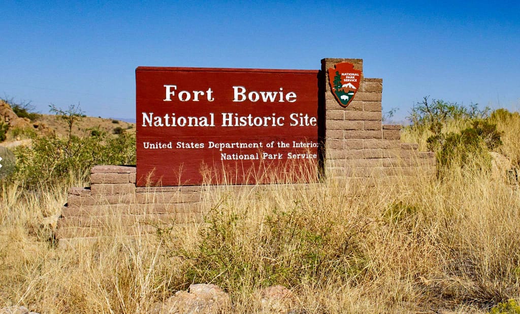
I visited Fort Bowie and Apache Pass in July 2020, during an epic cross-America road trip. To get to Fort Bowie, you have to want to go there. It is deep in the Arizona high country desert and is not on the way to anywhere else. The country is strikingly beautiful and the remnants of the fort are a stark reminder that this was once a hub of US Army operations against the Chiricahua Apaches under their leaders Cochise and Geronimo. There is a small visitor centre manned by the amazing staff of the National Park Service.
Strategic context: Fort Bowie and Apache Pass
The California Column
In the early 1860s the American Civil War spilled into the far southwest, a region sparsely settled by Europeans but vital for controlling communications between California, New Mexico, and Texas. The Union was determined to deny the Confederacy access to this corridor — both for its gold shipments from California and as a potential springboard for operations into Mexico.
To achieve this, Union forces from California, the ‘California Column’, a 2,500-strong mixed force of infantry, cavalry, and artillery, marched eastward across the deserts of Arizona Territory in April 1862. Their route was dictated by geography: mountain passes and rare water sources. One of the most critical was Apache Pass, a narrow defile in the Chiricahua Mountains that contained Apache Spring, one of the only reliable watering points for scores of miles.

But this ground was no empty desert. For generations, it had been the homeland of the Chiricahua Apache, under leaders like Cochise and Mangas Coloradas, who saw the pass as both sacred and strategically vital. To the Apache, any attempt by outsiders — whether Mexican, Anglo settler, or soldier — to control Apache Pass was an intrusion on their sovereignty.
Initial clashes with the Apache
As Union troops advanced, the Apache prepared to resist. The result was the Battle of Apache Pass (15–16 July 1862), one of the few large-scale confrontations between U.S. troops and the Chiricahua during the Civil War years.
The clash convinced Union commanders that any lasting control of the pass and its spring required a permanent military presence. Within weeks, soldiers of the 5th California Volunteer Infantry constructed a rudimentary outpost nearby, naming it Fort Bowie after their colonel, George Washington Bowie. Initially little more than a stockade of wood and earth, it was the first stage for what would become a hardened adobe and stone post on higher ground a few years later.
Fort Bowie as the hub of operations
For the next three decades, Fort Bowie was not merely a fortification but the hub of U.S. military operations against the Chiricahua Apache. From Fort Bowie military expeditions were conducted against Cochise, then later the long pursuit of Geronimo. The fort symbolised the U.S. Army’s determination to impose control over the borderlands and secure the vital communications artery through southeastern Arizona.
⚔️ Go deeper — Members get exclusive access to the Deep Research Collection, Field Notes, and monthly Research Dispatches. Try membership free for 7 days, cancel anytime. From $9/month.
The Battle of Apache Pass, 15–16 July, 1862
The Strategic Setting
When the California Column pushed eastward in the summer of 1862, its greatest enemy was not the Confederacy but the terrain itself: deserts, mountain ranges, and scarce water. Apache Pass was vital because it contained Apache Spring — a dependable water source on the long march toward New Mexico. For the Chiricahua Apache under Cochise and Mangas Coloradas, it was also sacred ground and a defensible chokepoint. Any force that attempted to pass would be vulnerable to ambush.
Day One – Into the pass
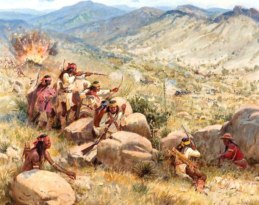
On 15 July, Captain Thomas Roberts led about 150 men of the 1st California Infantry and mounted detachments into Apache Pass. The column was stretched along the wagon trail in blistering heat, soldiers already weakened by thirst. As the advance guard neared the spring, war cries erupted from the rocky slopes.
From concealed positions among the mesquite, boulders, and ridges, roughly 500 Apache warriors opened fire with rifles, muskets, and arrows. The Californians scrambled for cover but were pinned down, unable to reach the spring only a few hundred yards away.
The skirmish raged for hours. The Apaches would fire, slip back into cover, then reappear on another ridge, exploiting their knowledge of the terrain. Several soldiers fell in the initial volleys, and thirst began to sap the energy of the rest. Without water, the march could not continue — the spring had to be taken.
The howitzers arrive
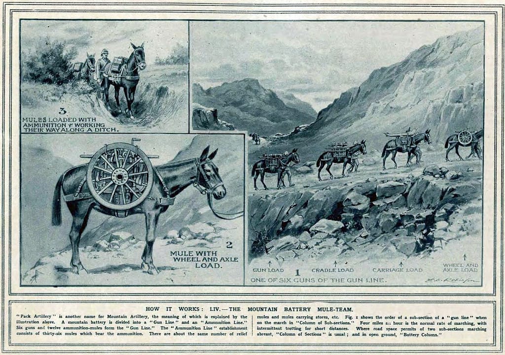
Roberts made a decisive choice. He ordered forward the two 12-pounder mountain howitzers, hauled across the desert on mule-packs. The guns were laboriously hauled into position under fire, crews unlimbering in exposed ground.
When the first shells burst among the rocks, the effect was immediate. The Apaches had never faced sustained artillery fire. The explosions sent splinters of stone and deadly shrapnel across the slopes, collapsing carefully prepared firing positions. Warriors who had pressed close to the trail fell back in shock.
The Californians used the respite to advance toward the spring, laying down volleys of musket fire as the artillery methodically shelled ridgelines. By dusk, the soldiers held the water source, though at least a dozen had been killed or wounded. The Apaches melted into the hills, but they were not finished.
Day Two – Renewed Assault
At dawn on 16 July, the Apaches struck again. Bands under Cochise moved along the higher ridges, attacking the flanks and rear of the California Column. Once more, the howitzers were brought to bear, their gunners firing case shot at close range and shelling the slopes beyond musket reach.
This second day was less desperate than the first, as the soldiers were now established at the spring, but the attacks tested every guard post and rear detail. Several mule drivers and stragglers were killed. Yet the Apaches could not withstand the combined musketry and the shellfire. By afternoon, they faded back toward the Dragoon Mountains.
Aftermath and Significance
The Battle of Apache Pass cost the Californians at least nine killed and a similar number wounded. Apache casualties are uncertain, but estimates range from 30 to more than 60, unusually high losses for warriors skilled in disengagement. The shock of artillery had tipped the balance.
For Cochise and Mangas Coloradas, the battle was bitter: they had inflicted losses but failed to hold their spring. For the U.S. Army, the engagement underscored that any permanent line of communication through the pass required a fixed garrison. Within weeks, the first Fort Bowie was built on the spot.
From Apache Pass to the Apache Wars
The clash at Apache Pass secured the Union’s immediate objective and justified the fort’s construction, but it was only the opening chapter of a much longer conflict. For the next decade, Fort Bowie became the fulcrum of U.S. operations against the Chiricahua Apaches. From its adobe walls rode the patrols and campaigns directed at Cochise and later Geronimo, whose resistance to encroaching settlers and Army pressure turned the isolated outpost into a headquarters for thirty years of frontier war.
Fort Bowie in the Apache Wars: Cochise and Geronimo
With Apache Pass secured, Fort Bowie became far more than a garrison post. For the next thirty years it stood as the US Army’s outpost in the heart of Chiricahua Apache country, its adobe walls watching over one of the most contested landscapes in the southwest.
Cochise and the Chiricahua Resistance
For much of the 1860s, the fort’s soldiers found themselves locked in a brutal war of ambushes, raids, and reprisals against Cochise, the charismatic leader of the Chiricahua Apaches. Unlike the large set-piece battles fought elsewhere in the Civil War, this was a war of sudden attacks on wagon trains, isolated patrols, and ranches scattered across the valleys. Fort Bowie provided a base from which columns of cavalry could patrol the approaches, but the Chiricahuas’ intimate knowledge of the mountains gave them the edge.
By the early 1870s, wearied by years of inconclusive fighting, the U.S. government sought a negotiated peace. In 1872, General Oliver O. Howard met Cochise in the Dragoon Mountains and agreed to the creation of a reservation in Cochise’s homeland, the Chiricahua Mountains. Fort Bowie stood as the military guarantor of that uneasy truce until Cochise’s death in 1874.
The Geronimo Campaigns
Peace did not last. In the late 1870s, U.S. authorities attempted to relocate the Chiricahuas away from their mountain strongholds, sparking fresh resistance. The most famous figure of this era was Geronimo, a warrior and medicine man who repeatedly eluded capture. Though his following rarely numbered more than a few dozen fighting men, Geronimo’s mobility, leadership, and knowledge of the terrain tied down thousands of U.S. and Mexican soldiers.
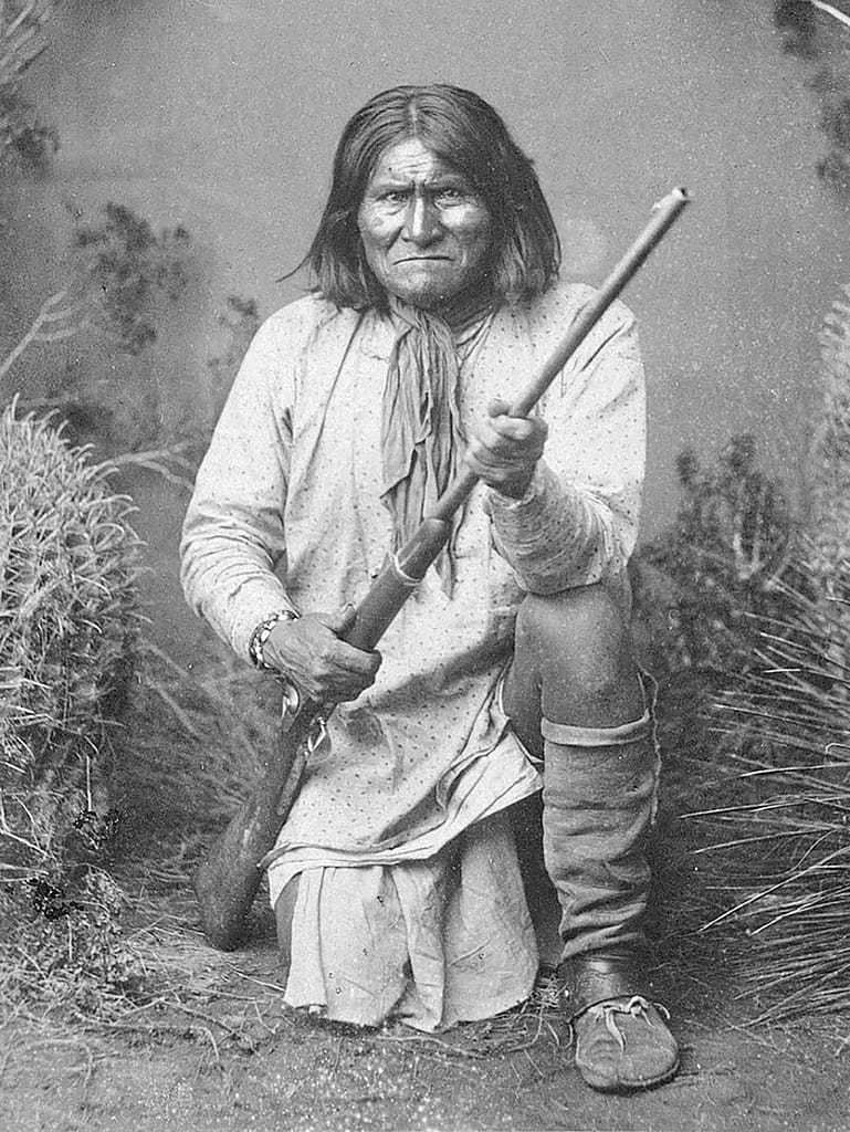
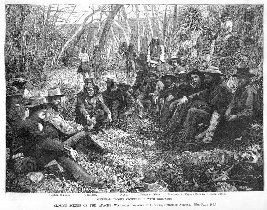
From May 1885, the US Army began a relentless pursuit of Geronimo and his band. The pursuing force comprised up to 5,000 US soldiers and, in cooperation with the Mexican government, pursued Geronimo across the border into Mexico. Scouts—many of them Apaches from rival groups—were critical to tracking Geronimo’s movements, and some of the most famous U.S. Army officers of the Indian Wars, including General George Crook and later General Nelson Miles, used Fort Bowie as their forward base.
Geronimo eventually surrendered on 4 September 1886. He and his band were initially held at Fort Bowie, and later sent as prisoners to Fort Pickens, Pensacola Florida. Some of the Apache children were sent to the Carlisle Indian Industrial School, where many died from tuberculosis and other transmissable diseases. Geronimo lived until 1909 and eventually related his life story to author Stephen Melvil Barrett, who published the autobiography in 1906.

Aftermath of the Apache campaigns
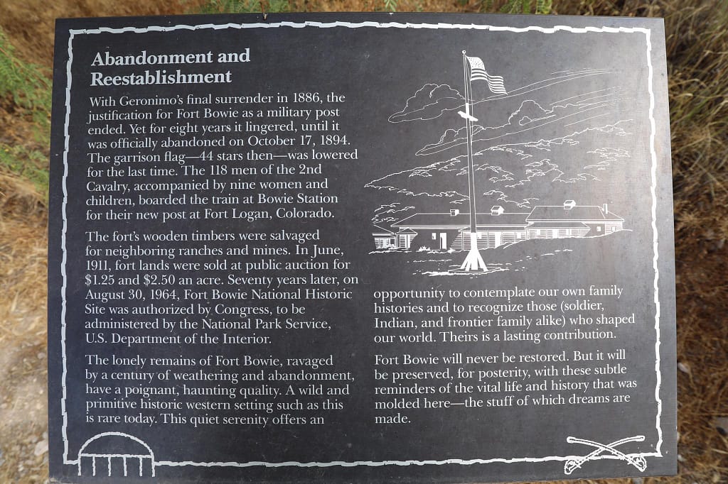
In the weeks following Geronimo’s surrender, Fort Bowie briefly held him and his band before they were transported east into permanent exile. The fort’s purpose had ended; within a decade, the Army abandoned it altogether. But its role as the headquarters of the long Apache Wars cemented its place in the history of the frontier.
Fort Bowie Today
Visiting Fort Bowie is unlike touring most frontier forts. There is no car park immediately outside the ruins and no road cutting through the parade ground. To reach the site you must hike—about 2.5 kilometres (1.5 miles) along a gently rising desert trail from the visitor centre carpark. This approach is intentional, designed by the National Park Service to echo the isolation of the 19th-century post and immerse visitors in its landscape.
The approach trail
The walk itself tells much of the story. Along the way, interpretive signs point out the remains of the Butterfield Overland Mail stage station—burned during the Apache conflicts—and the stone cairns that mark the cemetery where soldiers, settlers, and Apaches alike were buried. The trail also passes the site of the original 1862 fortification before climbing toward the more permanent 1868 Fort Bowie. In this way, visitors retrace the layered history of the region before they even set foot inside the fort.
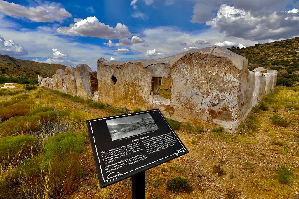
Ruins of Fort Bowie
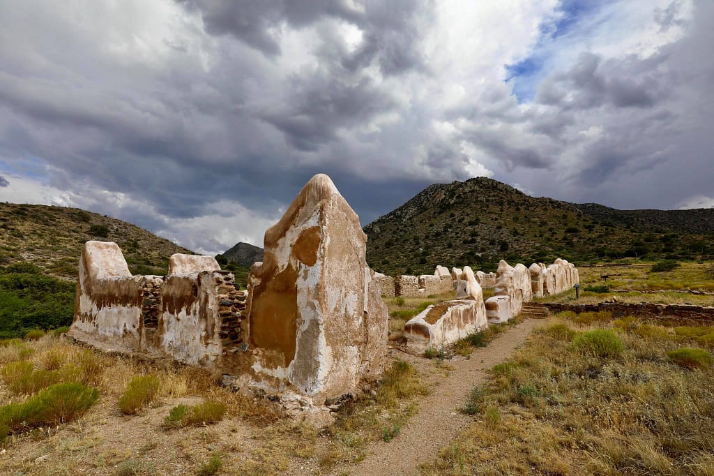
What survives of Fort Bowie today are mainly the adobe and stone walls of the later adobe and stone fort. Walking through them, you can still recognise the footprint of the officers’ quarters, the hospital, the commissary, and the parade ground. The absence of roofs and timber—long since salvaged or weathered away—gives the site a haunting openness, but period photographs and diagrams on the interpretive boards help visitors picture the fort at its peak, bustling with cavalry patrols and supply wagons.
The terrain
Beyond the fort, the high ground commands sweeping views over Apache Pass and the surrounding hills. It is easy to see why the site was chosen: the springs lay close at hand, and any movement along the pass could be watched from the ramparts. Standing here today, the rugged country seems peaceful, but was once a hotbed of tension during the decades of conflict between Apaches fighting for their homelands and soldiers intent on securing the frontier.
The Visitor Centre
At the end of the trail, the modern visitor centre provides context with exhibits, photographs, and artifacts recovered from the fort. The small bookstore is particularly strong on regional history, offering biographies of Cochise and Geronimo, memoirs of soldiers stationed at Fort Bowie, and studies of the Apache Wars. Rangers on site are usually keen to discuss both the military history and the broader Apache story, giving the site a human dimension often missing at other forts.
Link to the National Park Service Fort Bowie website
Additional images of Fort Bowie



Found this useful? Buy me a coffee — it helps fund future battlefield research


Authored by Mick Prictor, a retired military officer with 40 years’ service, and a military historian specialising in terrain-focused analysis of tactics, doctrine, and command decision-making in land warfare. His work draws on extensive battlefield fieldwork—more than 280 sites worldwide—and one of the world’s largest private collections of historic military arms, uniforms, and equipment. About me
📚 Further Reading
This battle study nests within the broader analytical framework explored in the Research Hub, where operational methods, operating environments, armies, commanders, and weapons are examined across conflicts and eras. The links below connect related studies across the wider body of battlefield analysis on the BattlefieldTravels site.
⚔️ Explore all battle studies from America’s Old West 1840-1912
🏛️ Explore the museum of America’s Old West historic weapons and equipment
The book list for this conflict includes the leading campaign studies, memoirs, and operational analyses available on America’s Old West, selected specifically to complement this battlefield study.
📚America’s Old West (1840-1912) – Recommended Reading
🗞️ For updates on new battlefield studies and research insights, you can subscribe to the Newsletter.
Related Battle Studies, Museum Pieces & Reading Resources


🧭 Battlefield Travel Guide: Fort Bowie
Getting There
- Nearest Towns: Bowie (20 km north) and Willcox (50 km west), Arizona.
- Transport: From I-10, take the Bowie or Willcox exits; follow Apache Pass Road south to the trailhead.
- Trail Access: A 5 km (3 mile) round-trip hiking trail leads to the fort, passing key historic sites.
Site Orientation
- Key Landmarks: Butterfield Overland Stage Station ruins, Apache Springs, Battle of Apache Pass site, fort parade ground.
- Walking Routes: The signed Fort Bowie Trail (2.5 km each way) includes interpretive stops before reaching the fort and Visitor Center.
- Best Vantage Points: Overlooks above Apache Pass provide sweeping desert and mountain views.
Museums & Visitor Centre
- Fort Bowie Visitor Center: Small but excellent displays on the Apache Wars, Chiricahua Apache leaders, and daily life at the fort.
- Interpretive Markers: Along the approach trail, signs explain the stagecoach route, the 1862 battle, and the fort’s evolution.
On-Site Experience
- Atmosphere: Remote and quiet, with ruins surrounded by rugged desert hills and mesquite scrub.
- Cemetery: Resting place of soldiers, settlers, and Apaches, highlighting the fort’s human cost.
- Guides & Tours: Rangers occasionally lead interpretive hikes and talks.
Nearby Points of Interest
- Chiricahua National Monument: Striking volcanic rock pinnacles, once a Chiricahua Apache stronghold.
- Tombstone, AZ: Famous frontier town, c. 90 minutes west.
- Willcox Historic District: Railroad-era town with heritage museums.
Practical Tips
- When to Visit: October–April for cooler weather; summers can be extremely hot.
- Facilities: Restrooms, water, and exhibits at Visitor Center only; none at trailhead.
- Special Considerations: Carry water, hat, and sunscreen; the trail is exposed. Allow 2–3 hours round trip.
Subscribe to Battlefield Travels and receive a free E-Book Battlefield Guide
Unlock expert battlefield analysis, campaign reconstructions, and historical insights drawn from firsthand exploration and primary sources.
🗺️ You’ll receive:
🎖️ Exclusive historical insights you won’t find elsewhere
📘 A free eBook: 10 Tips for Exploring Historic Battlefields
📰 New battlefield studies straight to your inbox as they are published

⚔️ Go deeper — Members get exclusive access to the Deep Research Collection, Field Notes, and monthly Research Dispatches. Try membership free for 7 days, cancel anytime. From $9/month.

Another fascinating account. Thank you!
Thanks Tom, A very remote and really spectacular little piece of Arizona! Mick