‘In the Indochina of 1947, it was a wild gamble at finishing the war in one single master stroke’
— Bernard Fall, Street Without Joy (1961)
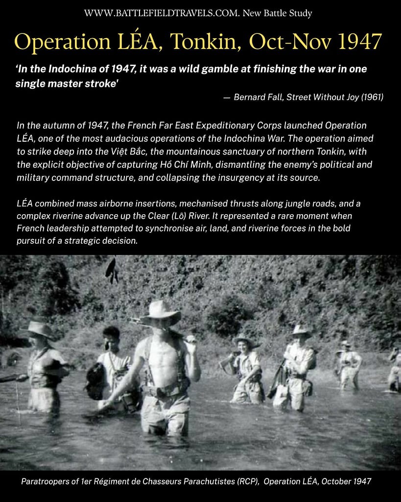
In the autumn of 1947, the French Far East Expeditionary Corps launched Operation LÉA, one of the most audacious operations of the Indochina War. The operation aimed to strike deep into the Việt Bắc, the mountainous sanctuary of northern Tonkin, with the explicit objective of capturing Hồ Chí Minh, dismantling the enemy’s political and military command structure, and collapsing the insurgency at its source.
LÉA combined mass airborne insertions, mechanised thrusts along jungle roads, and a complex riverine advance up the Clear (Lô) River. It represented a rare moment when French leadership attempted to synchronise air, land, and riverine forces in the bold pursuit of a strategic decision.

Key facts
🗺️ Operation LÉA (Việt Bắc Campaign) 7 October–8 November 1947
⚔️ French Indochina War, 1946–1954 ~15,000 troops of the French Far East Expeditionary Corps versus ~35,000 Việt Minh
🎯 Objective: The French sought to end the incipient war by eliminating Viet Minh leadership and operating bases in the Việt Bắc sanctuary area of Tonkin
Visit my virtual museum of weapons, uniforms and equipment of the French Indochina War
Google Earth map – location of the Operation LÉA battlefields
🧭🥾 Walking the Battlefield
I explored the Operation LÉA battlefields in the old Việt Bắc sanctuary zone in April 2025. I was armed with a range of primary and secondary accounts, including the original French Operations Order and graphic overlays for the airborne drop. I also used unit histories, Việt Minh accounts, diagrams, maps, and GIS overlays in Google Earth Pro to locate key battlefield sites.
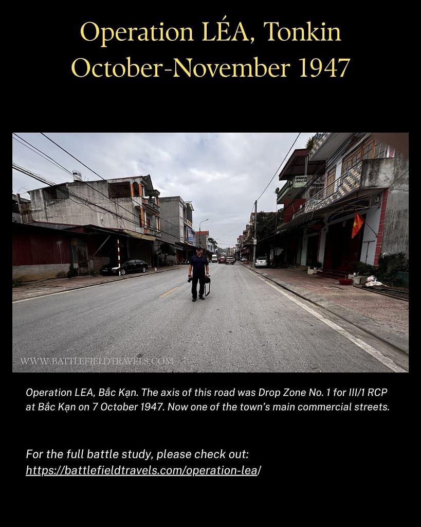
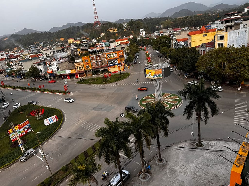
The urban areas of Bắc Kạn, Chợ Mới, and Chợ Đồn have expanded dramatically since 1947, but the landscape is still recognisable, as are the bridges and key buildings that were the French objectives on 7-9 October 1947. I travelled the old Route Coloniale 4 from Lạng Sơn to Cao Bằng, then the old RC3 bis via Phủ Tông Hoá to Bắc Kạn and Chợ Đồn, following the advance of Colonel Beaufre‘s mechanised column.
My overwhelming impression in this rugged country was that, while a combined airborne/mechanised/riverine assault looks decisive on a map, the reality on the ground is very different. The distances are vast, and the terrain is incredibly rugged. The airborne units that dropped on day one of Operation LÉA were separated from each other by 40-60 km of mountains and jungle. They then had to hold their objectives until the mechanised column covered the 140km of jungled mountains from Lạng Sơn to Cao Bằng and the 120km from Cao Bằng to Bắc Kạn, fending off ambushes along the way. A hermetically sealed envelopment was never going to happen!
Table of Contents
- Introduction: Operation LÉA
- Strategic Context – the French Indochina War
- Operation LÉA: Opposing Forces
- Airborne assault on Bắc Kạn – morning of 7 October 1947
- 🔒Airborne assault on Chợ Mới – afternoon, 7 October 1947
- 🔒D+1 Airborne assault on Chợ Đồn – morning of 8 October 1947
- 🔒D+2 Airborne assault on Cao Bằng – morning of 9 October 1947
- 🔒Operation LÉA airborne operation – initial tactical success
- 🔒Mechanised advance – Colonel Beaufre’s Groupement-B
- 🔒The riverine flank – Lieutenant Colonel Communal’s Groupement-C
- 🔒Operation LÉA: the net tightens – or leaks?
- 🔒Clearance operations by Sauvagnac’s Groupement-S
- 🔒Clearance operations by Beaufre’s Groupement-B
- 🔒Deep dive: Did the French ever reach the Việt Minh political heartland?
- 🔒8 November 1947 – Transition to Operation CEINTURE
- 🔒Results and long-term implications
- 🔒The Operation LÉA battlefields today
- 🔒📚 Notes and References
- 📚 Further Reading
- Operation LÉA: Digital 3D map preparation
- 🧭 Operation LÉA Battlefield Travel Guide (Việt Bắc, October–November 1947)
- FAQ: Operation LÉA (1947)
Overview of Operation LÉA in 11-slides

Operaton LEA introduction Operaton LEA opposing leaders Operaton LEA, October 1947 Overview 
Operaton LEA, Airborne drop on Bac Kan Operaton LEA, Airborne drop on Cho Moi Operaton LEA, Airborne drop on Cho Don Operaton LEA, Airborne drop on Cao Bang Operaton LEA, Colonel Beaufre’s Mechanised Column Operaton LEA, Colonel Communal’s Riverine Column Operaton LEA, Clearing operations Operaton LEA, Conclusion and link to full article
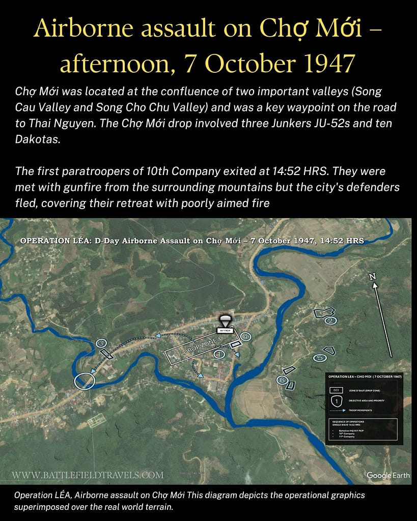
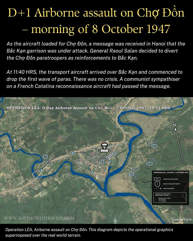
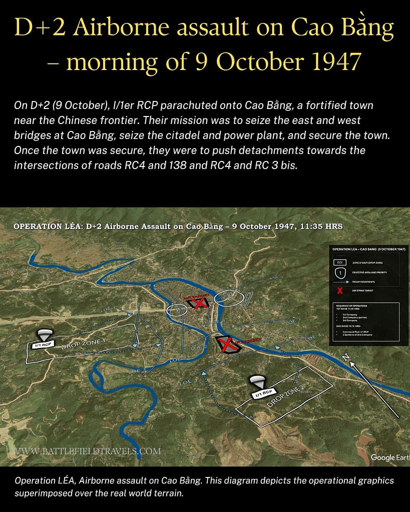
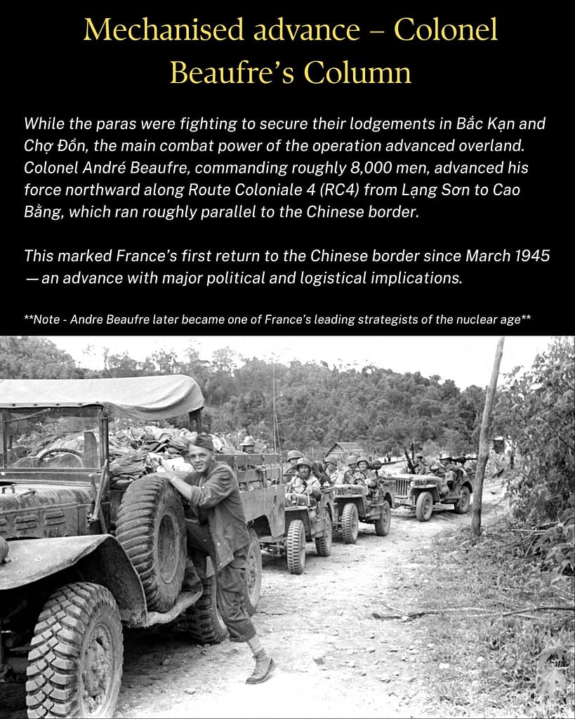
(Trying something new – let me know in comments if you like it!)
Introduction: Operation LÉA
In October 1947, the French Union launched Operation LÉA, one of the most ambitious actions of the French Indochina War. Known to the Việt Minh as the Việt Bắc Campaign (Chiến dịch Việt Bắc), it was conceived as a decisive blow aimed at the political and military heart of the Việt Minh movement. The French plan combined paratroop drops deep into enemy-held territory, a mechanised thrust along the Chinese frontier, and a riverine flotilla pushing up the Clear River.
The objectives were bold. By capturing Hồ Chí Minh, Võ Nguyên Giáp, and other senior leaders, the Commander of the Far East Expeditionary Corps, General Jean-Étienne Valluy, hoped to decapitate the insurgency and collapse the Việt Minh’s political infrastructure. Success, he believed, might end the war in a single stroke. Tactical control of Operation LÉA would be exercised by General Raoul Salan, Commander of TFIN (Troupes françaises d’Indochine du Nord).
Between 7 October and 8 November 1947, French forces struck into the rugged northern mountains of Tonkin. The campaign inflicted heavy casualties and destroyed stockpiles of weapons and materiel. But the Việt Minh leadership slipped through the net.
The failure to annihilate the enemy meant that, despite tactical victories, Operation LÉA became a symbol of the strategic frustrations that would plague the French effort in Indochina.
Strategic Context – the French Indochina War
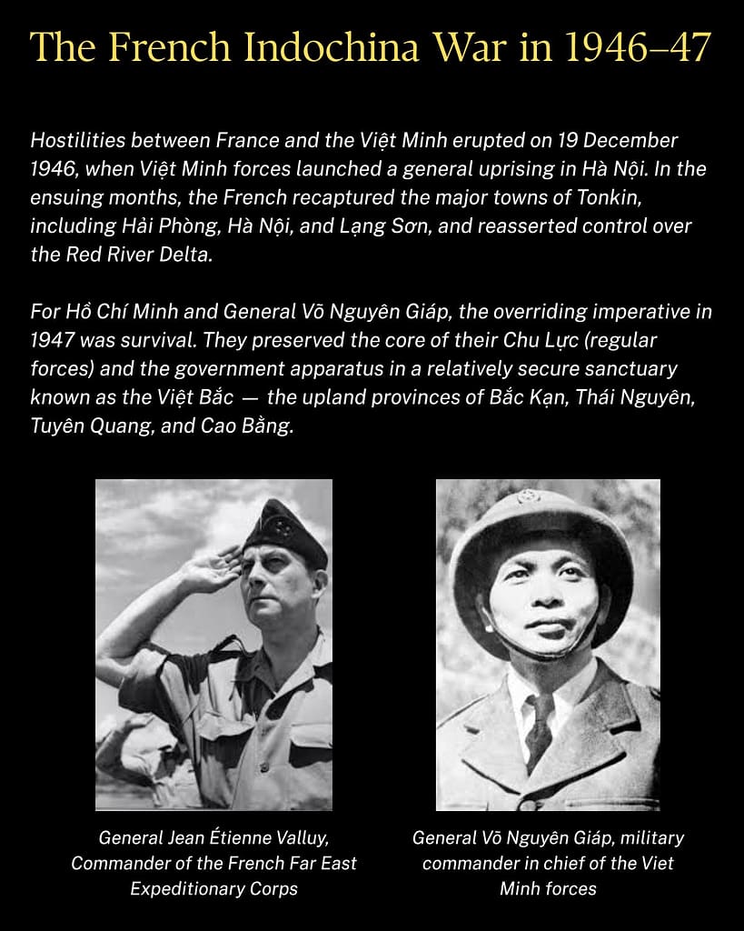
The Indochina War in 1946–47
Hostilities between France and the Việt Minh erupted on 19 December 1946, when Việt Minh forces launched a general uprising in Hà Nội. In the ensuing months, the French recaptured the major towns of Tonkin, including Hải Phòng, Hà Nội, and Lạng Sơn, and reasserted control over the Red River Delta.
Beyond the towns and the major roads, French control was fragile. The Việt Minh political cadres maintained their networks in the villages, organising taxation, propaganda, and guerrilla activity. The French could garrison cities and outposts, but they lacked the manpower to dominate the countryside.
The Việt Bắc Sanctuary
For Hồ Chí Minh and his military commander, General Võ Nguyên Giáp, the overriding imperative in 1947 was survival. They preserved the core of their Chu Lực (regular forces) and the government apparatus in a relatively secure sanctuary known as the Việt Bắc — the upland provinces of Bắc Kạn, Thái Nguyên, Tuyên Quang, and Cao Bằng.
The region’s geography favoured defence. Rugged mountains, dense forests, and a primitive road network limited French mobility. From bases hidden in valleys and forests, the Việt Minh could direct operations into the Red River Delta while protecting their leadership from sudden attack. The area also kept them within reach of the Chinese border, a potential lifeline if circumstances shifted.
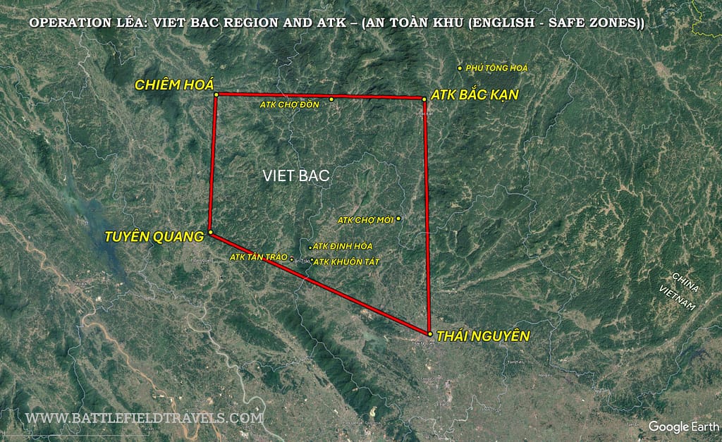
French Objectives for Operation LÉA
General Valluy believed that by decapitating the Việt Minh leadership and destroying their base area, he could bring the conflict to a swift conclusion. His intelligence service had identified the location of key command centres, training facilities, propaganda outlets, and munition stockpiles. French intelligence estimated 30,000–35,000 Việt Minh troops in the redoubt, with a combat strength equivalent to fifteen regular battalions.4Salan, Mémoires: Fin d’un Empire (Paris, 1971), p. 92.
Prior to Operation LÉA, the French had already conducted significant airborne operations in Indochina. During Operation PAPILLON I, ~450 paratroopers of the 1er RCP had seized Hòa Bình in a daring operation. A month later, on Operation APHRODITE, more than 1,000 paratroopers of the 1er RCP and 1er Bataillon de Choc dropped at Phú Thọ. Operation LÉA would be on a much larger scale and would test whether modern airborne and mechanised warfare could crush a nationalist insurgency before it consolidated.
Việt Minh Strategy
The Việt Minh leadership followed Mao Zedong’s doctrine of protracted people’s war:
- Avoid battle against superior forces unless conditions guaranteed local superiority.
- Rely on the people for intelligence, supplies, and recruits.
- Preserve leadership at all costs by dispersal and mobility.
- Maintain base areas where cadres could regroup, train, and expand their influence.
Hồ and Giáp understood that their forces were still in the strategic defensive phase. They could ambush convoys and harass garrisons, but their priority was to preserve the movement. They therefore expected French offensives and planned for evasion rather than confrontation.
Aerial reconnaissance photographs revealed that the Việt Minh had prepared for a possible French assault on the Việt Bắc. A French intelligence report in August 1947 stated: “The access routes south of the Tuyên Quang – Thái Nguyên – Phủ Lạng Thương line have been completely destroyed. On the waterways, rafts are being prepared for the construction of dams [to block river passage].”6Andre Beaufre, Into the Heart of the Việt Minh Redoubt, journal article
The Việt Minh had cut the few roads in the region by digging deep ditches across them. On RC4 and RC3 bis (extension), the main roads the French would rely on during Operation LÉA, there were about 100 such gaps over nearly 250 km of road. In his after-action review, Colonel Beaufre noted that filling these gaps required “a thousand well-equipped men supplied with stones; their deployment was organised as the advance progressed .”7Andre Beaufre, Into the Heart of the Việt Minh Redoubt, journal article
What was at stake in 1947
By the summer of 1947, both sides recognised that the war had entered a critical stage. France needed a decisive victory to justify continued commitment in Indochina to a sceptical French public. The Việt Minh only needed to survive, confident that time and political momentum were on their side.
Operation LÉA was therefore a contest of strategy: French search-and-destroy versus Việt Minh survival and persistence. The campaign would test the limits of both approaches in the challenging terrain of the Việt Bắc.
Operation LÉA: Opposing Forces
 French Union forces
 French Union forces
The French plan of operations
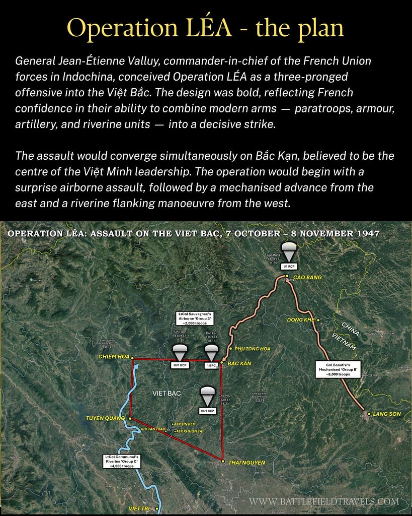
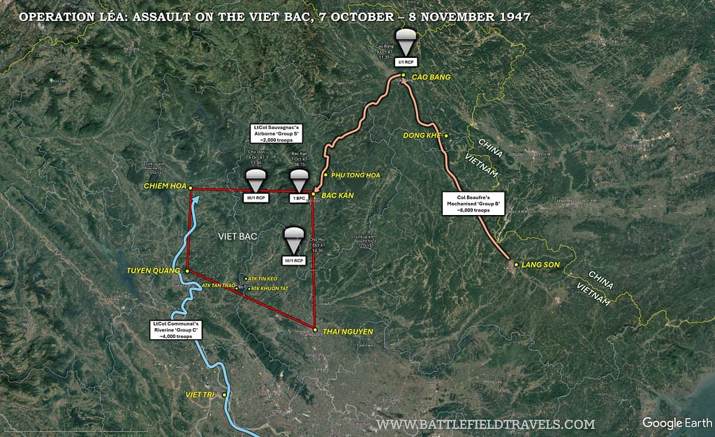
General Jean-Étienne Valluy, commander-in-chief of the French Union forces in Indochina, conceived Operation LÉA as a three-pronged offensive into the Việt Bắc. The design was bold, reflecting French confidence in their ability to integrate modern combined arms—paratroops, armour, artillery, and riverine units—into a decisive strike.
Overall command
Tactical control of the operation was exercised by General Raoul Salan, commander of TFIN (Troupes françaises d’Indochine du Nord (French forces in Northern Indochina)).
General Salan intended to converge simultaneously on Bắc Kạn, believed to be the centre of the Việt Minh leadership. The operation would begin with a bold airborne assault on to the key objectives, followed by a mechanised advance from the east and a riverine flanking manoeuvre from the west.
Airborne assault: Groupement-S (Sauvagnac)
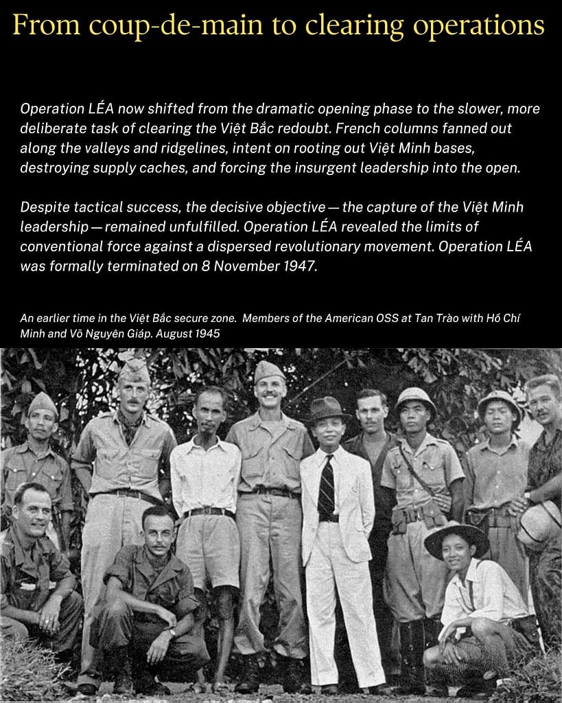
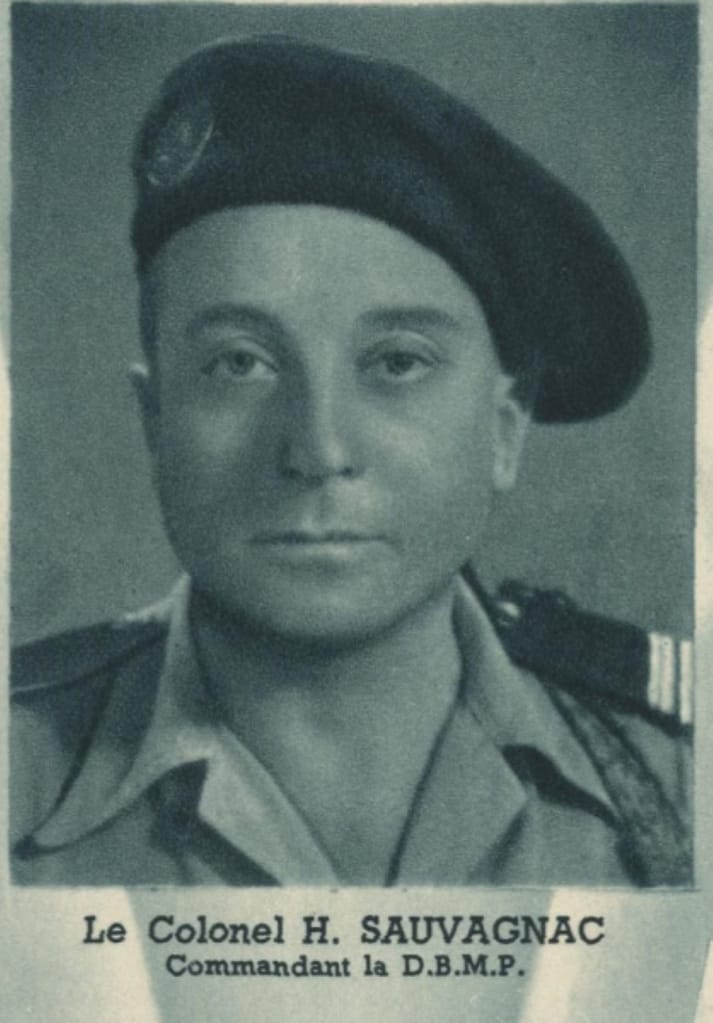
The airborne component was commanded by Lieutenant-Colonel Henri Sauvagnac, commander of the Demi-Brigade de Marche Parachutiste (DBMP – composite parachute half-brigade) and was to conduct the coup-de-main operation. Its mission was to paralyse the Việt Minh high command, seize bridges and key infrastructure, and, if possible, capture Hồ Chí Minh and Võ Nguyên Giáp.
The Operations Order specified three main objectives:
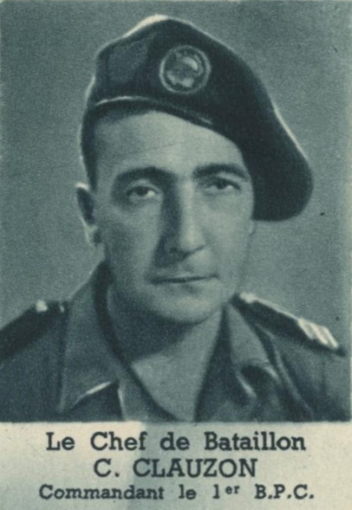
- Bắc Kạn: the political capital of the Việt Bắc, targeted by the 1er Bataillon Parachutiste de Choc (1er BPC – “1st Shock Parachute Battalion”) under Major Clauzon and Colonel Sauvagnac’s DBMP headquarters
- Chợ Mới: targeted by two companies of III/1er Régiment de Chasseurs Parachutistes (III/1er RCP – ‘3rd Battalion, 1st Parachute Chasseur Regiment‘) under Capitaine Guiard.
- Chợ Đồn: to be secured by the remainder of III/1er RCP under Major Fossey-François.
- On D+2, a further drop by I/1er RCP under Major Vismes would seize Cao Bằng and secure access bridges in support of the mechanised column.
The drop plan was ambitious. It assumed surprise and rapid consolidation, but the units were widely dispersed, and the terrain around Bắc Kạn was rugged, limiting communication once on the ground.8Fall, Street Without Joy (New York, 1961), pp. 28–29.
Mechanised Advance: Groupement-B (Beaufre)
The heaviest blow was to be delivered by Colonel André Beaufre and his mechanised force of about 8,000 troops. His mission was to advance north from Lạng Sơn along Route Coloniale 4 (RC4), reoccupy Cao Bằng, and then turn southwest along RC3 bis and cover the 120km to Bắc Kạn through the Col de Léa (Léa Pass – which gave the operation its name), to link with the paras at Bắc Kạn. Beaufre’s column was heavily armed, comprising:
- 3e Régiment Étranger d’Infanterie (3e REI – ‘3rd Foreign Legion Infantry Regiment‘) under Lieutenant-Colonel Royer.
- Régiment d’Infanterie Coloniale du Maroc (RICM – ‘Colonial Infantry Regiment – Moroccan‘) under Lieutenant-Colonel de La Brosse.
- A Bataillon de Marche of the 5e Régiment de Tirailleurs Marocains (BM 5e RTM – ‘Provisional Battalion of the 5th Moroccan Tirailleurs Regiment‘) mounted on horses and mules.
- II/1er Régiment d’Infanterie Coloniale (II/1er RIC – ‘2nd Battalion, 1st Colonial Infantry Regiment‘).
- III/69e Régiment d’Artillerie d’Afrique (III/69e RAA – ‘3rd Battalion, 69th African Artillery Regiment’) with heavy support.
- Elements of the Régiment d’Artillerie Coloniale du Maroc (RACM – ‘Colonial Artillery Regiment – Moroccan’).
- Engineer companies.
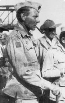
Beaufre’s force was essentially a mobile strike group, comprising armoured cars, half-tracks, and artillery capable of breaching Việt Minh roadblocks. Its advance was expected to restore French control along RC4, a critical axis to the Chinese frontier.9Salan, Mémoires: Fin d’un Empire, pp. 100–104.
Riverine Flanking Manoeuvre: Groupement-C (Communal)
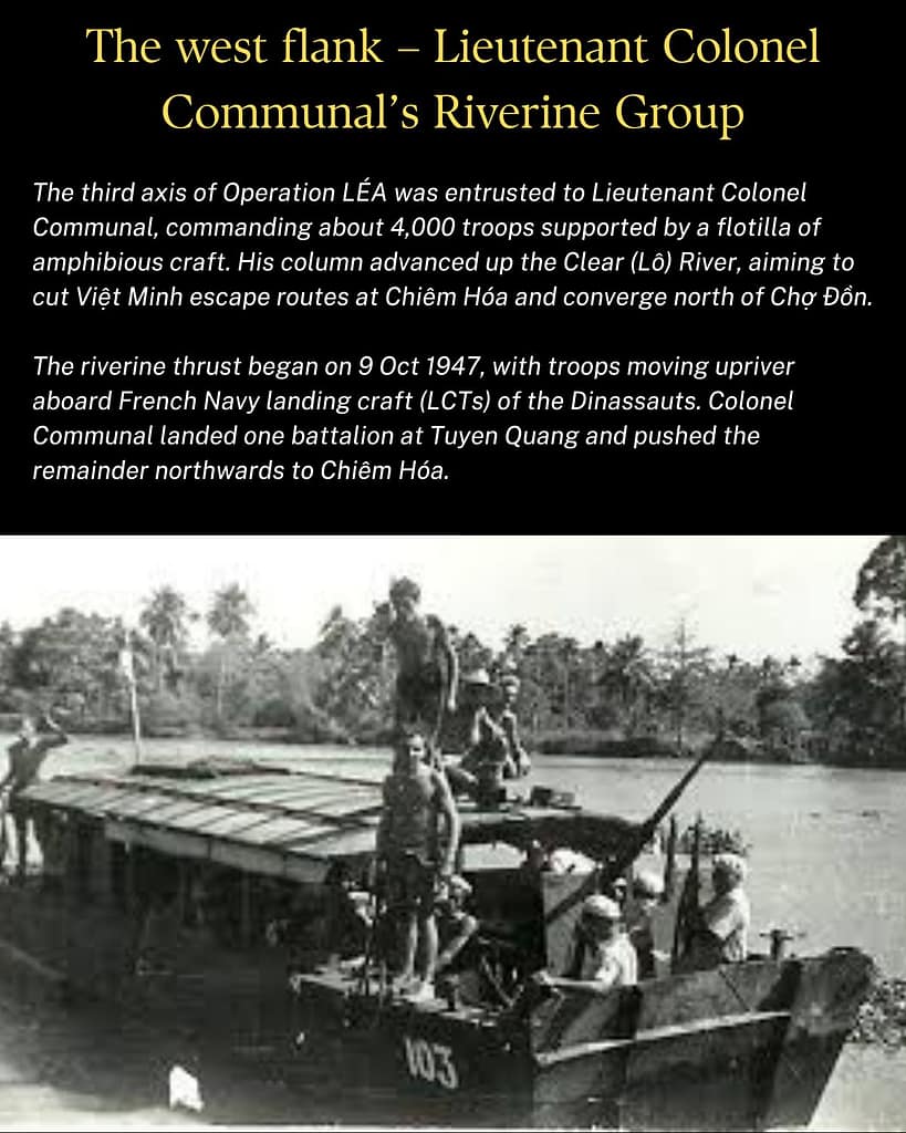
The third element, commanded by Lieutenant-Colonel Pierre Communal, was tasked with a wide flanking move up the Clear (Lô) River to the west. With about 4,000 troops, its mission was to cut off Việt Minh escape routes around Chiêm Hóa and link with the other columns north of Chợ Đồn. Communal’s column included:
- III/6e Régiment d’Infanterie Coloniale (III/6e RIC – ‘3rd Battalion, 6th Colonial Infantry Regiment’).
- A Bataillon de Marche of the 43e Régiment d’Infanterie (BM 43e RI – ‘Provisional Battalion of the 43rd Infantry Regiment’).
- Commando Jaubert, amphibious raiding.
- Supporting artillery from the 69e RAA.
- 1st, 3rd, and 5th Dinassauts (Division Navale d’Assaut, ‘Naval Assault Division’)) equipped with modified landing craft and amphibious vehicles.
- Armoured and engineering detachments.
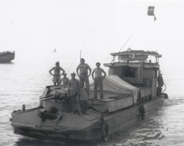
Progress was slow. The river was obstructed by rapids and natural barriers, forcing elements to disembark and march overland with their supplies. Nevertheless, the flotilla brought valuable amphibious craft into the region, which later supported clearing operations.10Windrow, The Last Valley: Dien Bien Phu and the French Defeat in Vietnam (London, 2004), p. 67.
Việt Minh Forces and Dispositions
 Việt Minh Forces and Dispositions
Main Force Units
The Việt Minh presence in the Việt Bắc was formidable. French intelligence believed the sanctuary housed 30–35,000 troops, though many were poorly armed militia. General Raoul Salan later estimated that the combat strength was equivalent to fifteen effective battalions.
According to Võ Nguyên Giáp’s memoirs, the main regiments engaged in the Operation LÉA zone were:
- 72nd Regiment at Bắc Kạn.
- 74th Regiment at Cao Bằng.
- 11th Regiment at Lạng Sơn.
- 147th Regiment in the Khê Pass region.
- 165 Regiment in the Việt Bắc
These units, supported by local militias and village defence groups, were instructed to avoid pitched battle and preserve strength. Instead, they would harass French convoys, destroy bridges, and draw the French into ambushes.
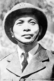
Leadership
French intelligence — unusually accurate for this period — had pinpointed the presence of key Việt Minh leaders in the redoubt:
- Hồ Chí Minh, head of state, based at Định Hóa.
- Võ Nguyên Giáp, commander-in-chief, in Tuyên Quang.
- Trường Chinh, Communist Party general secretary, in Bắc Kạn.
- Nguyễn Văn Huyên, Minister of Education, in Chiêm Hóa.
- Hoàng Văn Thái, Chief of Staff, also in Bắc Kạn.
Had the French succeeded in capturing any of these figures, the consequences for the Việt Minh movement would have been devastating. As it was, the French paratroopers came so close to achieving their mission that they found correspondence on Hồ Chí Minh‘s desk, ready for signature.11Fall, Street Without Joy, p. 28.
Balance of Forces
On paper, the French Union deployed approximately 15,000 troops, supported by armour, artillery, and aircraft. The Việt Minh could muster a comparable number in the area, though many were lightly armed and lacked heavy weapons.
Yet numbers told only part of the story. The French relied on rapid movement along roads, rivers, and airborne axes. The Việt Minh could vanish into forests, abandon towns, and re-emerge behind French lines. The contest would therefore be decided not by force ratios but by whether Valluy’s three converging columns could trap the Việt Minh leadership before it melted away into the Việt Bắc wilderness.
Airborne assault on Bắc Kạn – morning of 7 October 1947
Operation LÉA commences
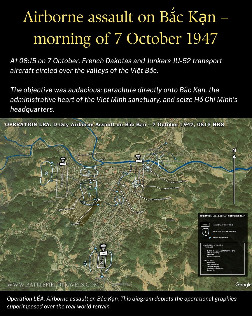
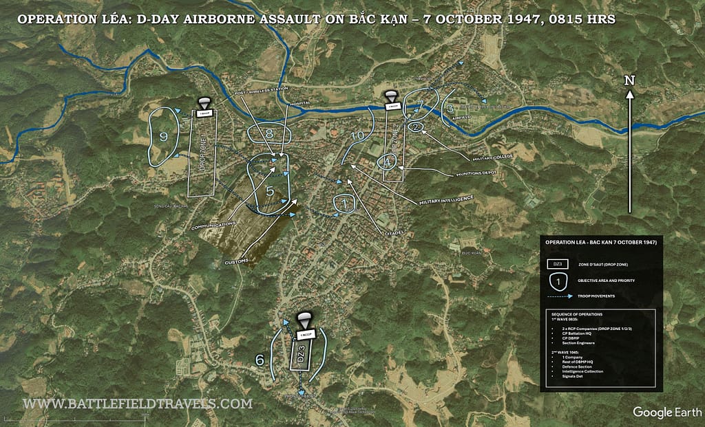
At 08:15 on 7 October, French Dakotas and Junkers JU-52 transport aircraft circled over the valleys of the Việt Bắc. The objective was audacious: parachute directly onto Bắc Kạn, the administrative heart of the Việt Minh sanctuary, and seize Hồ Chí Minh’s headquarters.
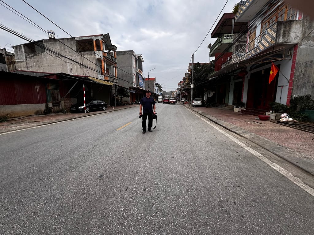
Bắc Kạn – 1st wave landings
After a preliminary bombing and strafing run by fighter aircraft, the 1er Bataillon Parachutiste de Choc under Major Clauzon jumped onto three designated drop zones around the town.
The first two aircraft dropped their paratroopers at Drop Zone No. 2 to secure the Sông Cau bridge. The following aircraft dropped a platoon at Drop Zone No. 3 to establish a roadblock south of the town. The remaining 16 aircraft dropped their paratroopers at Drop Zones No. 1 and 2.
Tactical surprise was almost complete. A Việt Minh battalion was in the area and engaged the aircraft and descending paratroopers. Many of the Việt Minh troops were unprepared for a large-scale airborne assault and fled in confusion, abandoning weapons, documents, and prisoners.
Securing the Bắc Kạn objectives
As the paratroopers landed, they rallied and raced immediately to their objectives. By 08:45, Grent’s platoon had seized the bridge over the Sông Cau River. By 09:30, 1st Company had seized the Voice of Vietnam radio station (although the radio equipment had been removed), the hospital and the residence. At 09:45 there was a minor skirmish at the Courthouse.
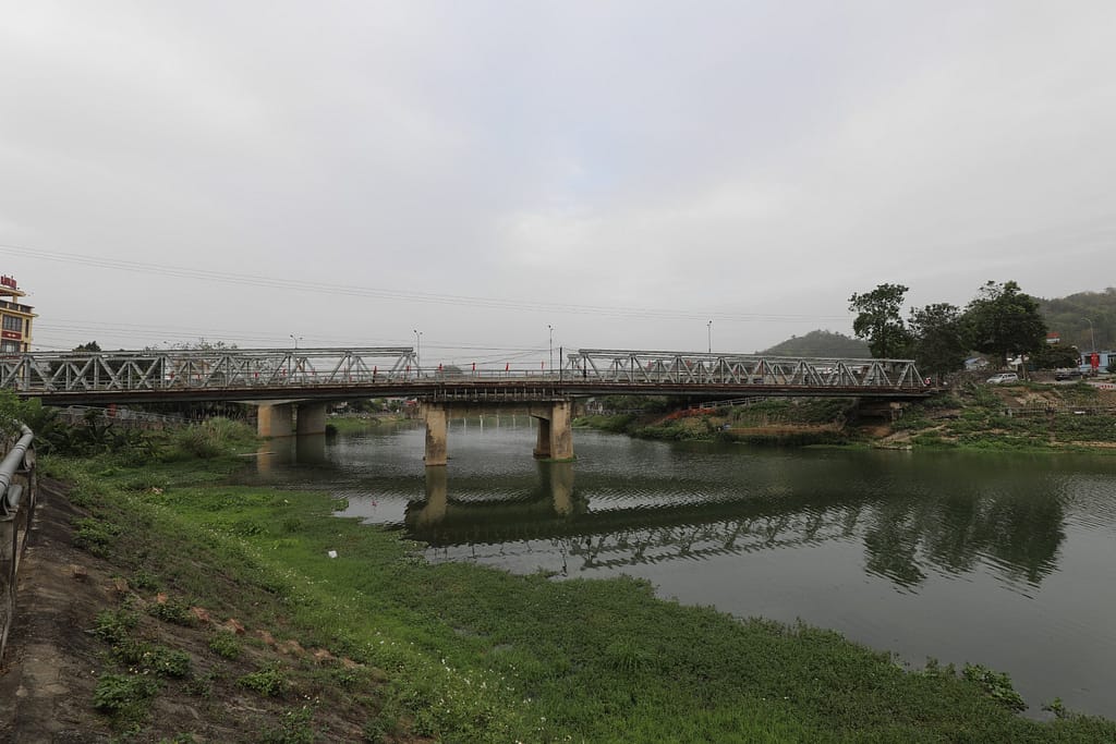
Bắc Kạn – 360 degree image of the Sông Cau River bridge.
Bắc Kạn – 2nd wave of paratroopers
At 10:45, the second wave of paratroopers dropped, with 15 aircraft dropping on Drop Zone No. 1 and four aircraft on Drop Zone No. 2. Again, the paratroopers rushed to secure their pre-planned objectives. Some paratroopers were attacked with knives and bamboo poles by local civilians.
By 13:15 HRS, the paratroopers had secured the town. They captured stockpiles of materiel and freed around 200 French and Vietnamese hostages who had been taken during the initial uprising in December 1946. They also took dozens of prisoners, including a senior minister13Fall, Street Without Joy, pp. 28–29.. French reports claimed over 260 enemy dead in the opening hours.
The main prize escapes
But the ultimate prize eluded them. Hồ Chí Minh and Võ Nguyên Giáp had already dispersed into the surrounding forests. Later, Hồ admitted that French patrols passed within metres of his hiding place, but he slipped away undetected.14Hồ Chí Minh, quoted in Salan, Mémoires,p. 94.
Expansion of the Bắc Kạn airhead
Once inside Bắc Kạn, the paras established defensive perimeters and began aggressive patrolling. Engineers secured bridges and key road junctions. A parachute surgical unit was set up in the town, treating more than a hundred wounded over the coming weeks — both French and Việt Minh.15Windrow, The Last Valley, p. 29.
However, isolation quickly became a problem. Radio contact with Hanoi and with the advancing columns was intermittent. The drop had scattered units across rough, forested terrain, forcing small groups to fight their way to assembly points. Meanwhile, Việt Minh cadres were already regrouping in the surrounding hills, harassing patrols and ambushing convoys on the approach roads.
👉 Continue reading — this article is part of the BattlefieldTravels Deep Research Collection. The full 12,949-word analysis draws on eyewitness accounts of the 1947 French Operation LÉA, (Việt Bắc Campaign), operational records and reports, operational graphics, extensive GIS terrain analysis, firsthand fieldwork on the battlefields around Bắc Kạn Chợ Mới, Chợ Đồn, Cao Bằng, and Tuyên Quang, and engagement with the local communities. Primary source examination, tactical conclusions, and notes & references that exist nowhere else in English. Try membership free for 7 days.
📚 Further Reading
This battle study nests within the broader analytical framework explored in the Research Hub, where operational methods, operating environments, armies, commanders, and weapons are examined across conflicts and eras. The links below connect related studies across the wider body of battlefield analysis on the BattlefieldTravels site.
⚔️ Explore all battle studies from the French Indochina War 1946-1954
⚔️ Explore all battle studies involving the French Foreign Legion
🏛️Explore the museum of French Indochina War historic artefacts
📚French Indochina War 1946-54 – Recommended Reading
🗞️ For updates on new battlefield studies and research insights, you can subscribe to the Newsletter.
You may also like
 ⚔️🔒Operation HIRONDELLE, (Raid on Lạng Sơn), Vietnam,
17-21 July 1953
 ⚔️🔒Battle of Route Coloniale 4,
(Cao Bang Ridge Disaster),
16 Sep-18 Oct 1950
 ⚔️🔒Battle of Phủ Tông Hoá, Tonkin, 25 July 1948
 ⚔️ Battle for Dien Bien Phu, Vietnam,
13 March – 7 May 1954
 🏛️ French Indochina War (1946–1954) Weapons and Equipment
 🏛️ French Algerian War (1954–1962) Weapons and Equipment
Operation LÉA: Digital 3D map preparation
This is how I converted the original Operation LÉA battlefield graphics into digital overlays, then laid them on 3D digital terrain to match with the current topography. I was then able to walk the ground and identify the exact locations of the French drop zones, objectives, routes, check points etc.
🧭 Operation LÉA Battlefield Travel Guide (Việt Bắc, October–November 1947)
Operation LÉA was a bold French airborne and ground campaign aimed at striking deep into the Việt Bắc to disrupt Việt Minh leadership, command infrastructure, and sanctuary areas. Unlike a single battlefield, LÉA unfolded across a dispersed network of drop zones, jungle tracks, river corridors, and vulnerable colonial roads. This guide follows the operation geographically, allowing visitors to understand how terrain, distance, and logistics shaped both French ambition and failure.
Getting There
- The operational area lies in northern Vietnam, north of Hanoi, in modern Bắc Kạn, Thái Nguyên, and Tuyên Quang provinces.
- Hanoi is the logical base, with road access north via National Routes QL3 and QL1 toward Thái Nguyên and Lạng Sơn.
- Independent travel is possible, but local drivers familiar with mountainous roads are strongly recommended.
- Expect slow travel times — distances are short, but terrain is demanding.
Site Orientation – The LÉA Battlespace
- The Việt Bắc is a rugged region of steep jungle-covered ridges, narrow valleys, and limited road infrastructure.
- French forces relied on a combination of airborne insertion, riverine movement, and long vulnerable road columns.
- The Việt Minh exploited interior lines, concealment, and superior local knowledge.
- Understanding LÉA requires thinking in terms of movement corridors rather than fixed battlefields.
Bắc Kạn – Airborne Decapitation Attempt
- Bắc Kạn was the primary airborne objective of Operation LÉA.
- French paratroopers dropped directly onto the town in October 1947.
- The operation aimed to capture Hồ Chí Minh, Võ Nguyên Giáp, and Việt Minh headquarters.
- The town today is heavily modernised, but its valley setting illustrates why it was a natural command hub.
- Key insight: airborne tactical success did not translate into operational control.
Chợ Mới and Chợ Đồn – Jungle Corridors and Missed Opportunities
- These smaller settlements sat astride jungle tracks linking Bắc Kạn to surrounding valleys.
- French columns struggled to move rapidly enough to seal escape routes.
- Dense vegetation, poor tracks, and ambush terrain favoured the Việt Minh.
- On the ground, visitors will appreciate how easily movement could be concealed.
Route Coloniale 4 (RC4) – Lạng Sơn to Cao Bằng to Bắc Kạn
- RC4 formed the eastern ground axis intended to link with airborne forces.
- The route passed through narrow valleys, defiles, and ambush-prone ridgelines.
- French columns were repeatedly delayed, canalised, and harassed.
- Later disasters along RC4 (1950) echo the vulnerabilities exposed during LÉA.
- Driving sections of RC4 today reveals just how limited manoeuvre options were.
Route Coloniale 3 bis (extension) (RC3 bis) – Central Axis into the Việt Bắc
- RC3 bis links Cao Bằng with Bắc Kạn.
- This route represented the most direct ground approach to the airborne drop zones.
- Terrain alternates between narrow valleys and steep jungle-covered slopes.
- French reliance on roads constrained tempo and initiative.
The Lô (Clear) River System – Riverine Operations
- The Lô River served as a key French logistical and manoeuvre corridor.
- Riverine columns attempted to penetrate deep into Việt Minh-controlled areas.
- Ambushes along riverbanks demonstrated Việt Minh adaptability.
- Visitors following the river can visualise how movement was both enabled and constrained by waterways.
On-Site Experience
- Expect limited formal interpretation or signage related to Operation LÉA.
- The value lies in terrain appreciation rather than monuments.
- Walking valley floors and observing ridgelines is essential to understanding outcomes.
- Mapping tools and period overlays significantly enhance the visit.
Nearby Points of Interest
- Thái Nguyên – French logistics hub and gateway to the Việt Bắc.
- Tuyên Quang – Later focal point of French defensive efforts.
- Cao Bằng – Strategic context for later RC4 operations.
Practical Tips
- Plan multi-day travel; this is a campaign route, not a single stop.
- Hire local drivers familiar with mountain roads.
- Weather can dramatically affect visibility and road conditions.
- Use offline maps and GPS — mobile coverage is inconsistent.
- Approach sites with cultural sensitivity; this is not a tourist circuit.
FAQ: Operation LÉA (1947)
Operation LÉA was a major French offensive launched in October 1947 during the First Indochina War. It aimed to strike deep into the Việt Bắc region to disrupt Viet Minh leadership, logistics, and command structures through a combination of airborne, road, and river operations.
The primary objective was to capture or kill senior Viet Minh leaders, including Hồ Chí Minh and Võ Nguyên Giáp, and to dismantle the Việt Bắc as a functioning sanctuary and headquarters area.
The operation unfolded across northern Vietnam, centred on Bắc Kạn, Chợ Mới, Chợ Đồn, the Lô River system, and the road networks of Route Coloniale 3 and Route Coloniale 4.
Tactically, French forces achieved several local successes, including a successful airborne drop at Bắc Kạn. Strategically, the operation failed to achieve its main objectives, as Viet Minh leadership escaped and quickly re-established control.
The operation failed due to the size and ruggedness of the terrain objectives, limited road infrastructure, slow-moving ground columns, and the Viet Minh’s superior knowledge of jungle routes and interior lines. French forces were unable to seal escape corridors in time.
Operation LÉA demonstrated the limits of deep penetration operations against a dispersed, terrain-adapted insurgent force. It shaped later French operations and foreshadowed vulnerabilities that would reappear during the Route Coloniale 4 disaster in 1950.
Subscribe to Battlefield Travels and receive a free E-Book Battlefield Guide
Unlock expert battlefield analysis, campaign reconstructions, and historical insights drawn from firsthand exploration and primary sources.
🗺️ You’ll receive:
🎖️ Exclusive historical insights you won’t find elsewhere
📘 A free eBook: 10 Tips for Exploring Historic Battlefields
📰 New battlefield studies straight to your inbox as they are published

⚔️ Go deeper — Members get exclusive access to the Deep Research Collection, Field Notes, and monthly Research Dispatches. Try membership free for 7 days, cancel anytime. From $9/month.
Another excellent and comprehensive study, Mick. I’ve posted the link to a FB group of mainly French subscribers, so you should see an influx of hits from Francophone domains soon (after the post is approved). Yes, the slide summary idea works well.
I’m heading back to VN in March to look around the area covered by Operation Papillon, among other things.
Thanks Tony,
It was hard work pulling this together – especially the riverine aspects. Op PAPILLON is on my to-do list. I walked all the ground around Hoa Binh, RC6, Ao Trach etc earlier this year. Also visited Moc Chau and Son La, which were the ground advance objectives after the PAPILLON drop. Information is scarce!
Make sure you visit the hilltop fort at Moc Chau. Mr Tranh runs a great little museum and a well preserved site.
Mick