British 3rd Division and Commandos secure the eastern D-Day beachhead!
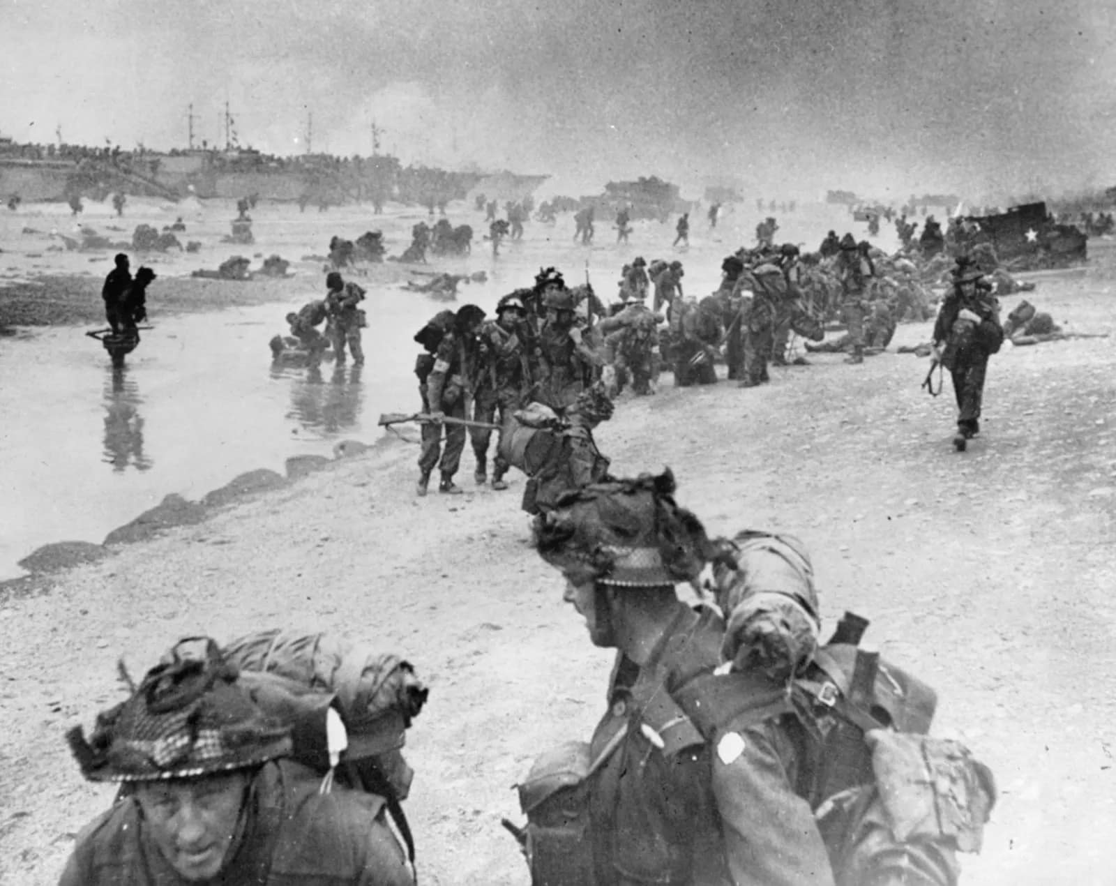
On 6 June 1944, the British 3rd Division, supported by the 1st Special Service Brigade and 79th Armoured Brigade, stormed Sword Beach, the easternmost Allied landing sector in Normandy. Their success secured the D-Day landing Allied left flank, linked with the airborne lodgement at the Orne, and set the stage for the long struggle for Caen.
Key facts
Google Earth map – location of D-Day Sword Beach
Normandy series of battlefield studies
This article is part of a series exploring the D-Day airborne and amphibious battlefields on 6 June 1944 and the immediate aftermath. Click on the hotlinks to open the battlefield study.
Strategic Context – Operation OVERLORD
Allied grand strategy
By 1944, the Western Allies had resolved to open a second front in Europe. The Soviet Union had been carrying the main burden of the land war since 1941, suffering immense casualties. Stalin pressed Roosevelt and Churchill for direct action in France to relieve pressure on the Eastern Front. The Anglo-American response was Operation Overlord, the cross-Channel assault designed to break into north-west Europe and defeat Nazi Germany.1Max Hastings, Overlord: D-Day and the Battle for Normandy (London: Michael Joseph, 1984), pp. 29–33.
D-Day operational framework
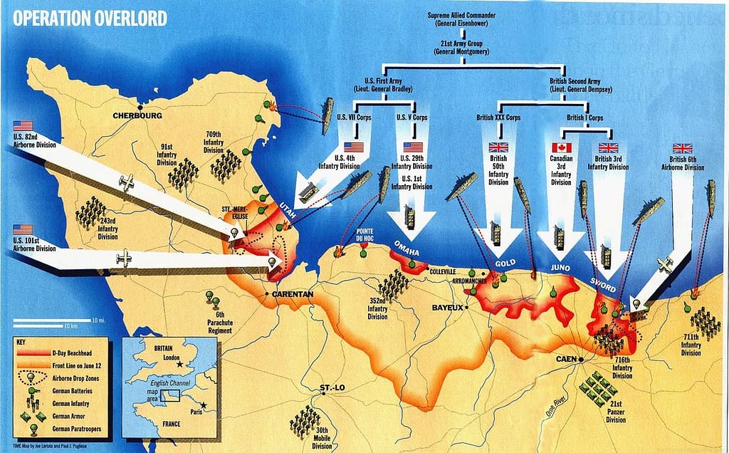
Strategic Context: Why Sword Beach was important on D-Day
Sword Beach was the easternmost of the five Allied landing beaches on D-Day, 6 June 1944. It extended for roughly 8 kilometres along the Normandy coast from Ouistreham to Saint-Aubin-sur-Mer. The sector was allocated to the British 3rd Infantry Division, supported by Lord Lovat’s 1st Special Service Brigade, Royal Marine Commandos and armour.
The landing force was tasked with capturing Ouistreham, advancing inland to link up with the airborne forces on the Orne, and seizing Caen, only 15 kilometres inland from the coast. Caen was a critical operational objective. As the hub of the Normandy road network, its capture would open the way for Allied exploitation into the interior of France.3L.F. Ellis, Victory in the West, Vol. I: The Battle of Normandy (London: HMSO, 1962), pp. 181–183
Link with the eastern flank airborne operations
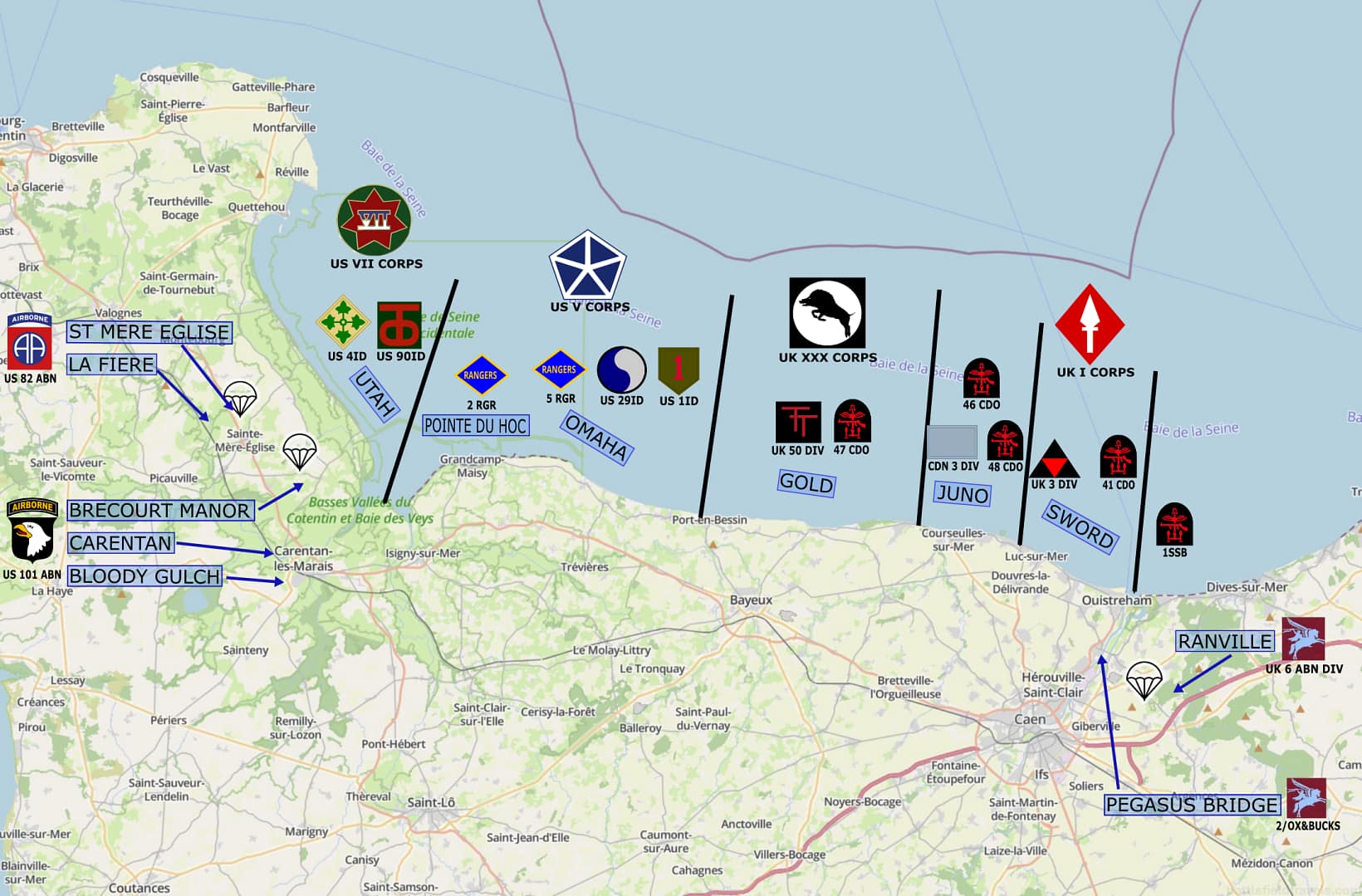
Sword Beach also linked the seaborne landings with the airborne operations on the eastern flank. To the west of Sword Beach, the Canadians at Juno were tasked with securing Bayeux–Caen road objectives. To the east, the British 6th Airborne Division had landed during the night to seize the Orne River bridges, destroy the Merville Battery, and hold the high ground east of Caen against counter-attack.
The integrity of the Allied left flank depended on the Sword–airborne linkup. Without it, German armour could potentially cut between the beaches and roll up the invasion front.4Stephen Ambrose, D-Day, June 6, 1944: The Climactic Battle of World War II (New York: Simon & Schuster, 1994), pp. 228–232.
The German defensive plan
German forces defending the Sword sector fell under Generalleutnant Wilhelm Richter’s 716. Infanterie-Division, a static coastal formation spread thinly along the frontage. More significantly, the 21. Panzer-Division, the sole German armoured formation deployed near the invasion beaches, was in an assembly area near Caen. The possibility of a rapid counter-attack by this division posed a serious risk to the British landings. Its proximity shaped both Allied planning and German reactions on D-Day.5Niklas Zetterling, Normandy 1944: German Military Organisation, Combat Power and Organisational Effectiveness (Winnipeg: J.J. Fedorowicz,
2000), pp. 97–99.
Opposing Forces at Sword Beach

 Allied Forces

 Allied Forces
The assault on Sword Beach was assigned to the British 3rd Infantry Division, under Major-General Tom Rennie. The division, a veteran formation reconstituted after Dunkirk, comprised three infantry brigades supported by armour, artillery, engineers, and specialised assault units of the 79th Armoured Division.
3rd Infantry Division Order of Battle (Sword sector, 6 June 1944):
- 8th Infantry Brigade (Brigadier E.C. Cotton):
- 1st Battalion, Suffolk Regiment
- 2nd Battalion, East Yorkshire Regiment
- 1st Battalion, South Lancashire Regiment
- 9th Infantry Brigade (Brigadier B.H. Collett):
- 2nd Battalion, Lincolnshire Regiment
- 1st Battalion, King’s Own Scottish Borderers
- 2nd Battalion, Royal Ulster Rifles
- 185th Infantry Brigade (Brigadier K.P. Smith):
- 2nd Battalion, Royal Warwickshire Regiment
- 1st Battalion, Royal Norfolk Regiment
- 2nd Battalion, King’s Shropshire Light Infantry
- Divisional Troops:
- 2nd Battalion, Middlesex Regiment (MMG)
- 76th and 92nd Field Regiments, Royal Artillery
- 20th Anti-Tank Regiment, Royal Artillery
- 3rd Reconnaissance Regiment, Royal Armoured Corps
Armour and Specialist Support:
- 27th Armoured Brigade (Brigadier G.E. Prior-Palmer) with Sherman DD tanks from the 13th/18th Royal Hussars assigned to the first wave.
- Elements of the 79th Armoured Division provided specialist armour: AVREs (for demolition), Crocodile flamethrower tanks, and Crab flail tanks.
- 1st Special Service Brigade (with two French Troops attached) tasked with seizing Ouistreham and linking with the 6th Airborne Division.
- Royal Engineers assault teams for obstacle clearance.
Naval fire support from cruisers HMS Belfast, HMS Arethusa, and destroyers of Force S.6L.F. Ellis, Victory in the West, Vol. I: The Battle of Normandy (London: HMSO, 1962), pp. 183–186.
 German Forces at Sword Beach
 German Forces at Sword Beach
The defence of the Sword Beach sector was entrusted to 716. Infanterie-Division, commanded by Generalleutnant Wilhelm Richter. This was a static division of low-grade infantry, supplemented by fortress battalions and Osttruppen companies. Its units were widely dispersed in strongpoints (Widerstandsnester) across an 8 km frontage, manning casemates, anti-tank guns, and machine-gun nests integrated with the coastal villages.
716. Infanterie-Division Order of Battle (Sword sector, June 1944):
- Infanterie-Regiment 726 (two battalions in coastal defence)
- Infanterie-Regiment 736 (two battalions in coastal defence)
- Artillerie-Abteilung 1716 (four batteries with a mix of 75 mm, 100 mm, and 150 mm guns in fixed emplacements)
- Attached units:
- 642. Ost-Battalion (Georgian)
- Coastal anti-aircraft batteries
- Fortress engineers and static machine-gun detachments
More importantly, the 21. Panzer-Division, under Generalleutnant Edgar Feuchtinger, was positioned south of Caen. The division had been rebuilt in France with a mixture of German equipment and captured French vehicles converted for combat use. Its order of battle included:
- 22. Panzer-Regiment (with Panzer IVs and converted Hotchkiss chassis SP guns)
- 125. Panzergrenadier-Regiment
- 192. Panzergrenadier-Regiment
- 155. Panzer-Artillerie-Regiment
- Reconnaissance, engineer, and anti-tank battalions
The division’s proximity meant that a counter-attack could, in theory, reach the beaches on D-Day itself. However, it was subject to the German command system requiring Hitler’s release of panzer reserves, a constraint that delayed its full intervention.7Niklas Zetterling, Normandy 1944: German Military Organisation, Combat Power and Organisational Effectiveness (Winnipeg: J.J. Fedorowicz, 2000), pp.99–104.
Sword Beach geography & terrain
Beach terrain
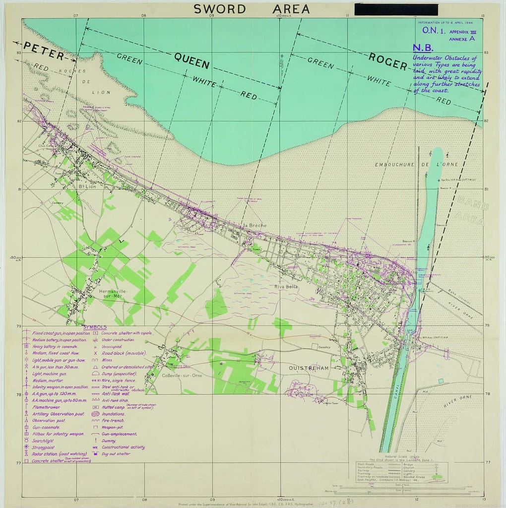
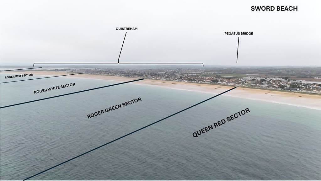
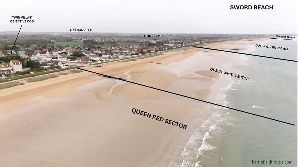
Sword Beach stretched along the Normandy coast for roughly 8 kilometres, from Ouistreham on the Orne estuary in the east to Saint-Aubin-sur-Mer in the west. The shoreline was characterised by wide tidal flats, up to 500–600 metres at low tide, which exposed assaulting troops to fire as they crossed.
Offshore, sandbanks and reefs complicated the run-in for landing craft, particularly off Ouistreham, where narrow channels forced waves to concentrate under enemy fire. Tides were strong, requiring precise timing. The assault was launched on a rising tide, allowing obstacle clearance teams to work while still permitting craft to reach the beach.
Obstacles included stakes, ramps, mined hedgehogs, and Belgian gates, designed to tear apart landing craft or trap them under fire. In many sectors, seawalls and embankments backed the beach, providing defenders with elevated firing positions and attackers with an obstacle that slowed their exit from the sand.8Georges Bernage, Sword Beach: British Landings 1944 (Bayeux: Heimdal, 1994), pp. 22–25.
Coastal villages
Behind the beach lay a string of coastal villages: Lion-sur-Mer, Luc-sur-Mer, and Hermanville-sur-Mer, with stone houses, walled gardens, and narrow streets that were readily adapted into strongpoints. German Widerstandsnester (resistance nests) were integrated into these settlements, with machine-gun embrasures firing down lateral streets, 50 mm and 75 mm anti-tank guns sited to cover exits, and mortar positions inland. Each strongpoint was designed to act independently, capable of all-round defence.
Inland: the Caen plain
The inland terrain rose gradually toward the Caen plain, cut by orchards, hedgerows, and small watercourses. This bocage country offered cover but also channelled movement into narrow lanes. The main axis of advance led toward Caen, 15 kilometres inland, following the Caen–Bayeux highway and secondary routes through villages such as Periers, Lebisey, and Colombelles. These roads were easily defensible choke points, especially if German reserves could be brought forward quickly.9Ellis, Victory in the West, Vol. I (1962), pp. 186–188.
The Orne River and beyond
To the east, the Orne River and Caen Canal formed a major natural boundary. Bridges at Bénouville (Pegasus Bridge) and Ranville (Horsa Bridge) had been seized by the 6th Airborne Division in the early hours of D-Day. Their capture prevented the Germans from using these water barriers to cut the Sword bridgehead off from reinforcements. Control of the Orne crossings enabled the British to link their beach assault with the airborne lodgement, thereby securing the Allied left flank against counterattacks from the east.10Stephen Ambrose, Pegasus Bridge (New York: Simon & Schuster, 1984), pp. 98–104.
Phase 1 – The assault landings (06:30–09:00 hours)
05:30–07:25 — Naval & Air bombardment at Sword Beach
At 05:30 hours on 6 June 1944, Naval Force S, under Rear-Admiral A.G. Talbot, opened the preparatory bombardment of Sword sector. British cruisers HMS Belfast and HMS Arethusa, supported by destroyers and monitors, targeted known strongpoints along the coast, while rocket ships and landing craft mounted with guns provided closer fire support. RAF Bomber Command and the USAAF had attacked the area earlier in the night, but with limited effect due to cloud cover. Naval fire, although intense, did not completely neutralise the German positions, many of which were reinforced concrete casemates.11Ellis, Victory in the West, Vol. I (1962), pp. 188–190.

07:25–08:15 — First wave landing: DD Shermans & 8th Brigade
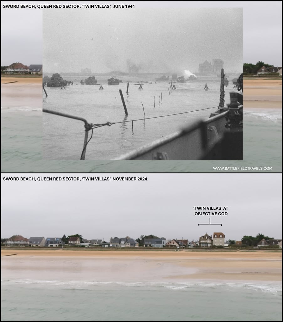
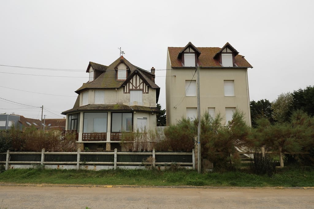
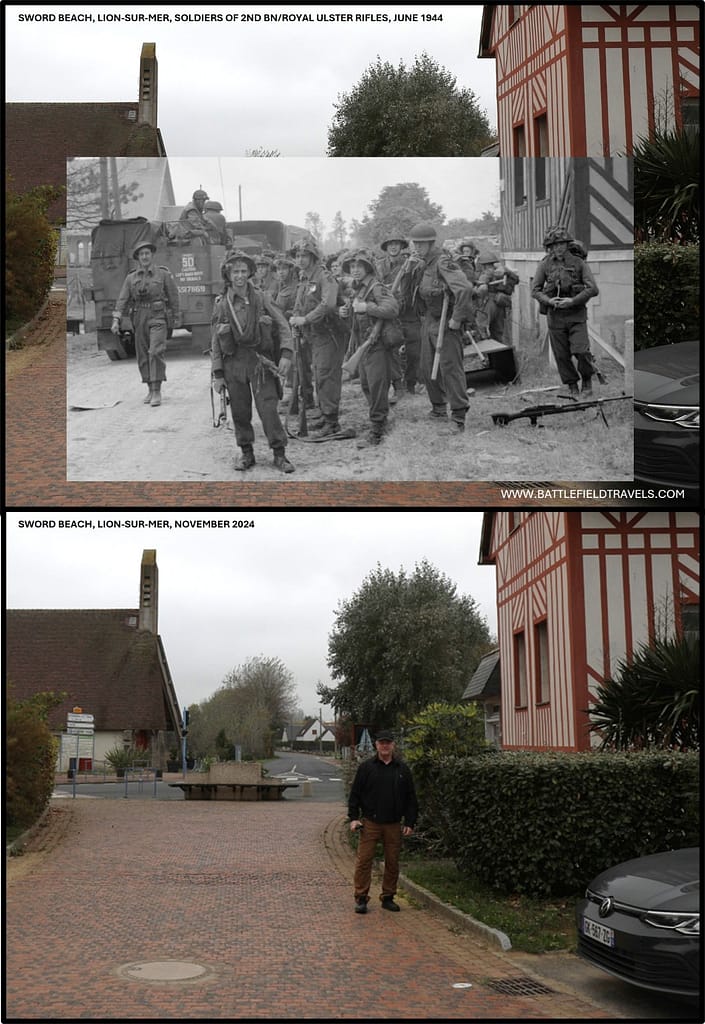
At 07:25, the first wave of assault craft approached the beach, led by Sherman DD tanks of the 13th/18th Royal Hussars. Although several ships foundered in the rough seas, the majority reached shore and immediately engaged enemy positions. Behind them came infantry battalions of the 8th Brigade. The 2nd East Yorkshire Regiment landed opposite strongpoints at Lion-sur-Mer, while the 1st South Lancashire Regiment and 1st Suffolk Regiment struck Hermanville-sur-Mer.
07:45–09:00 — Engineers & ‘Hobart’s Funnies’: AVREs, Crabs, Crocodiles
Under fire from machine-guns and anti-tank guns, the infantry and armour units pushed inland from the tidal flats with the support of specialised armour: AVREs using petards to blast casemates, flail tanks clearing mines, and Crocodiles deploying flame.12Tim Saunders, Sword Beach: British 3rd Division – D-Day (Barnsley: Pen & Sword, 2002), pp. 47–50.
Resistance was stiff. German 50 mm and 75 mm anti-tank guns, sited to cover the beach exits, knocked out several Shermans and AVREs. Mortar fire and small-arms fire from fortified houses in Lion-sur-Mer inflicted casualties on the East Yorkshires.
At Hermanville, progress was slowed by entrenched positions in the village, but combined arms tactics — infantry supported by armour and engineers — gradually overcame the defences. By 09:00, all three battalions of the 8th Brigade had secured a shallow lodgement, with beach exits cleared sufficiently for follow-up waves to land.13Zetterling, Normandy 1944 (2000), pp. 104–107.
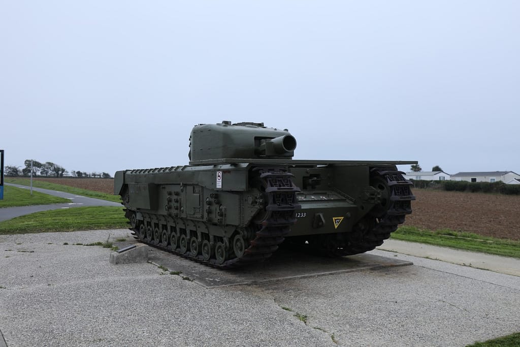
07:45–09:00 — Ouistreham: No. 4 Commando & Kieffer’s Free French Troops
Meanwhile, to the east, No. 4 Commando, including two Free French Troops under Commandant (Major) Philippe Kieffer, landed at Ouistreham. Their mission was to eliminate the German strongpoints guarding the lock gates and to link up with the 6th Airborne Division, which was holding the Orne bridges.
Fighting through pillboxes and casemates with grenades and flamethrowers, the Commandos cleared the port installations in bitter close combat. By mid-morning, they had reached the outskirts of Ouistreham, securing a vital link between the seaborne and airborne operations.14Stephen Ambrose, Pegasus Bridge (1984), pp. 114–118.

By 09:00 — Beach exits cleared and lodgement secured
By the end of Phase 1, Sword Beach was established as a foothold. The first wave had suffered signficant casualties, particularly among armour and engineers, but the assault battalions had penetrated inland beyond the coastal villages. The beach exits were under Allied control, and the way was open for the 185th Brigade to push toward Caen.
⚔️ Go deeper — Members get exclusive access to the Deep Research Collection, Field Notes, and monthly Research Dispatches. Try membership free for 7 days, cancel anytime. From $9/month.
Phase 2 – Expansion inland and German counter-attacks (09:00–13:00 hours)
09:00–10:30 — 185th Brigade drives on Biéville–Lebisey (axis to Caen)
By 09:00 hours, the 8th Infantry Brigade had secured Hermanville-sur-Mer and was consolidating its hold on Lion-sur-Mer. Beach exits were cleared, allowing the 185th Infantry Brigade to begin its advance inland. The 2nd Royal Warwickshire Regiment, supported by armour of the 13th/18th Hussars, moved along the axis toward Biéville and Lebisey Wood, the direct approach to Caen.
The 1st Royal Norfolk Regiment and 2nd King’s Shropshire Light Infantry followed, tasked with securing villages on the flanks and maintaining the momentum of the advance.15Ellis, Victory in the West, Vol. I (1962), pp. 190–192.
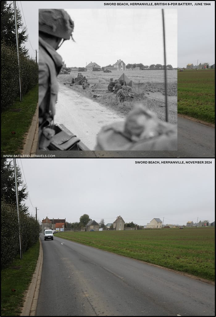
10:30–12:30 — German response by 21st Panzer Division battlegroups
The plan had been to reach Caen itself by evening, but German resistance stiffened inland. Lebisey Wood, lying astride the road to Caen, had been fortified by elements of 21. Panzer-Division and forward detachments of 716. Infanterie-Division. British infantry advancing toward the wood encountered mortar and machine-gun fire, halting their progress. Armour was unable to break through without infantry clearing the tree line, and repeated probing attacks were repulsed. By late morning, the 185th Brigade was held up north of the wood, only 5 km short of Caen, but unable to push further without heavier support.16Tim Saunders, Sword Beach: British 3rd Division – D-Day (2002), pp. 61–65.
Meanwhile, the 9th Infantry Brigade had landed and pushed inland on the eastern flank. The 2nd Royal Ulster Rifles and 1st King’s Own Scottish Borderers advanced toward Periers Ridge, linking with the airborne bridgehead at Ranville. By midday, the brigade had made contact with patrols from the 6th Airborne Division, securing the vital junction between the seaborne and airborne forces. This closed the gap along the Orne and anchored the Allied left flank against German counter-attacks from the east.17Stephen Ambrose, Pegasus Bridge (1984), pp. 125–128.
11:30–13:00 — Panzer thrusts to the coast against air and naval firepower
The German response began in earnest during the late morning. 21. Panzer-Division, commanded by Generalleutnant Edgar Feuchtinger but with Kampfgruppen directed in practice by Oberst Hermann von Oppeln-Bronikowski, launched counter-attacks northward. One battle group struck between Periers and Biéville, attempting to cut the Sword lodgement from the Orne. Another drove through open ground between Luc-sur-Mer and Lion-sur-Mer, briefly reaching the coast near Luc.
For a short time, German panzers and half-tracks penetrated to within sight of the Channel, threatening to split the British and Canadian beaches. However, Allied naval gunfire and air strikes fell upon the exposed armour. RAF Typhoons of 2nd Tactical Air Force engaged columns moving in daylight, destroying many vehicles and forcing withdrawals.18Zetterling, Normandy 1944 (2000), pp. 109–112.
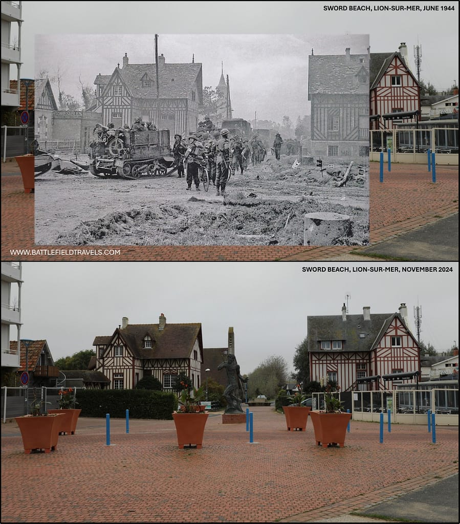
12:30–13:00 — Situation at midday: Sword secure, advance on Caen checked
By early afternoon, the German counterattacks had been halted. The British held Hermanville and Biéville but were unable to take Lebisey Wood. The link with the airborne forces was secure, and the Sword Beach bridgehead was firmly established.
Phase 3 – Afternoon fighting and the push towards Caen (13:00–24:00 hours)
13:00–16:00 — Renewed attacks at Lebisey Wood: Warwickshires & 27th Armoured
During the afternoon of 6 June, the British 3rd Division pressed to expand the Sword bridgehead and reopen the advance toward Caen. The 185th Brigade, reinforced with armour from the 27th Armoured Brigade, renewed attacks on Lebisey Wood. The wood, commanding the main Caen highway, was strongly held by Panzergrenadiers of 21. Panzer-Division with mortars and anti-tank guns in well-prepared positions. Repeated attempts to dislodge them were driven back, and losses among the Royal Warwickshires and attached armour mounted steadily.
By evening, it was clear that Caen could not be taken on D-Day. The wood remained in German hands, blocking further progress.19Ellis, Victory in the West, Vol. I (1962), pp. 193–194.

14:00–18:00 — Consolidation: 8th & 9th Brigades extend the lodgement
Elsewhere, the division consolidated its positions. 8th Brigade secured Hermanville and pushed outposts toward Colleville and Periers Ridge. 9th Brigade, after linking with the 6th Airborne Division at Ranville, extended its line along the Orne, ensuring continuity between beach and airborne lodgements. This linkup was one of the major successes of the day, preventing German forces from exploiting the natural barrier of the Orne River and Caen Canal.
15:30–18:00 — Additional 21st Panzer Division probes: aggressive but uncoordinated
German resistance intensified throughout the afternoon. Kampfgruppen of 21. Panzer-Division launched further local counterattacks, supported by artillery from south of Caen. Though aggressive, these attacks lacked coordination and were hindered by Allied naval and air supremacy.
Fire from cruisers HMS Belfast and HMS Arethusa, as well as destroyers close inshore, repeatedly broke up German concentrations. RAF Typhoon fighter-bombers of 2nd Tactical Air Force continued to strike armour moving across open ground, inflicting losses and dissuading larger-scale German thrusts.20Zetterling, Normandy 1944 (2000), pp. 112–115.
16:30–18:30 — Von Oppeln-Bronikowski reaches the sea (Lion–Luc)
The most dramatic German penetration came when a Kampfgruppe of 21. Panzer under von Oppeln-Bronikowski reached the coast between Lion-sur-Mer and Luc-sur-Mer in the late afternoon. This thrust threatened to sever Sword from Juno Beach. However, the counter-attack lacked depth and reserves; Allied artillery and naval gunfire quickly isolated the forward elements. By evening, most of the surviving panzers had withdrawn south to regroup.
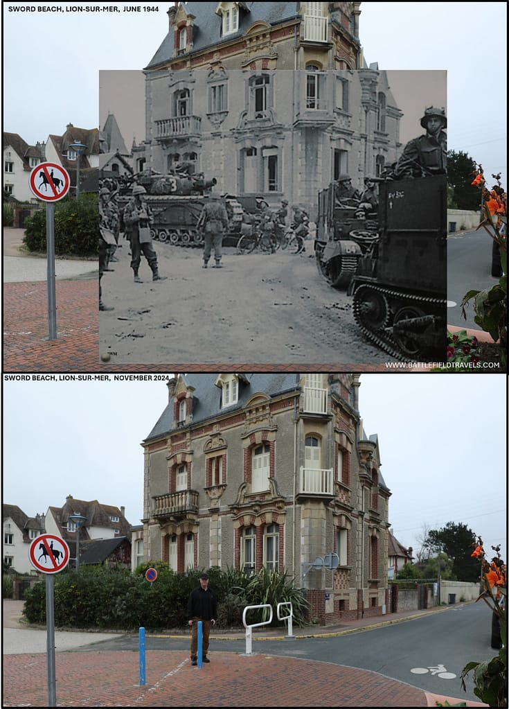
Evening–24:00 — Holding the Line; Caen Deferred to Later Operations
By nightfall, the British had secured a firm lodgement between the Orne and the western link to Juno. Sword Beach itself was firmly in Allied hands, with all three brigades of the 3rd Division ashore, supported by armour and artillery. Yet the failure to seize Caen was a serious operational disappointment. The Germans had held the city and its approaches, allowing it to become the focal point of the Normandy battle for the following six weeks.
Outcomes & Analysis
D-Day totals landed
By the close of 6 June 1944, the British 3rd Infantry Division had established a solid lodgement at Sword Beach. Approximately 29,000 men and 630 tanks had been landed. The division had linked with the 6th Airborne Division on the eastern flank, secured Hermanville and the approaches toward Biéville, and cleared the coastal strongpoints along its frontage.
Casualties on Sword Beach (6 June)
Casualties on Sword Beach were lighter than on Juno or Omaha, estimated at around 630 killed, wounded, or missing on D-Day, 6 June 1944.21Ellis, Victory in the West, Vol. I (1962), p. 194.
Why Caen wasn’t taken on D-Day — Lebisey, Panzer Counter-stroke
Operationally, the primary objective — the capture of Caen on D-Day — was not achieved. The failure to take Caen was the result of a combination of factors: the strength of German resistance in Lebisey Wood, the rapid counterattack by 21. Panzer-Division, and delays in moving sufficient Allied armour and artillery inland. The lodgement was secure, but the inability to capture Caen on the first day meant that the Allies faced a prolonged struggle for the city.22David Fraser, And We Shall Shock Them: The British Army in the Second World War (London: Cassell, 1983), pp. 337–339.
Lessons from the German perspective: strongpoints, piecemeal commitment, Allied firepower
For the Germans, the day revealed both strengths and weaknesses. Local strongpoints and the commitment of 21. Panzer inflicted disruption and prevented an Allied breakout. Yet the lack of coordination, the piecemeal employment of armour, and the overwhelming effect of Allied air and naval firepower blunted their efforts. Without unified command or rapid release of reserves, German counterattacks failed to dislodge the beachhead.
Strategic Outcome — Left flank secured and a prolonged battle for Caen begins
Strategically, the survival of Caen allowed the Germans to anchor their defensive line on the city and bring forward armoured divisions into the Normandy sector. For the Allies, Sword Beach had fulfilled its critical role of securing the left flank, linking with airborne forces, and ensuring the invasion front could not be rolled up from the east. The price of this success, however, was that Caen would remain a contested objective, requiring major operations — Perch, Charnwood, and Goodwood — before the city finally fell in mid-July 1944.23John Buckley, Monty’s Men: The British Army and the Liberation of Europe, 1944–45 (New Haven: Yale University Press, 2013), pp. 85–87.
The Sword Beach battlefield today
Key locations: Ouistreham, Hermanville, Lion-sur-Mer
Sword Beach today is heavily built-up, with the resort towns of Ouistreham, Lion-sur-Mer, and Hermanville-sur-Mer covering much of the original landing ground. Nevertheless, several key locations preserve the memory of 6 June 1944.
Inland: Colleville → Biéville → Lebisey Wood
At Ouistreham, the Musée du Débarquement No. 4 Commando occupies a former German strongpoint. Exhibits commemorate the role of the British Commandos and the Free French Troops under Kieffer who fought through the town’s bunkers and seawall. Nearby, a preserved German command bunker serves as a museum, providing insight into the defensive network along the coast.24Georges Bernage, Sword Beach: British Landings 1944 (Bayeux: Heimdal, 1994), pp. 110–113.
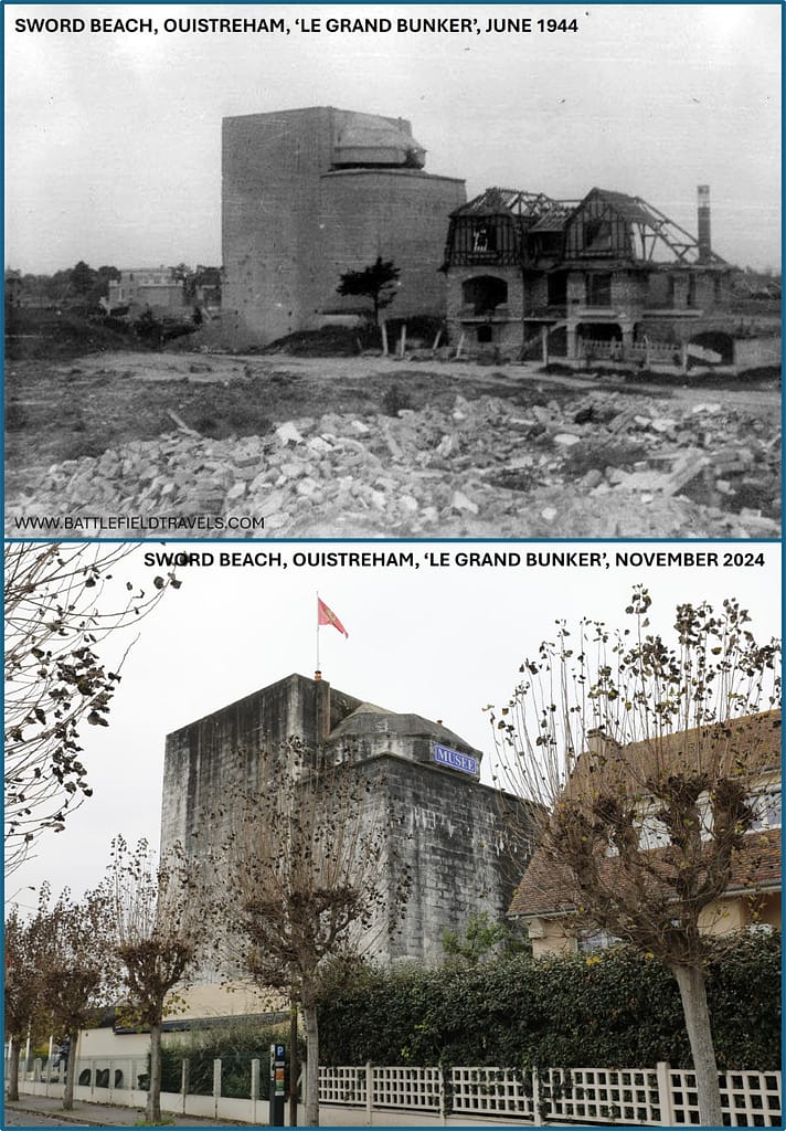
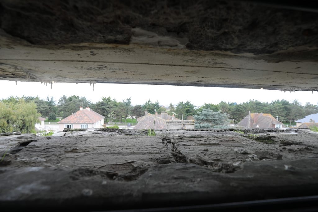
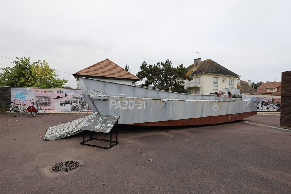
Further west, at Hermanville-sur-Mer, stands the British Sword Beach Memorial dedicated to the men of the 3rd Infantry Division. The Commonwealth War Graves Cemetery at Hermanville contains over 1,000 burials from the Normandy campaign. Along the beachfront, remnants of bunkers and casemates remain visible, although they are often integrated into modern structures or hidden by later development.
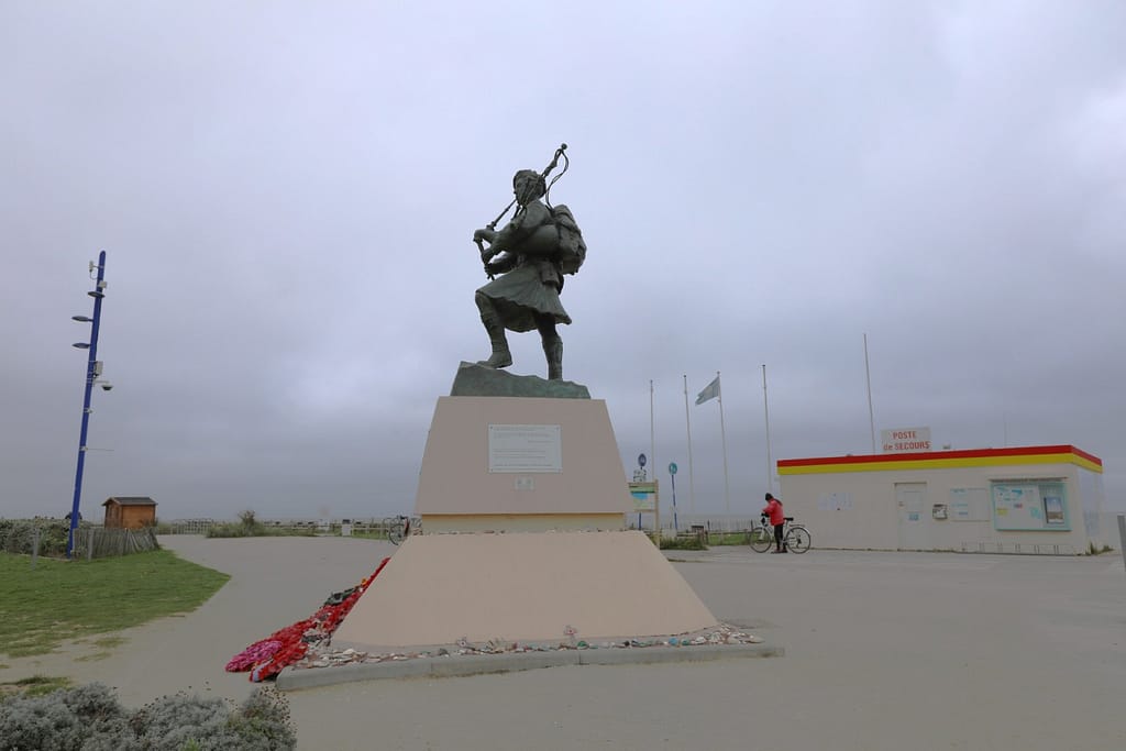
At the eastern end of Sword Beach, at Colleville-Montgomery, is a statue of Piper Bill Millin, of 1st Special Service Brigade, who famously piped the landing ashore with ‘Heilan Laddie’ and signalled the arrival of reinforcements at Pegasus Bridge with ‘The Blue Bonnet’.
Orne & Canal — Pegasus Bridge & Airborne lodgement
The inland advance route toward Caen can be traced through Colleville, Biéville, and Lebisey Wood. The wood itself, still standing today, remains a sombre reminder of the point at which the British D-Day advance stalled. To the east, visitors can follow the line of the Orne to the Pegasus Bridge Memorial, where the coup de main of the 6th Airborne Division is preserved through the restored bridge and an adjoining museum.
Reading the Ground — Wide Tidal Flats, Seawalls, Bocage Chokepoints
Sword Beach in Darryl F. Zanuck’s ‘The Longest Day’, 1962
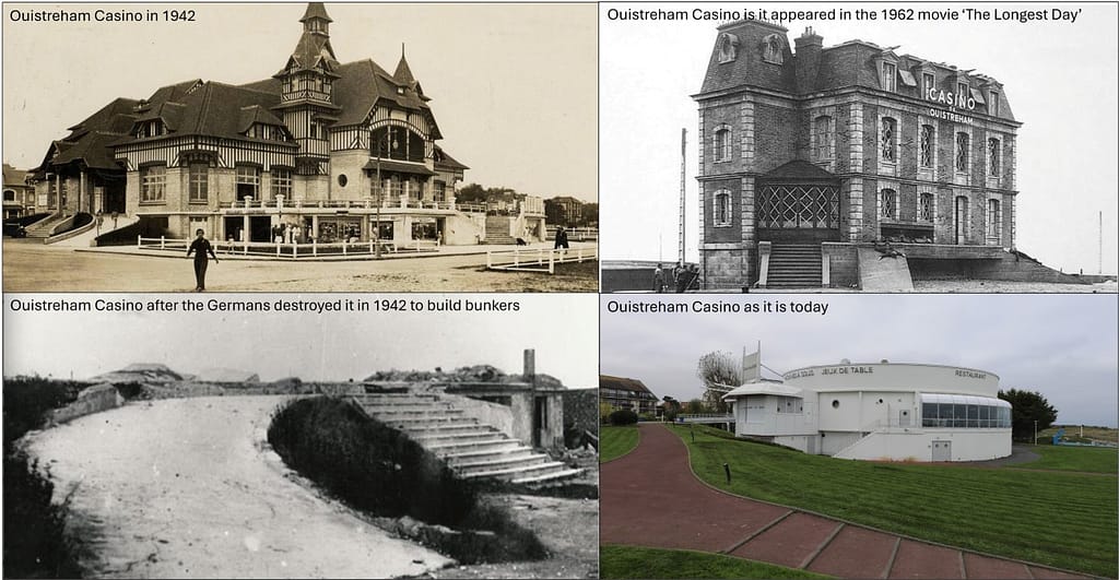
In Darryl F. Zanuck’s classic 1962 movie ‘The Longest Day’, there is a long depiction of the Sword Beach landing. Lord Lovat (played by Peter Lawford) is shown during the landing, and Piper Bill Millin pipes the 1st Special Service Brigade ashore (as he did on D-Day). The most stunning scene is a long single-take overhead shot of Commandant Keiffer and the Free French Commandos assaulting the German-held Ouistreham Casino. That scene was actually shot at Port-en-Bessin, part of Omaha Beach, and the Casino was built as a facade so it could be blown up in the movie.
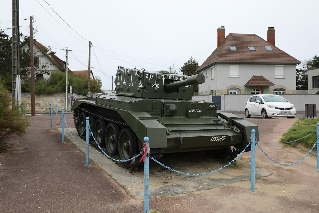
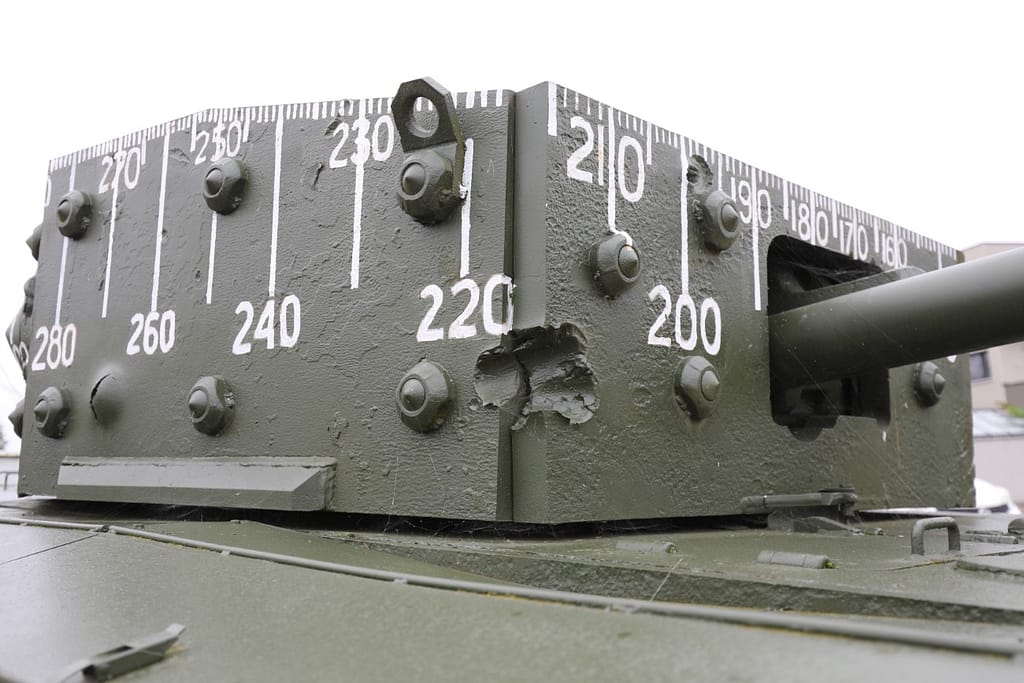
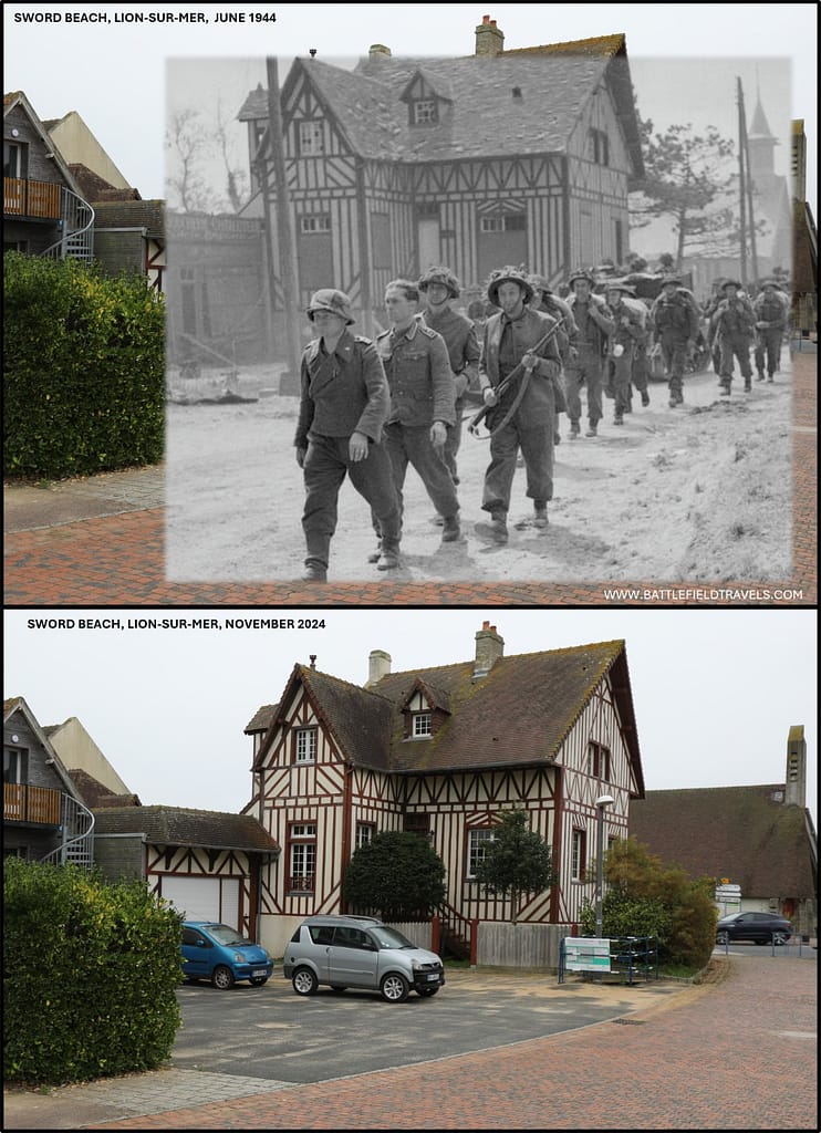
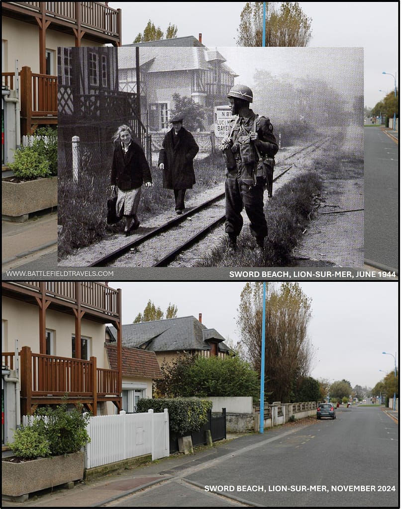
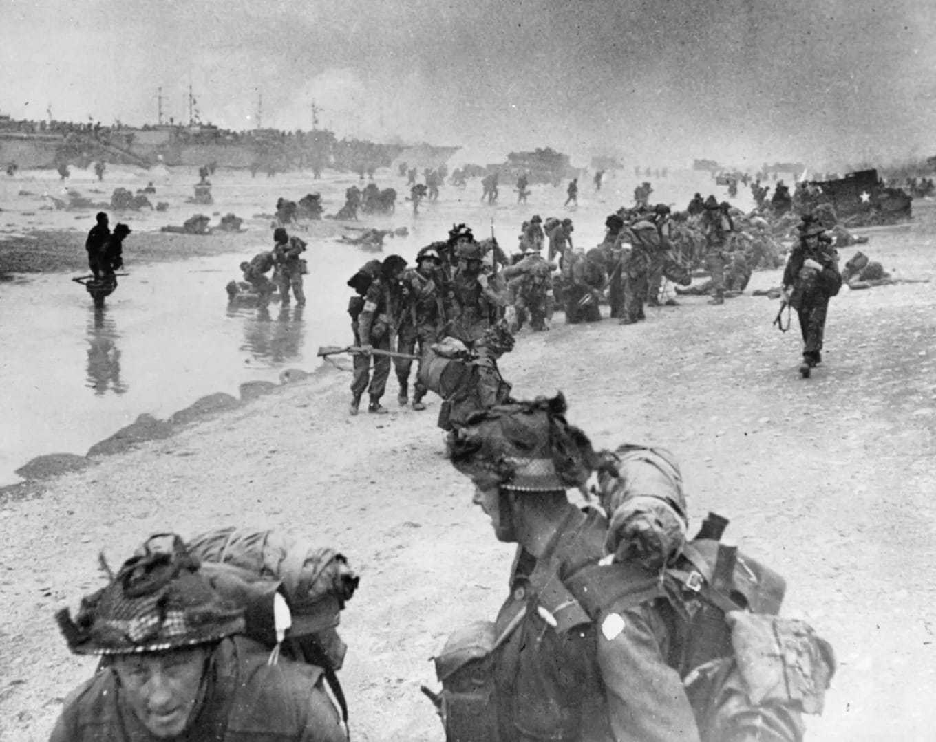
Additional images of Sword Beach
Found this useful? Buy me a coffee — it helps fund future battlefield research


Authored by Mick Prictor, a retired military officer with 40 years’ service, and a military historian specialising in terrain-focused analysis of tactics, doctrine, and command decision-making in land warfare. His work draws on extensive battlefield fieldwork—more than 280 sites worldwide—and one of the world’s largest private collections of historic military arms, uniforms, and equipment. About me
❓ Test Your D-Day Knowledge
Twenty questions covering the airborne operations, invasion beaches, commanders, forces and fighting of 6 June 1944.
20 questions · 60% to pass · expect a challenge
📚 Notes and References
Notes
- 1Max Hastings, Overlord: D-Day and the Battle for Normandy (London: Michael Joseph, 1984), pp. 29–33. ↩︎
- 2Carlo D’Este, Decision in Normandy (London: Collins, 1983), pp. 45–50. ↩︎
- 3L.F. Ellis, Victory in the West, Vol. I: The Battle of Normandy (London: HMSO, 1962), pp. 181–183 ↩︎
- 4Stephen Ambrose, D-Day, June 6, 1944: The Climactic Battle of World War II (New York: Simon & Schuster, 1994), pp. 228–232. ↩︎
- 5Niklas Zetterling, Normandy 1944: German Military Organisation, Combat Power and Organisational Effectiveness (Winnipeg: J.J. Fedorowicz,
2000), pp. 97–99. ↩︎ - 6L.F. Ellis, Victory in the West, Vol. I: The Battle of Normandy (London: HMSO, 1962), pp. 183–186. ↩︎
- 7Niklas Zetterling, Normandy 1944: German Military Organisation, Combat Power and Organisational Effectiveness (Winnipeg: J.J. Fedorowicz, 2000), pp.99–104. ↩︎
- 8Georges Bernage, Sword Beach: British Landings 1944 (Bayeux: Heimdal, 1994), pp. 22–25. ↩︎
- 9Ellis, Victory in the West, Vol. I (1962), pp. 186–188. ↩︎
- 10Stephen Ambrose, Pegasus Bridge (New York: Simon & Schuster, 1984), pp. 98–104. ↩︎
- 11Ellis, Victory in the West, Vol. I (1962), pp. 188–190. ↩︎
- 12Tim Saunders, Sword Beach: British 3rd Division – D-Day (Barnsley: Pen & Sword, 2002), pp. 47–50. ↩︎
- 13Zetterling, Normandy 1944 (2000), pp. 104–107. ↩︎
- 14Stephen Ambrose, Pegasus Bridge (1984), pp. 114–118. ↩︎
- 15Ellis, Victory in the West, Vol. I (1962), pp. 190–192. ↩︎
- 16Tim Saunders, Sword Beach: British 3rd Division – D-Day (2002), pp. 61–65. ↩︎
- 17Stephen Ambrose, Pegasus Bridge (1984), pp. 125–128. ↩︎
- 18Zetterling, Normandy 1944 (2000), pp. 109–112. ↩︎
- 19Ellis, Victory in the West, Vol. I (1962), pp. 193–194. ↩︎
- 20Zetterling, Normandy 1944 (2000), pp. 112–115. ↩︎
- 21Ellis, Victory in the West, Vol. I (1962), p. 194. ↩︎
- 22David Fraser, And We Shall Shock Them: The British Army in the Second World War (London: Cassell, 1983), pp. 337–339. ↩︎
- 23John Buckley, Monty’s Men: The British Army and the Liberation of Europe, 1944–45 (New Haven: Yale University Press, 2013), pp. 85–87. ↩︎
- 24Georges Bernage, Sword Beach: British Landings 1944 (Bayeux: Heimdal, 1994), pp. 110–113. ↩︎
Resources & References
Primary & Official Histories
- L. F. Ellis, Victory in the West, Vol. I: The Battle of Normandy (London: HMSO, 1962).
- C. P. Stacey, The Victory Campaign: The Operations in North-West Europe, 1944–45 (Ottawa: Queen’s Printer, 1960).
- War Diaries, 3rd Infantry Division, 8th, 9th & 185th Brigades, The National Archives (UK).
- Naval Staff Histories, Operation Neptune, Admiralty Records.
- RAF 2nd Tactical Air Force Operations Records, The National Archives (UK).
Secondary Sources (Cited in Footnotes)
- Ambrose, S. E. (1999). D-day, June 6, 1944: the climactic battle of World War II. Thorndike.
- Beevor, Antony. (2009). D-Day: The Battle for Normandy. Penguin Books
- Ryan, Cornelius (1959). The Longest Day: June 6, 1944. Simon and Schuster, New York.
- Hastings, Max (1984). Overlord : D-Day and the battle for Normandy. Simon and Schuster, New York.
- Georges Bernage, D-Day Landing Beaches: The Guide (Bayeux: Heimdal, 2009).
- Stephen Ambrose, Pegasus Bridge (New York: Simon & Schuster, 1984).
- Stephen Fisher, Sword Beach: The Untold Story of D-Day’s Forgotten Victory (LPenguin, 2025).
- John Buckley, Monty’s Men: The British Army and the Liberation of Europe, 1944–45 (New Haven: Yale University Press, 2013).
- Niklas Zetterling, Normandy 1944: German Military Organisation, Combat Power and Organisational Effectiveness (Winnipeg: J.J. Fedorowicz, 2000).
Recommended Additional Works
- Carlo D’Este, Decision in Normandy (London: Collins, 1983).
- Chester Wilmot, The Struggle for Europe (London: Collins, 1952).
- David Fraser, And We Shall Shock Them: The British Army in the Second World War (London: Cassell, 1983).
- Ken Ford, D-Day 1944 (3): Gold & Juno Beaches (Oxford: Osprey Campaign Series, 2002).
- Michael Reynolds, Steel Inferno: I SS Panzer Corps in Normandy (New York: Sarpedon, 1997).
Cartography & Terrain Analysis
- GSGS 4347 series 1:50,000 Normandy maps (Allied issue, 1944).
- IGN aerial photography overlays of Sword sector.
- Google Earth Pro terrain analysis: Ouistreham to Lebisey Wood axis.
- Field survey: Hermanville, Ouistreham, Lion-sur-Mer, and Pegasus Bridge environs.
📚 Further Reading
This battle study nests within the broader analytical framework explored in the Research Hub, where operational methods, operating environments, armies, commanders, and weapons are examined across conflicts and eras. The links below connect related studies across the wider body of battlefield analysis on the BattlefieldTravels site.
⚔️ Explore all battle studies from World War Two 1939-1945
🏛️Explore the museum of World War Two historic artefacts
The book list for this conflict includes the leading campaign studies, memoirs, and operational analyses of the D-Day landings, selected specifically to complement this battlefield study.
📚World War Two – Recommended Reading
🗞️ For updates on new battlefield studies and research insights, you can subscribe to the Newsletter.
Related Battle Studies, Museum Pieces & Reading Resources
 ⚔️ D-Day: Brecourt Manor assault, Easy Company, 506th PIR,
6 June 1944
 ⚔️ D-Day: Juno Beach landings,
6 June 1944
 ⚔️ D-Day: Utah Beach landings,
6 June 1944
 ⚔️ D-Day: Omaha Beach landings,
6 June 1944
 📝 🔒Field Note: XXX Corps Orders, Leopoldsburg, Belgium, 15 Sep 1944
 ⚔️ D-Day: Gold Beach landings,
6 June 1944
🧭 Battlefield Travel Guide: Sword Beach
Getting There
- Nearest Towns: Ouistreham (east end), Lion-sur-Mer, Hermanville-sur-Mer, Colleville-Montgomery.
- Access: From Caen (~15 km), follow D515 north to Ouistreham; coastal road D514 runs the length of the beach.
- Parking: Lots near Ouistreham ferry terminal, Sword Beach Museum, and seafront car parks at Hermanville/Lion-sur-Mer.
Site Orientation
- Sectors: OBOE, PETER, QUEEN — the latter being the main assault sector at La Brèche, Ouistreham.
- Key Landmarks: Sword Beach Museum, Pegasus Bridge (inland at Bénouville), Hillman Strongpoint inland at Colleville-Montgomery.
- Best Vantage Points: Ouistreham seafront for an overview; Pegasus Bridge for understanding British–Airborne link-up.
- Walking Routes: Seafront promenades; inland trails to strongpoints and memorials.
Museums & Visitor Centres
- On-site: No.4 Commando Museum (Ouistreham) — Small museum dedicated to Commandant Kieffer’s Free French commando and the Sword Beach landings.
- On-site: Le Grand Bunker – Museum of the Atlantic Wall (Ouistreham). The former command and fire direction post for the German defences, now converted into a multi-level museum. The museum also houses the landing craft used in the making of Saving Private Ryan
- Nearby: Pegasus Bridge Museum (Bénouville); Radar Station 44 Museum. Hillman Strongpoint museum site; Merville Battery (east of the Orne estuary).
On-Site Experience
- Interpretive Signage: Multilingual panels at major memorials and strongpoints.
- Atmosphere: The easternmost invasion beach — quieter than Omaha/Gold, with ferry activity at Ouistreham.
- Photography: Best light early or late; Pegasus Bridge is especially evocative at dawn/dusk.
Nearby Points of Interest
- Pegasus Bridge: Key Airborne site; museum and preserved original bridge.
- Merville Battery: Preserved German gun positions taken by 6th Airborne.
- Caen: Memorial museum (Mémorial de Caen) and medieval city sites.
Practical Tips
- When to Visit: The Sword is less crowded; D-Day anniversaries still draw veterans and reenactments.
- Facilities: Restaurants, cafés, and services along the seafront; ferry port at Ouistreham.
- Notes: Coastal cycle path links Sword to Juno and Gold beaches — ideal for battlefield touring.
FAQ: Sword Beach (6 June 1944)
Sword Beach was the easternmost Allied landing sector on 6 June 1944. Its objectives included capturing Ouistreham, linking up with British airborne troops holding the Orne bridges, and advancing towards Caen.
The British 3rd Infantry Division spearheaded the assault, supported by Lord Lovat’s 1st Special Service Brigade, Royal Marine Commandos, and specialised armour from the 79th Armoured Division.
Despite heavy resistance, the landing force secured a foothold. The linkup with airborne troops was achieved, but the advance to Caen stalled, leaving the city contested for weeks.
Approximately 1,000 Allied casualties were sustained on Sword Beach on 6 June 1944, compared to higher losses on some other landing beaches.
Yes. Visitors can explore the beach itself, the Atlantic Wall defences, and museums such as the Musée du Mur de l’Atlantique at Ouistreham, which provide context to the fighting on D-Day.
Subscribe to Battlefield Travels and receive a free E-Book Battlefield Guide
Unlock expert battlefield analysis, campaign reconstructions, and historical insights drawn from firsthand exploration and primary sources.
🗺️ You’ll receive:
🎖️ Exclusive historical insights you won’t find elsewhere
📘 A free eBook: 10 Tips for Exploring Historic Battlefields
📰 New battlefield studies straight to your inbox as they are published

⚔️ Go deeper — Members get exclusive access to the Deep Research Collection, Field Notes, and monthly Research Dispatches. Try membership free for 7 days, cancel anytime. From $9/month.
G’day Mick,
Another great study of the Overlord landings, they are all excellent. I was fortunate to do a battlefield study tour there with the USMC SAW Course over a week and then participate in a subsequent week-long wargame covering the operation. It is incredible because so much of the terrain remains virtually the same as it was in 1944.
I have noticed in all of these you refer to this being the second European front to relieve pressure on the Soviets. I would contend that the second European front was actually opened in 1943 with the Allied invasion of Sicily and the subsequent Italian campaign which tied down several German Armies. This was especially the case after the Italian surrender in September 1943.
Cheers, Mal Rerden
All good points Mel. I agree that Italy was ‘a second front’ but it wasn’t ‘the second front’. It certainly didn’t cut it with Uncle Joe Stalin. The language at the Grand Strategic level was always that that the opening of a new front against Nazi Germany in northwest Europe would be the second front. Everything else was in the ‘sideshow’ or ‘soft underbelly’ category, even though it was tying up hundreds of thousands of troops on both sides. Mick
Thanks for the detailed treatment of the landings at Sword Beach and other Normandy beaches. I’m going to be there this time next week, and this page is going to be very helpful for interpreting the sites.
Tony, If I can help in any way, please just drop me a line. Are you covering all the beaches and airborne ops of just Sword Beach? I covered them all in detail last year.
I am currently in Germany. Just spent a week exploriung Market Garden battlefields at granular-level with some of the best authors and historians on the subject, then the massive fortress of Naarden. Crossed over into Germany for the Battle of Teutoberg Wald Wald (AD9), and teh Battle of Minden (1759). Now driving the Bastogne to explore the Battle of the Bulge.
Mick