Skip to content
Home » American Army

American Army

The American Army has fought across continents and climates, from frontier warfare to large-scale industrial conflict. This tag gathers all battlefield studies, museum artefacts, and reading material connected to U.S. land forces and their evolution in doctrine, weapons, and combat performance.

Reconstructing the D-Day landings and subsequent Normandy Campaign through terrain analysis, primary sources and on-site fieldwork
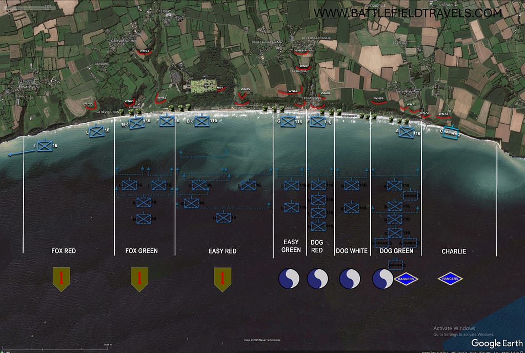
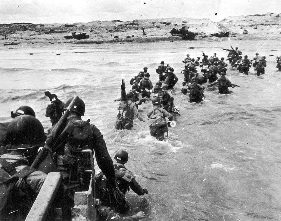
Omaha Beach, 1st Landing wave - 0635 hours
Omaha Beach, 1st Landing wave – 0635 hours
EXPLORE: BATTLES | WEAPONS & EQUIPMENT | READING | QUIZ

Key facts

🗺️ D-Day & the Normandy Landings, 6 June 1944
⚔️ Conflict: World War Two – Western Front
🪖 Major Allied forces: US First Army; British Second Army; US 82nd and 101st Airborne Divisions; British 6th Airborne Division
🪖 Major German forces: German Seventh Army; 84th Army Corps; 716th Infantry Division, 352nd Infantry Division and 21st Panzer Division
⭐ Principal Allied commanders: Dwight D. Eisenhower; Bernard Montgomery; Omar Bradley; Miles Dempsey
⭐ Principal German commanders: Gerd von Rundstedt; Erwin Rommel; Friedrich Dollmann
🎯 Strategic objective: Establish an Allied lodgement in Normandy for the liberation of north-west Europe
📌 Outcome: Allied victory; five beachheads established and airborne flanks secured, opening the Battle of Normandy.


🧭🥾 Walking the D-Day battlefields

Some aspects of the Normandy battlefields only become apparent when you walk the ground. The enormous distance across the exposed beaches at low tide, the surprisingly shallow folds and depressions that offered troops a way off Omaha Beach, and the importance of slightly raised roads across the flooded ground behind Utah are difficult to appreciate from maps and photographs alone.

I have spent many days exploring these battlefields: walking the beaches and exits, following the flooded lowlands and causeways, tracing airborne drop zones and glider landing grounds, climbing the bluffs above Omaha, and following the hedgerows, sunken lanes and narrow roads through which troops had to move inland. I have also stood where photographers stood on D-Day and in its immediate aftermath, capturing hundreds of ‘Then and Now’ images that help relate the surviving landscape to the events of 1944.

The invasion is often presented as five beaches and two airborne landings, but on the ground these were interconnected terrain problems. Beach exits determined where troops and vehicles could move inland; bridges and causeways became key terrain; villages controlled road networks; and apparently minor fields, hedgerows and folds in the ground shaped individual actions. At Pegasus Bridge, La Fière, Brecourt Manor and Omaha Beach, small pieces of terrain assumed importance far beyond their physical size.

This campaign study brings those pieces together. It follows the landings from the first gliders at Pegasus Bridge through the airborne operations, the five assault beaches and the fighting to consolidate the lodgement, linking the wider invasion plan to the individual battlefields I have explored on the ground.
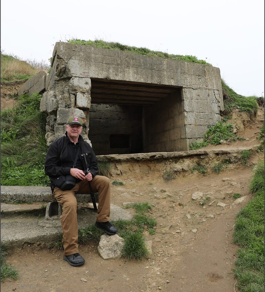
Omaha Beach WN73 Bunker
Bunker WN73, Vierville Draw, Omaha Beach

Normandy, 1944: Campaign Overview

Strategic Context: Operation Overlord

By the spring of 1944, the Western Allies had assembled the forces required to return to northwest Europe. Operation Overlord was intended to establish a secure lodgement in Normandy from which Allied armies could build up their strength, capture the ports and communications needed to sustain the campaign, and ultimately advance into Germany. Normandy offered suitable landing beaches within range of Allied air power and was less heavily defended than the Pas-de-Calais. An elaborate deception plan reinforced German expectations that the main invasion would fall farther north.

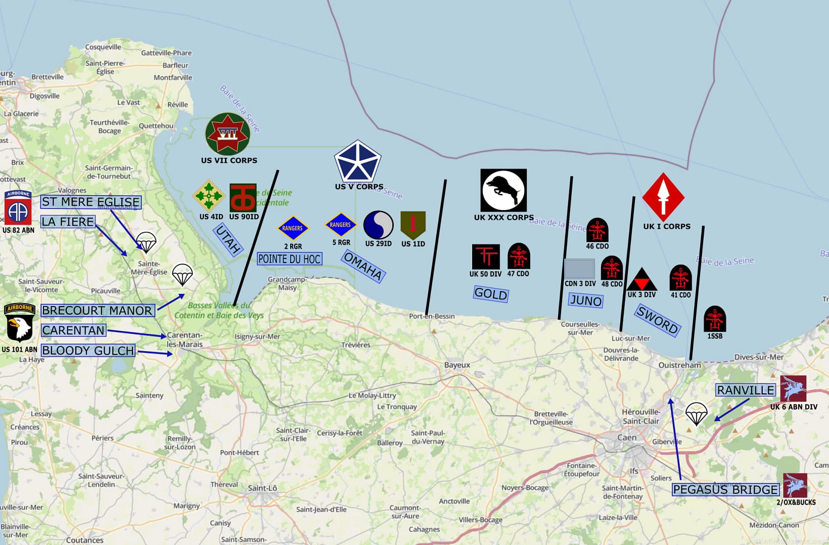
The invasion plan combined five amphibious assault beaches with airborne landings on both flanks. American forces would land at Utah Beach and Omaha Beach in the west, with the US 82nd and 101st Airborne Divisions securing the Cotentin approaches behind Utah. British and Canadian forces would land at Gold, Juno and Sword Beaches, while the British 6th Airborne Division protected the eastern flank beyond the Orne River. Naval gunfire, tactical air power and airborne operations were intended to isolate the battlefield and prevent German forces from destroying the lodgement before Allied strength could be built ashore.

Terrain was fundamental to the plan. Flooded lowlands restricted movement behind Utah; steep bluffs dominated Omaha; fortified coastal positions covered the beach exits. Rivers, canals, villages, ridgelines and the dense Norman bocage channelled movement inland. Beyond the enormous challenges of getting tens of thousands of troops and their equipment ashore, the Allies had to seize the terrain that would allow the five beachheads to survive and eventually become a single lodgement.

Pegasus Bridge: The first assault

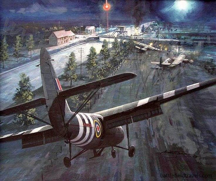
Ground combat began shortly after midnight on 6 June. At the eastern extremity of the invasion beaches, six Horsa gliders carried Major John Howard’s coup-de-main force on a silent approach to seize the two bridges spanning the Caen Canal and Orne River. Both crossings had to be captured intact. Their destruction would impede the advance from Sword Beach, while losing them to a German counterattack could expose the invasion’s eastern flank.

The Pegasus Bridge coup de main achieved extraordinary tactical surprise. Howard’s leading gliders landed within metres of the Caen Canal bridge, allowing the airborne troops to overwhelm the defenders before they could fire their demolition charges. The Orne River bridge was also secured. The problem then shifted from seizure. Howard’s small force had to hold the crossings until reinforced by the remainder of 6th Airborne Division and, eventually, heavier forces advancing inland from Sword Beach.
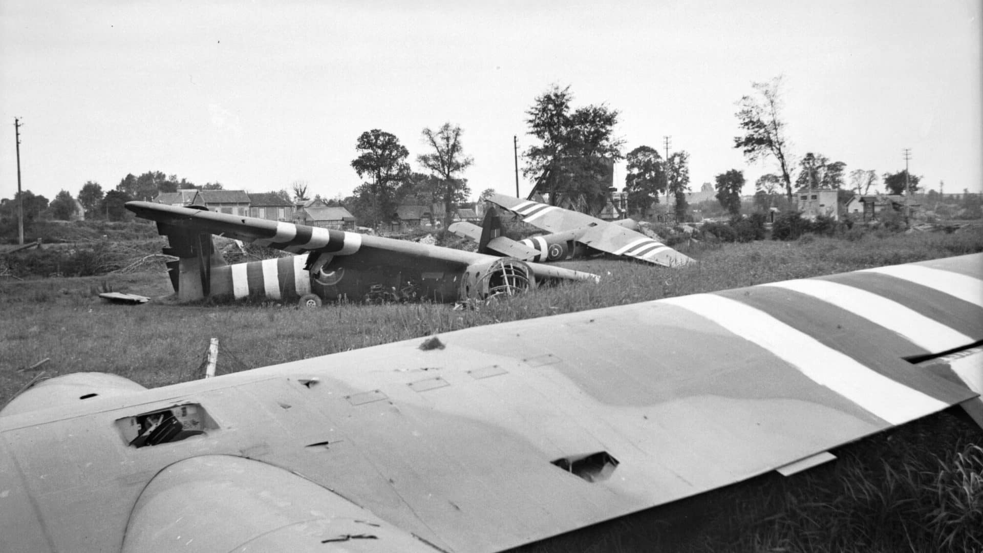
Pegasus Bridge, view over all Glider No. 2, Glider No. 1 and the Benouville Bridge visible in the background.

Ranville and Merville: Securing the eastern flank

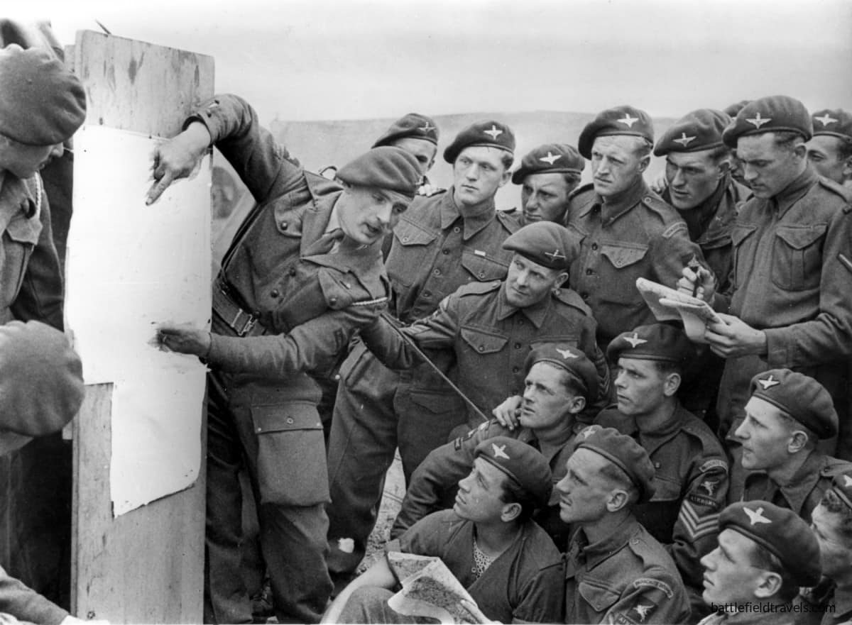
East of the Orne, the remainder of the British 6th Airborne Division landed by parachute and glider across a scattered series of drop and landing zones. Its tasks included destroying bridges over the River Dives, securing the high ground around Ranville and preventing German forces east of the Orne from interfering with the invasion beaches.

One of the most difficult objectives was neutralising the German coastal battery at Merville, whose guns were believed capable of firing on Sword Beach. Lieutenant Colonel Terence Otway’s 9th Parachute Battalion attacked despite severe dispersal during the airborne drop and the loss of much of its specialist equipment. The wider 6th Airborne Division operations at Ranville and Merville established a defensive bridgehead east of the Orne that would become the Allied invasion’s exposed eastern flank.

The British airborne operation therefore accomplished more than the spectacular seizure of Pegasus Bridge. It created a barrier between the invasion beaches and German forces approaching from the east, while preserving the crossings through which the airborne bridgehead could be reinforced.
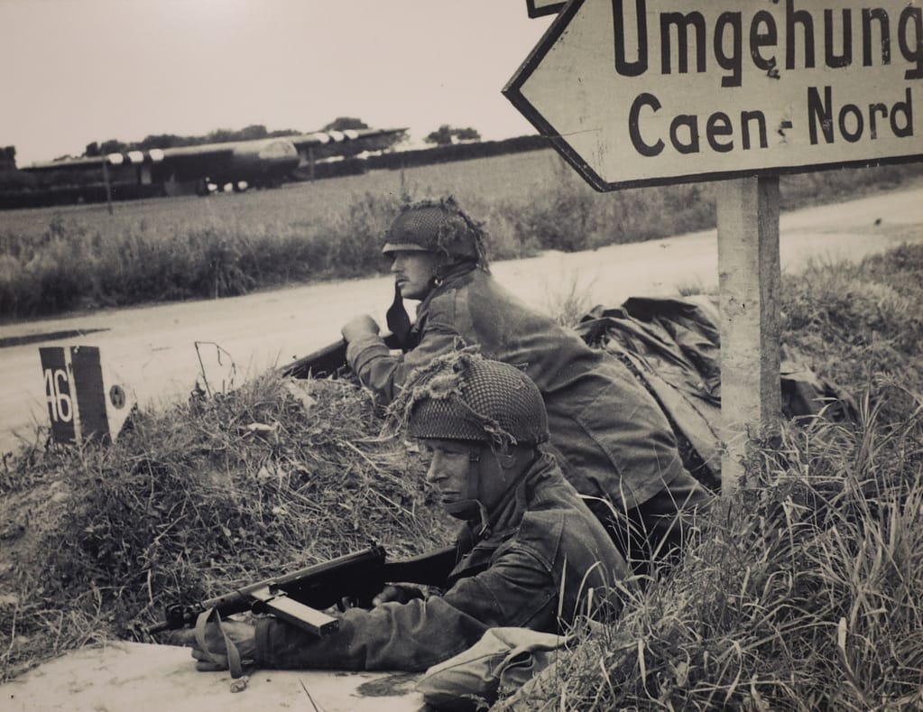
6th Airborne DIvision troops defending Ranville
6th Airborne Division troops defending Ranville

The American airborne operations: Securing the western flank

101st Airborne Division – Mission ALBANY

At the western end of the invasion area, the US 82nd and 101st Airborne Divisions descended into a very different landscape. German forces had deliberately flooded large areas behind Utah Beach, which meant villages and a small number of raised roads and causeways acquired disproportionate tactical importance. Scattered drops fragmented many airborne units, but also placed American paratroopers across the German rear areas.

The 101st Airborne Division was tasked principally with securing the four western exits from Utah Beach and disrupting German movement toward the invasion area. Paratroopers rallied in improvised groups and fought through the villages and hedgerows behind the coast. Near Sainte-Marie-du-Mont, Lieutenant Richard Winters led a small force from Easy Company, 506th Parachute Infantry Regiment, in the assault on the German battery at Brecourt Manor, eliminating guns that could fire toward the Utah Beach exits.

The fighting behind Utah Beach also marked the beginning of Easy Company’s combat experience in Normandy. From the scattered airborne landings and the assault at Brecourt Manor, the company’s route continued through Carentan and Bloody Gulch. The Easy Company battles in Normandy form part of a wider battlefield series following the company from D-Day through the Netherlands, Bastogne and the final advance into Germany and Austria.
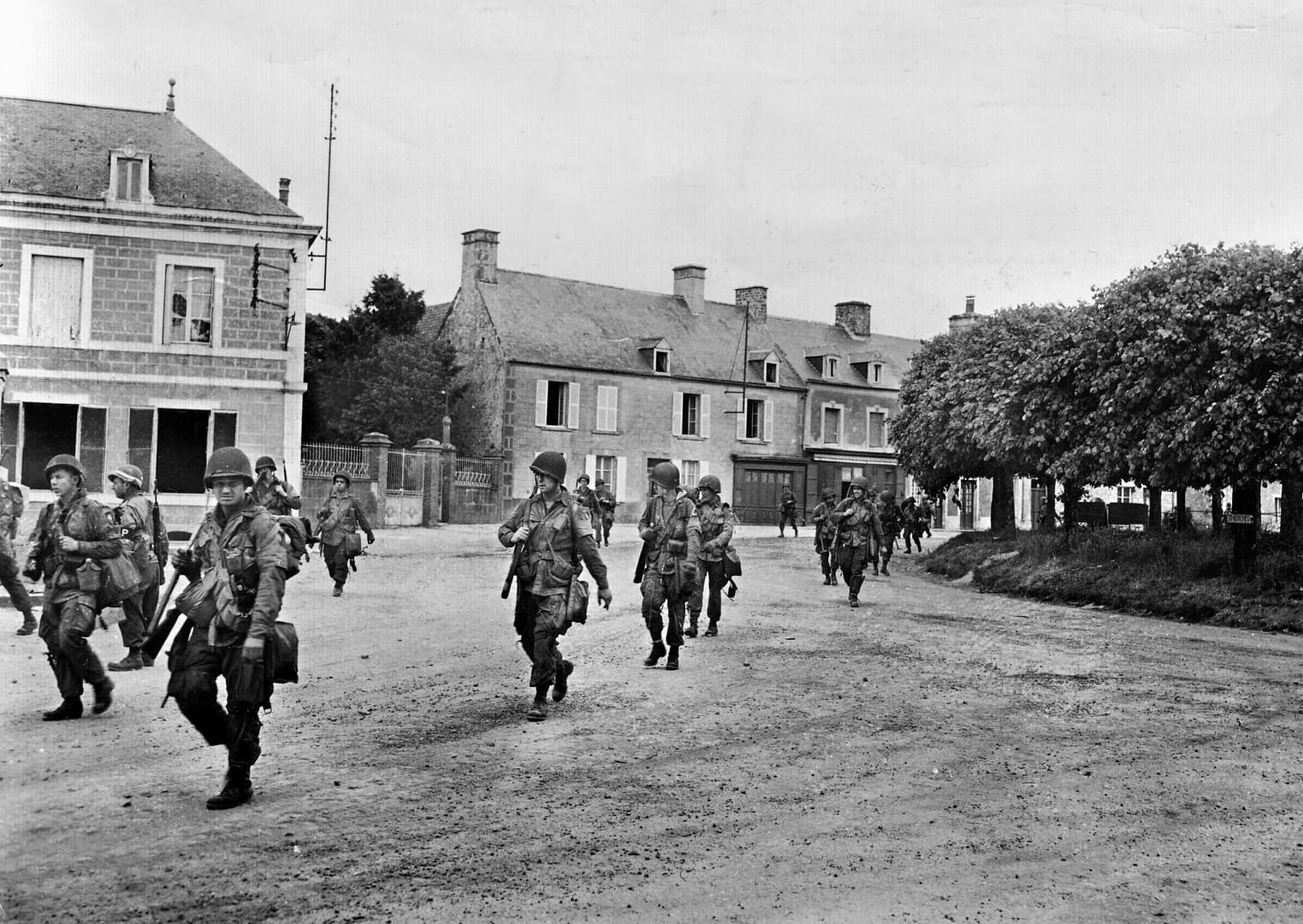
101st Airborne Division paratroopers passing through St-Marie-du-Mont, June 1944

82nd Airborne Division – Mission BOSTON

Farther north, the 82nd Airborne Division fought to secure the approaches around Sainte-Mère-Église, one of the critical road centres behind the invasion beaches. To its west, the battle for La Fière Causeway developed into a prolonged struggle for one of the few routes across the flooded Merderet valley. Here, a seemingly minor bridge and narrow raised causeway became key terrain because the surrounding inundations channelled all movement onto very few routes.

The American airborne landings were therefore inseparable from the Utah operation. By occupying road junctions, causeways and beach exits, disrupting German communications and forcing German units to fight inland, the paratroopers helped prevent a coordinated response against the troops coming ashore.
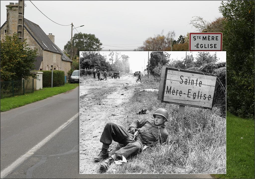
Then and now - 1944 and 2024. An American paratrooper on the southern entry into Sainte-Mere Eglise
Then and now – 1944 and 2024. An American paratrooper on the southern entry into Sainte-Mere Eglise

The success of the landings on 6 June did not immediately create a continuous Allied foothold. Utah and Omaha remained separated, and the road and rail centre of Carentan stood astride the communications connecting the two American beachheads. Capturing it became essential to consolidating the western lodgement.

Elements of the 101st Airborne Division advanced toward the town through flooded country and along exposed causeways before engaging the German defenders on its approaches and within the town itself. The Battle for Carentan continued the airborne role beyond its original D-Day missions and helped establish the physical connection between the Utah and Omaha sectors.

The German response did not end with the loss of Carentan. Counterattacking forces struck the American positions southwest of the town, producing the confused and violent Battle of Bloody Gulch. By this stage the character of the campaign was already changing. The immediate struggle to land on the Normandy coast was giving way to a battle to hold and expand the lodgement through hedgerows, sunken roads, villages and enclosed fields.
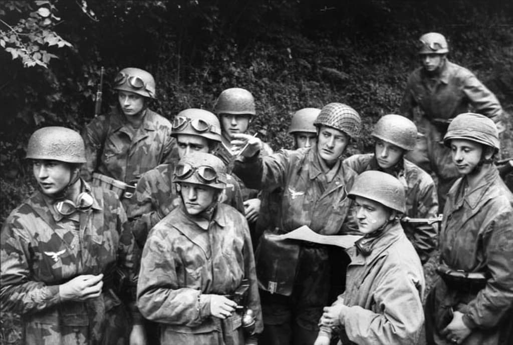
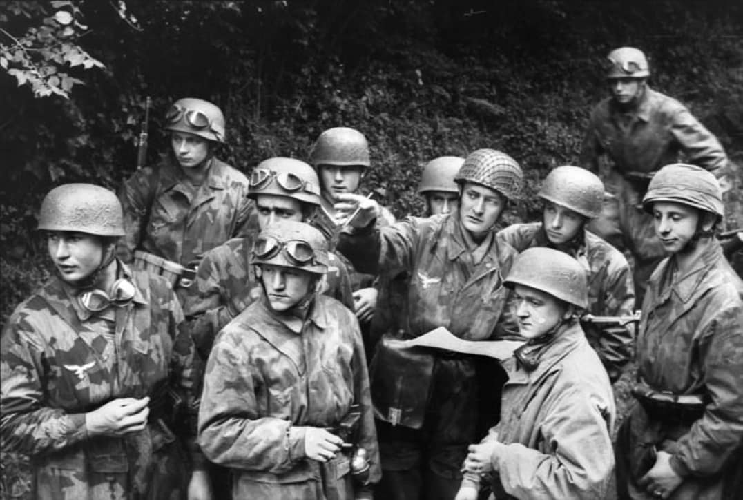
German Paratroopers from Fallschirmjäger-Regiment 6 at Carentan

Utah Beach

The westernmost amphibious landing took place on the Cotentin Peninsula. The US 4th Infantry Division came ashore at Utah Beach after currents and navigational errors carried the initial assault south of the intended landing area. The displacement proved advantageous. Resistance was lighter than at the planned landing site, and Brigadier General Theodore Roosevelt Jr famously chose to continue the operation from where the troops had landed rather than attempt to shift the assault north.

Success at Utah, however, depended on getting troops and vehicles off the coast. Flooding had transformed much of the hinterland into an obstacle, concentrating movement onto a handful of causeways. The beach landings and airborne operations therefore formed parts of a single tactical problem. As the 4th Infantry Division pushed inland, contact with elements of the 101st Airborne Division helped open the routes through the inundated ground and secure the beachhead.
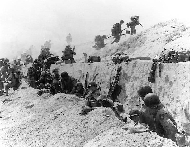
Troops of the US 4th Division move out over the seawall on Utah Beach

Pointe du Hoc

Between Utah and Omaha, cliffs dominated the coast at Pointe du Hoc. Allied intelligence identified the position as a German coastal battery capable of threatening the invasion fleet and landing beaches. Lieutenant Colonel James Rudder’s 2nd Ranger Battalion was assigned the task to neutralise the guns.

The Ranger assault on Pointe du Hoc required troops to land beneath the cliffs, scale them under fire and seize the fortified position above. The Rangers discovered that the main guns had been removed from their prepared emplacements, but patrols subsequently located and disabled them inland. Isolated on the headland, the Rangers then fought to hold their position while awaiting relief from forces advancing from Omaha.
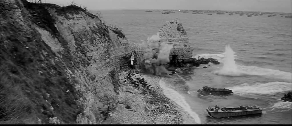
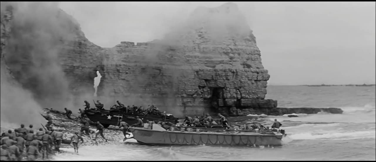
Screenshot from 'The Longest Day' shot onsite at Pointe du Hoc
Screenshot from ‘The Longest Day’ assault on Pointe du Hoc, actually shot onsite at Pointe du Hoc

Omaha Beach

At Omaha Beach, the US 1st and 29th Infantry Divisions encountered the most formidable resistance of any of the five Allied landing beaches. The terrain magnified the problem. A broad tidal flat and exposed beach lay beneath steep bluffs, while movement inland was channelled through five beach exits covered by German strongpoints, obstacles, mines and interlocking fire.

The initial Omaha Beach landings suffered heavy casualties. Amphibious tanks were lost, units became intermixed, engineers struggled to clear beach obstacles and German fire disrupted attempts to move through the planned exits. For a time, the assault appeared dangerously close to failure.

The breakthrough came not through the smooth execution of the original plan but through local initiative. Small groups of infantry, engineers and Rangers worked their way across and above the bluffs, infiltrating between German positions and attacking strongpoints from their flanks and rear. By the end of 6 June the Omaha lodgement remained shallow and vulnerable, but American troops had broken through the coastal defences. The cost made Omaha the bloodiest of the five D-Day beaches and demonstrated how profoundly local terrain could disrupt even the most carefully prepared operational plan.

Robert F. Sargent's famous photo of Easy Company, 16th Infantry Regiment landing at FOX GREEN Sector, Omaha Beach on D-Day. Aerial shot from the same location in November 2024.
Robert F. Sargent’s famous photo of Easy Company, 16th Infantry Regiment landing at FOX GREEN Sector, Omaha Beach on D-Day. Aerial shot from the same location in November 2024.

Gold Beach

East of Omaha, the British 50th (Northumbrian) Infantry Division landed at Gold Beach. Its objectives included securing the coast between the American and Canadian sectors, capturing Arromanches and pushing inland toward Bayeux while cutting the important Caen–Bayeux road.

German strongpoints and coastal defences caused delays at several locations, but British forces penetrated inland and made substantial progress during the day. The capture of Arromanches was particularly important because the site had been selected for one of the artificial Mulberry harbours that would sustain the Allied build-up before major French ports could be secured.
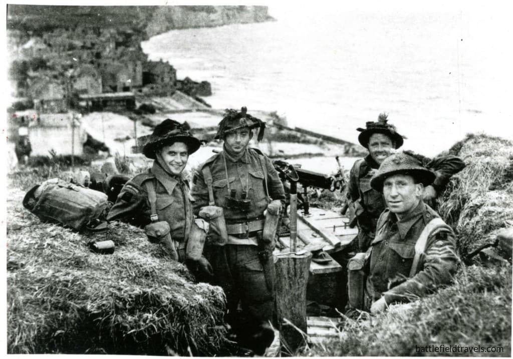
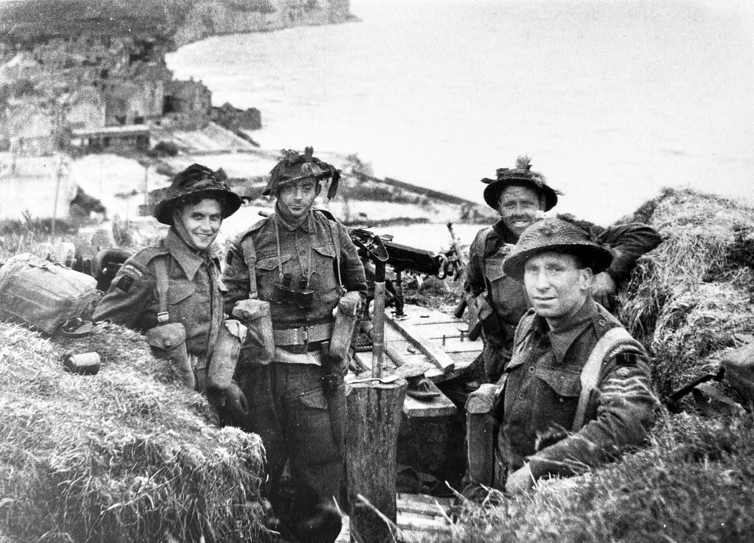
British soldiers of 1st Battalion, the Hampshire Regiment securing the high ground east of Arromanches. Arromanches visible in the background.

Juno Beach

The Canadian 3rd Infantry Division assaulted Juno Beach between the British landings at Gold and Sword. Rough seas, offshore obstacles and fortified coastal villages complicated the assault, and several Canadian units suffered heavily while breaking through the beach defences.

Once inland, however, Canadian forces advanced farther than many of the other seaborne formations on D-Day. Their objectives included securing the Caen–Bayeux road and linking the British and Canadian beachheads. Although not all planned objectives were reached and gaps remained between Allied formations, the Canadians had established a substantial lodgement by the end of the day.
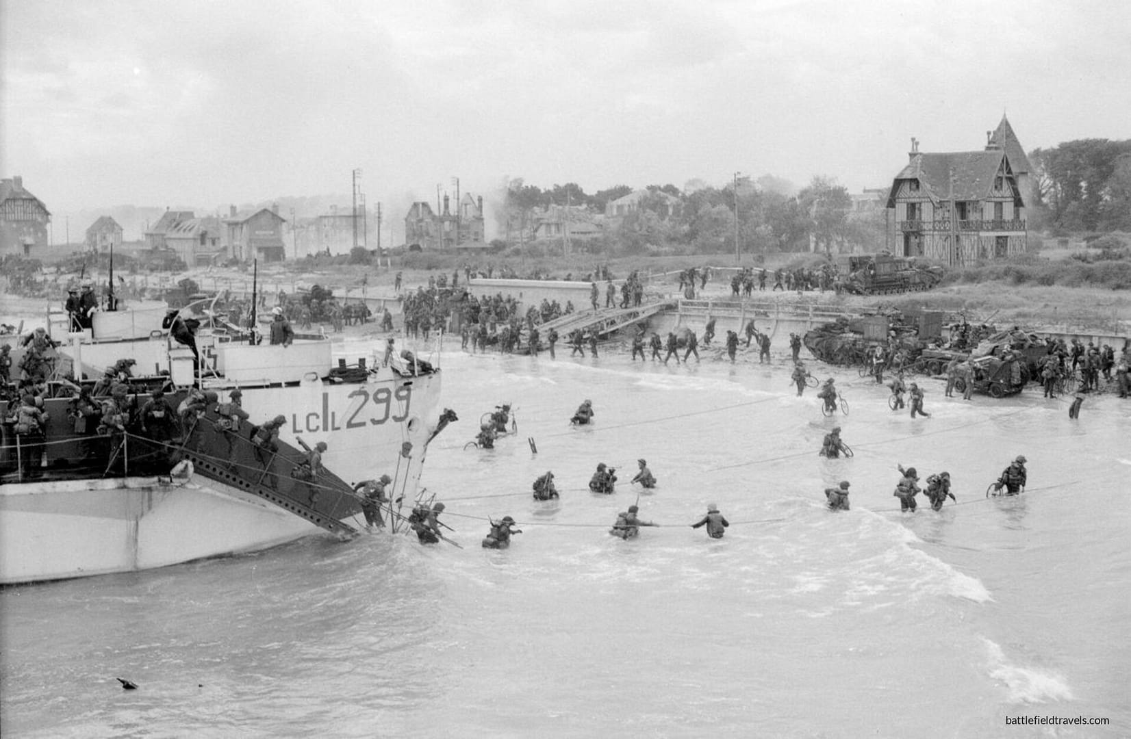
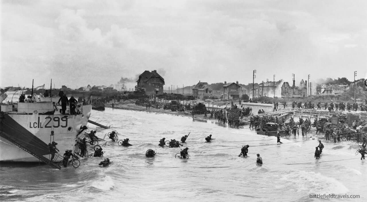
Juno Beach. Canadian 9th Brigade second wave landing at Bernieres-sur-Mer. Canada House visible in the background.

Sword Beach

At the eastern end of the amphibious assault, the British 3rd Infantry Division landed at Sword Beach. Its objectives extended well beyond clearing the immediate coastal defences. British forces were to advance toward Caen and, crucially, link with the 6th Airborne Division holding the bridges and defensive positions east of the Orne.

The link with the airborne troops was achieved, and was symbolised by the arrival of commandos under Brigadier Lord Lovat at Pegasus Bridge. Caen, however, remained in German hands. The failure to capture the city on D-Day helped shape the fighting that followed, as German armoured formations concentrated against the eastern side of the Allied lodgement.
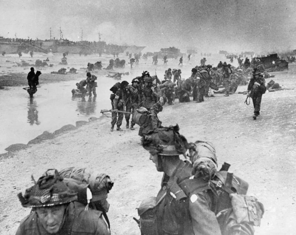
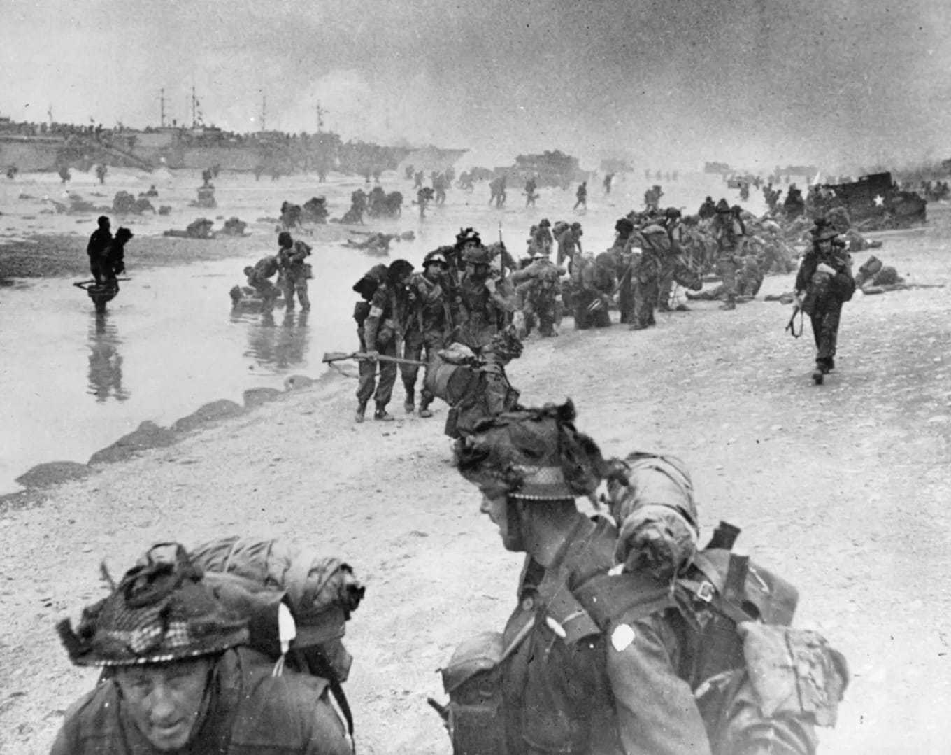
British soldiers landing on Sword Beach, D-Day, 6 June 1944

By the end of D-Day

By nightfall on 6 June, Allied forces had established themselves along the Normandy coast, but the five assault sectors had not yet become the secure, continuous lodgement envisaged in the invasion plan. The fighting around Carentan, the Cotentin Peninsula and Caen would continue, while the bocage increasingly imposed its own tactical demands. D-Day had succeeded, but the Battle of Normandy had only just begun.


🏛️Weapons & Equipment: World War Two
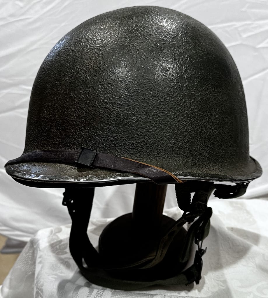
Helmet-US-MC1-front-seam-swivel-bail-06

Explore original weapons and equipment from the Second World War, drawn from my personal collection.

Uniforms, helmets, headgear, weapons, equipment from Australia, Britain, United States, Soviet Union, Germany, Japan, Italy, Romania, — personally handled, photographed and examined by me.


A curated reading list covering the Second World War across all theatres. Explore campaign histories, battlefield studies, biographies, primary accounts and contemporary military writings used in the research behind Battlefield Travels. The list will continue to grow as I publish new studies and draw upon new resources.


❓D-Day and Normandy Campaign Quiz. Test your knowledge!
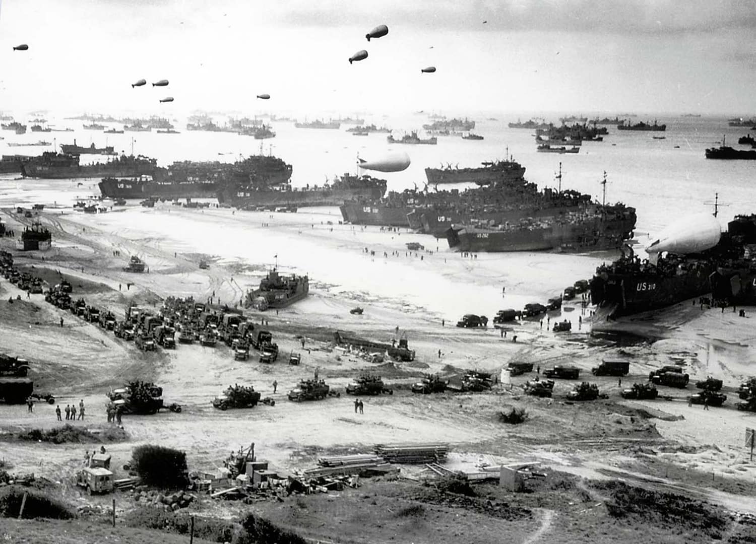
View from Fox Red colossal scale

20 questions generated out of a bank of 60. Testing your knowledge of the D-Day landings including the US and British airborne operations, and all five invasion beaches. Score 60% to pass — but expect a challenge!


D-Day and Normandy Campaign Battle Studies

In-depth battlefield analyses based on terrain, primary sources, and on-the-ground exploration.


What was D-Day and when did the Normandy landings take place?

D-Day was 6 June 1944, when Allied forces launched Operation Overlord with airborne and amphibious landings in Normandy, France. American troops landed at Utah and Omaha Beaches, British forces at Gold and Sword, and Canadians at Juno, while British and American airborne divisions landed behind the beaches to secure bridges, causeways, road junctions and other key objectives.

What were the five D-Day landing beaches?

The five Allied landing beaches were Utah, Omaha, Gold, Juno and Sword, extending along roughly 80 kilometres of the Normandy coast. American forces assaulted Utah and Omaha, British forces Gold and Sword, and Canadian forces Juno. Each beach presented different terrain, German defences and tactical problems, from the bluffs and draws overlooking Omaha to the flooded ground behind Utah.

Why was terrain so important during the Normandy landings?

Terrain influenced almost every stage of the fighting. Cliffs, beach exits, flooded fields, causeways, rivers, villages and the Norman bocage restricted movement and frequently channelled troops into predictable routes. At La Fière, for example, control of a narrow causeway across flooded ground became critical, while at Omaha the few draws leading through the coastal bluffs strongly influenced the battle to get off the beach.

Did the Battle of Normandy end on D-Day?

No. D-Day was the opening day of the Normandy campaign, not its conclusion. After establishing the beachheads, Allied forces still had to link them together, secure ports and key towns, and expand the lodgement against determined German resistance. Fighting continued through the summer, including the battles around Caen, Operation Cobra and the Falaise Pocket, before the German position in Normandy collapsed in August 1944.


Subscribe to Battlefield Travels and receive a free E-Book Battlefield Guide

Unlock expert battlefield analysis, campaign reconstructions, and historical insights drawn from firsthand exploration and primary sources.

🗺️ You’ll receive:

🎖️ Exclusive historical insights you won’t find elsewhere

📘 A free eBook: 10 Tips for Exploring Historic Battlefields

📰 New battlefield studies straight to your inbox as they are published


Belleau Wood

📝🔒Field Note: Belleau Wood, France, June 1918

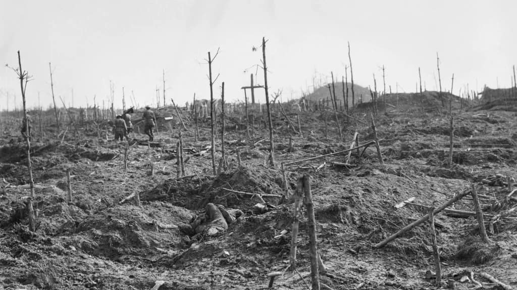
July 2012,  Belleau Wood, near Château-Thierry, France. I am exploring the site of the legendary US Marine battle in June 1918. The first impression of ‘Bois Belleau’ is confinement. The ground is enclosed by dense woodland, with limited lines of sight and little sense of distance.

WW1 Imperial German Model 1895 Pickelhaube, 73rd Hanoverian Fusilier Regiment (Ernst Junger)
WW1 Imperial German Model 1895 Pickelhaube, 73rd Hanoverian Fusilier Regiment — the regiment in which Ernst Jünger served and about which he wrote Storm of Steel

My WW1 collection is enormous – hundreds of uniforms, headgear items, combat equipment. Here are just a few pieces.

👉 Explore the companion collection: PART 1. ALLIED POWERS →

The First World War traumatised the nations of Europe – they were never the same again. The armies of 1918 looked very different from those that mobilised in 1914. Brightly coloured uniform items like the French madder red trousers and the Austro-Hungarian pike-grey uniforms gave way to drab greys, khakis and greens that provided at least some camouflage on the deadly battlefield. Napoleonic holdovers like the French curaissier uniforms of 1914 were gone. The soft and often decorative forms headgear that all armies used in 1914 was replaced by protective steel helmets, starting the French Adrian helmet in 1915, and culminating in the silica-nickel-steel German Model 1916/17/18 helmets.

While the basic infantry rifle that most countries remained unchanged throughout the war, the crew-served and heavy weapons saw significant advancement and vastly expanded scale of issue. The Lewis Gun, Browning Automatic Rifle, Madsen Light Machine Gun, and MG08/15 all provided the infantry with mobile firepower that could move with them in the advance. Grenades became a dominant weapon system in trench fighting and bifurcated into ‘defensive’ grenades (large shrapnel with wide lethal zone) and ‘offensive’ grenades (mode explosive and lighter shrapnel). Gas warfare developed rapidly from 1915 onwards, and so did the individual gasmask that every soldier carried.

Trench warfare created new demands for equipment such as lightweight entrenching tools, trench fighting knives and improvised maces . The trench periscope allowed soldiers to view across no-mans land without exposing themselves to enemy fire, and the next logical development was periscope rifle mounts for firing from below cover.

The enormous wartime production of weapons and equipment ensured that First World War matériel remained in widespread service during the Russian Civil War and in numerous inter-war conflicts worldwide.

This selection of WW1 uniforms, weapons and equipment showcases original items from my personal collection.


Weapons and equipment of the Central Powers. All from my personal collection.


IMPERIAL GERMAN


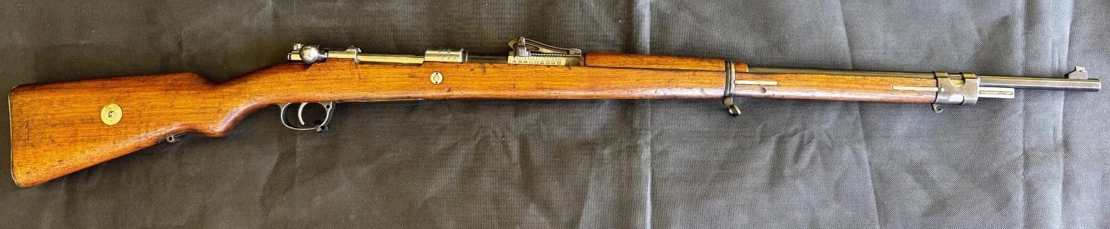
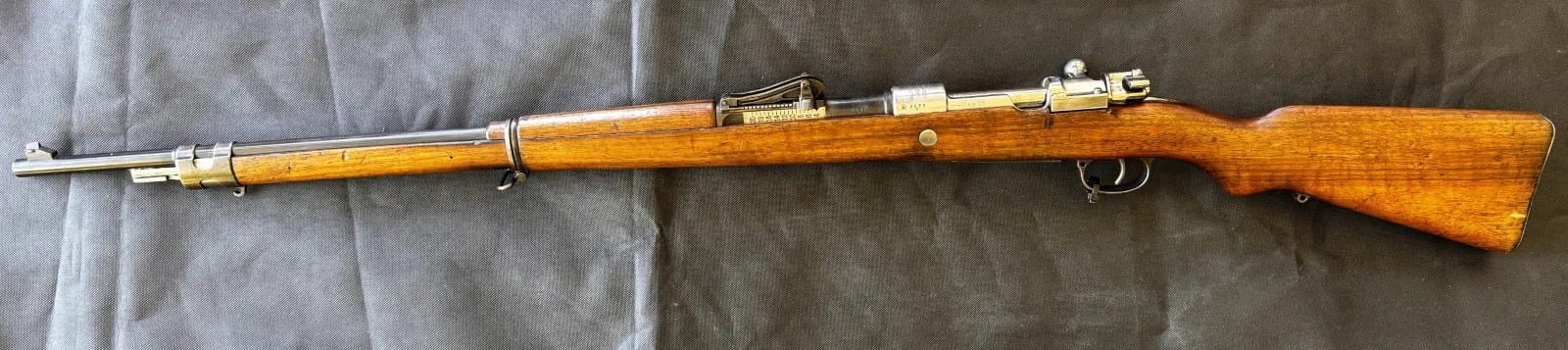
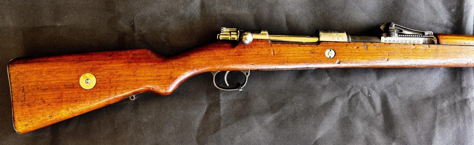
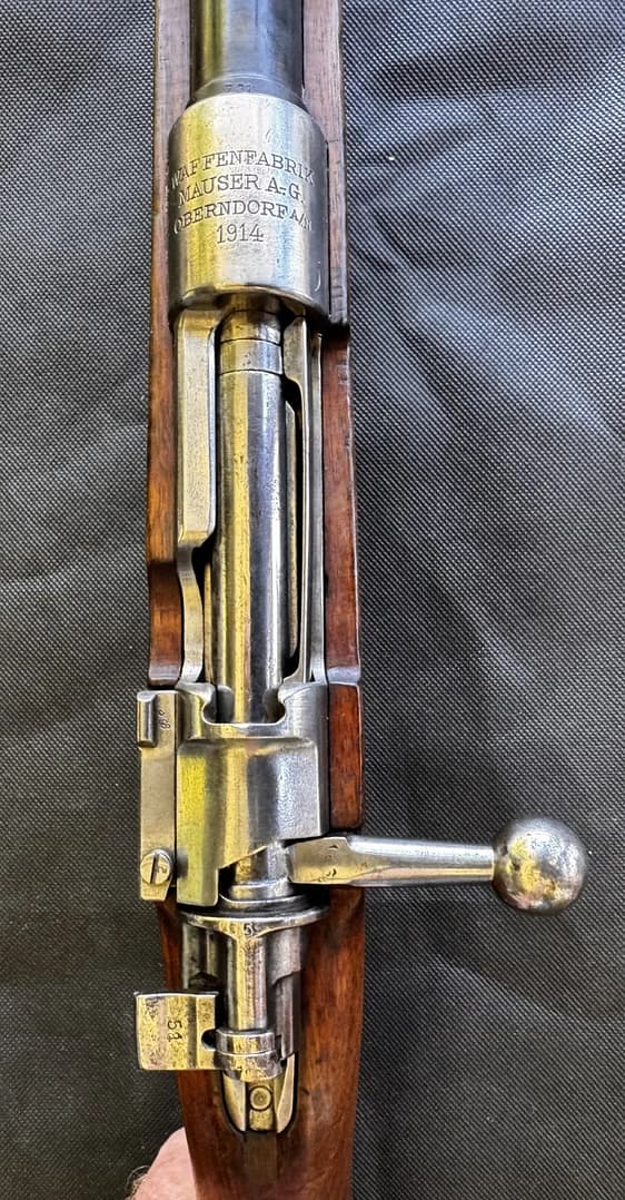
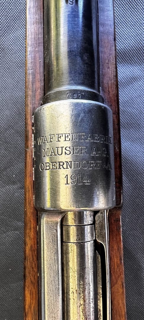
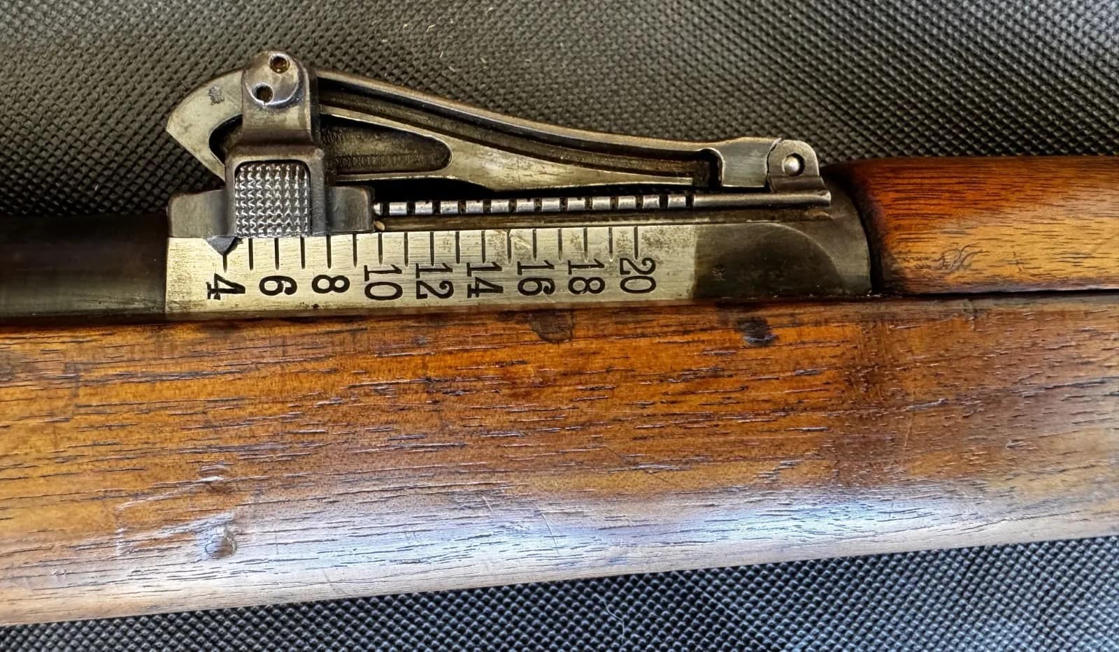
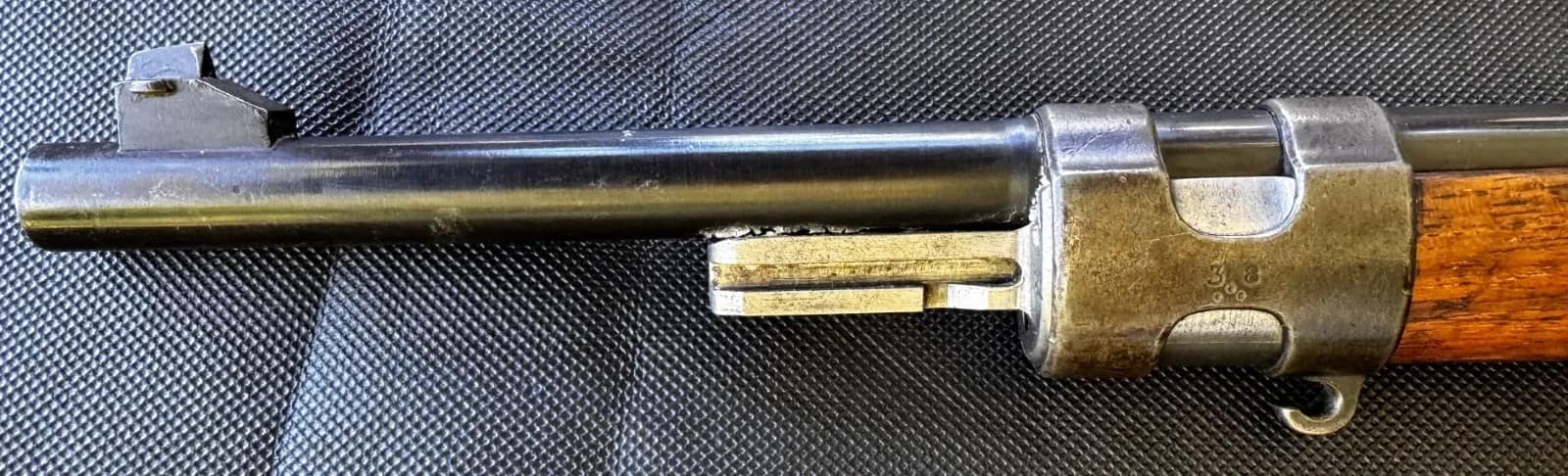
WW1 German Gewehr 98 Rifle. Mauser, Oberndorf 1914

The Mauser Gewehr 98 was the standard service rifle of the Imperial German Army during the First World War, produced by Mauser at Oberndorf and other arsenals. Chambered in 7.92×57mm, it featured a strong bolt action, long barrel, and excellent accuracy, reflecting German emphasis on marksmanship.


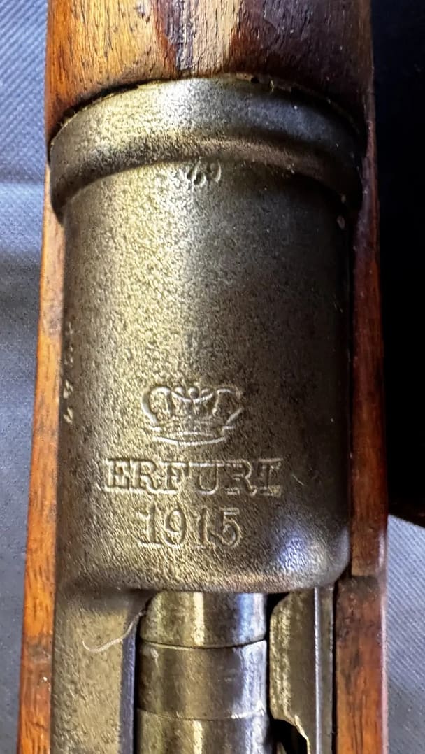
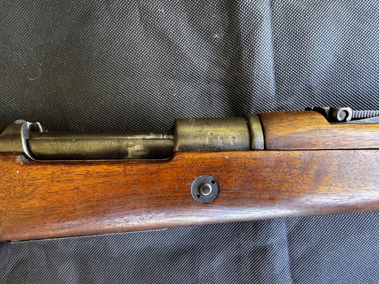
WW1 German Karabiner 98AZ (Kar AZ), Erfurt 1915

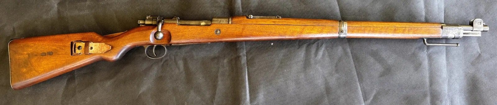
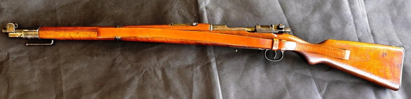
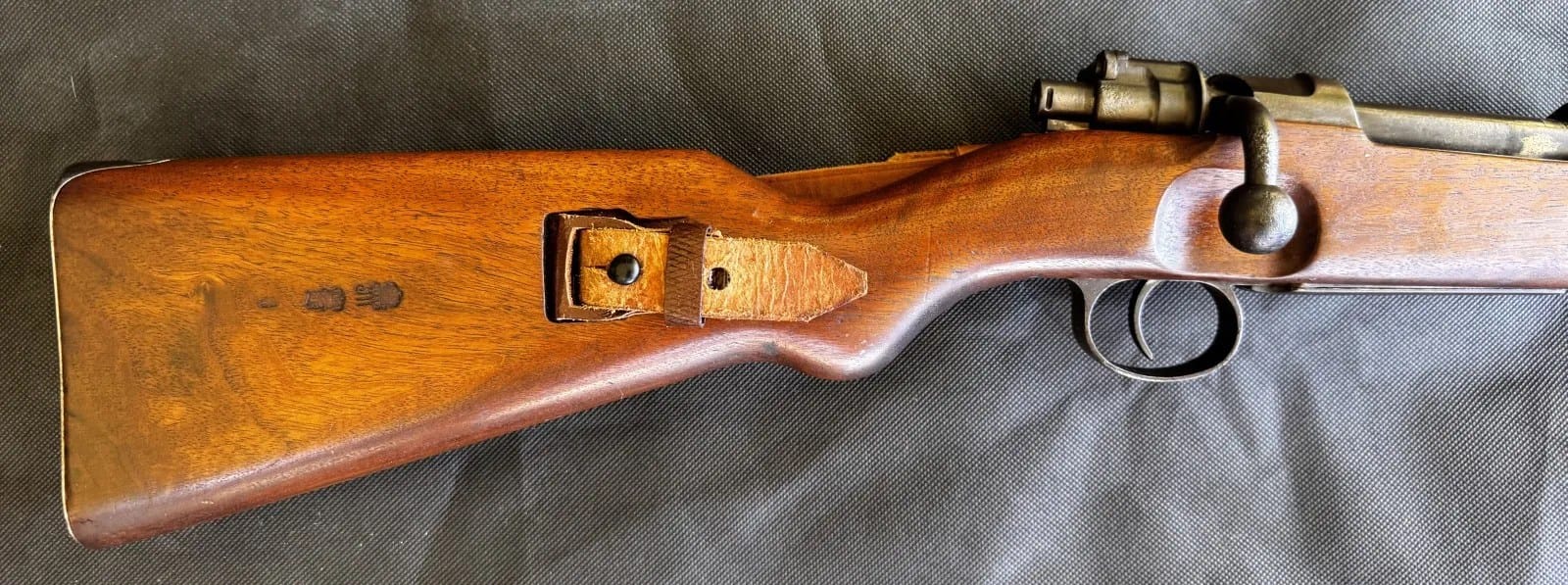
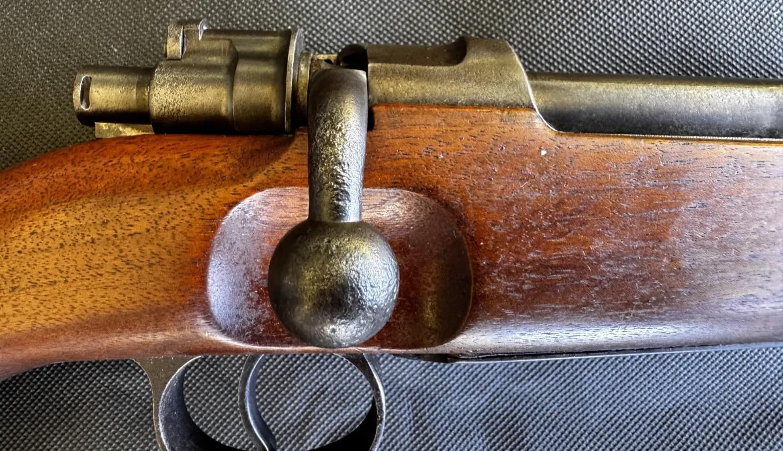
The Karabiner 98AZ was a shortened Mauser carbine issued to German cavalry, artillery, engineers, and other specialist troops during the First World War. Chambered in 7.92×57mm, it featured a turned-down bolt handle, stacking hook, and side-mounted sling arrangement suited to mounted and mobile troops. Introduced before the war and widely issued from 1914 onward, the Kar 98AZ balanced compact handling with the reliability of the Mauser bolt-action system.


WW1 German Grabenpanzer (Trench armour) + Stirnpanzer (Helmet front plate). From my personal collection.

This rare example of German personal armour illustrates attempts to provide additional protection for soldiers exposed to intense small-arms and shrapnel fire on the Western Front. The Grabenpanzer, a steel breastplate issued in limited numbers from 1916, was intended primarily for sentries, machine-gun crews, and troops operating in exposed trench positions. The Stirnpanzer, a detachable steel brow plate worn on the Stahlhelm, offered additional frontal protection but was heavy and unpopular for prolonged wear. Together, these items reflect the defensive character of trench warfare and the constant search for practical solutions to battlefield lethality.


WW1 uniform of the Kaiserliche Schutztruppe für Deutsch-Südwestafrika

This First World War uniform of the Kaiserliche Schutztruppe für Deutsch-Südwestafrika includes a distinctive slouch hat and leather equipment set worn by German colonial forces in present-day Namibia. The Schutztruppe combined European military traditions with adaptations for service in harsh colonial environments, reflecting the unique character of Germany’s overseas forces. Such uniforms illustrate the global reach of the First World War and the role of colonial troops in campaigns fought far beyond Europe.


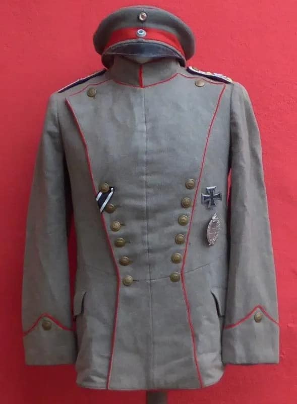
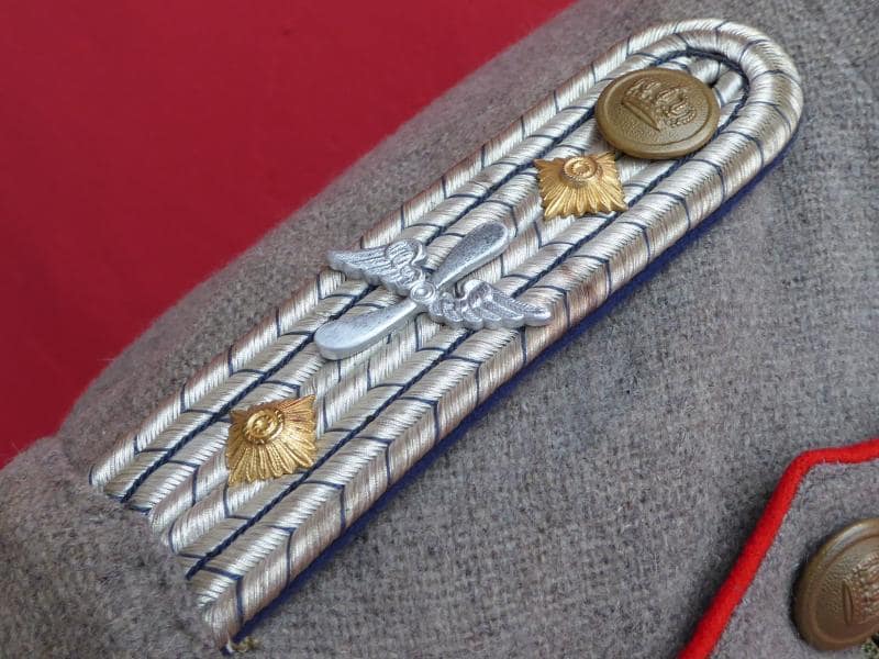
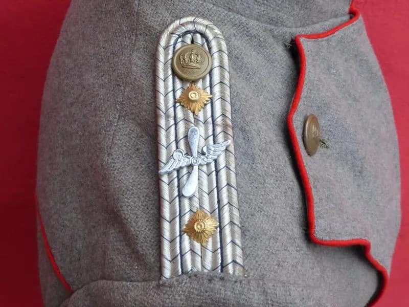
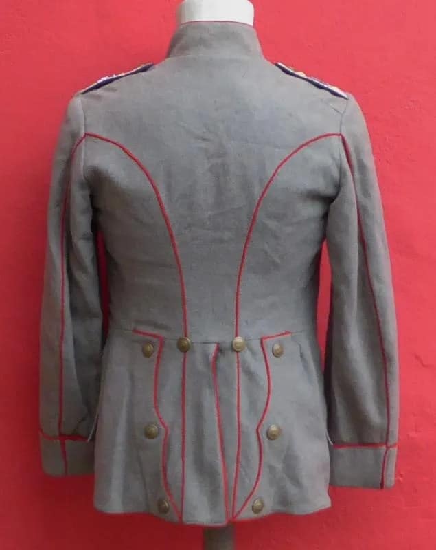
WW1 Imperial German Model Fliegerbluse (Pilot tunic), Uhlan pattern tunic (Uhlanka)

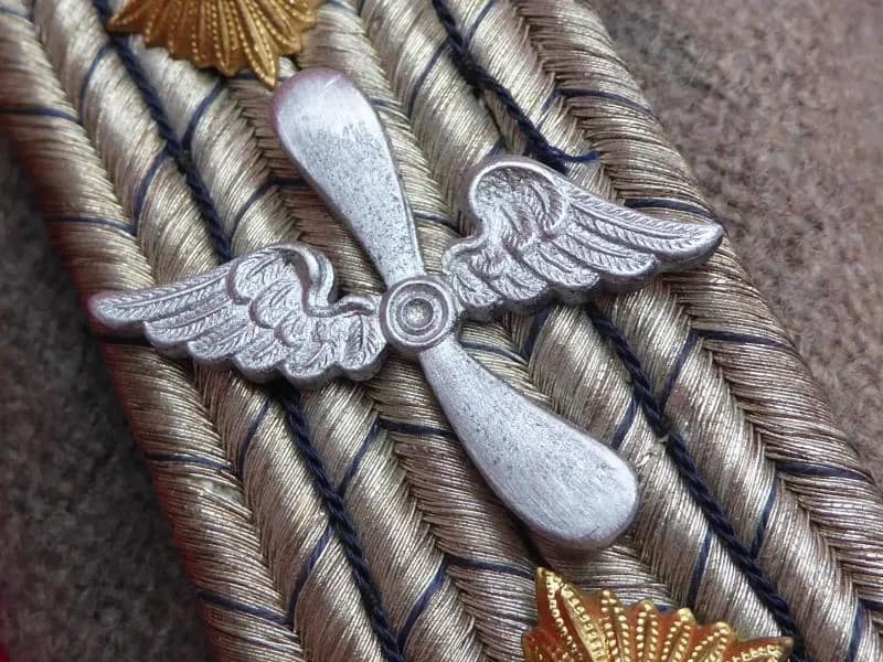
This Imperial German Fliegerbluse is a privately purchased pilot’s uniform. The owner was almost certanly a former cavalryman who continued to wear his stylish Uhlanka when he transferred to the Imperial German Air Service.

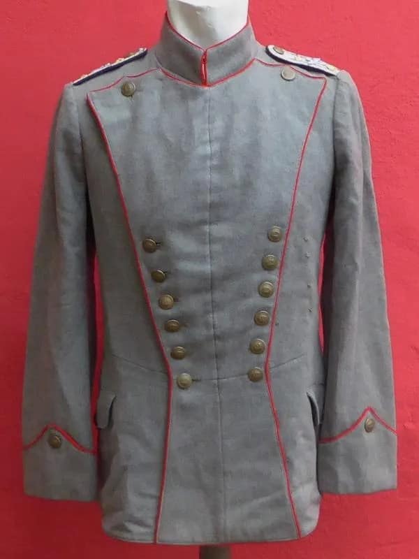
WW1 Imperial German Model 1907/10 tunic for an Offizierstellerverter, Infantry Regiment 141. From my personal collection.

This Imperial German Model 1907/10 tunic is attributed to an Offizierstellvertreter of Infantry Regiment 141, a senior non-commissioned rank roughly equivalent to a Warrant Officer Class One in Commonwealth armies. The tunic reflects the feldgrau field dress adopted by the German Army before the First World War, emphasising practicality and concealment. Rank insignia and regimental distinctions illustrate the structure and professional cadre that underpinned the Imperial German Army during the conflict.


WW1 Imperial German Model 1915 Feldbluse, 18th Foot Artillery Regiment. From my personal collection.

This Imperial German Model 1915 feldbluse is attributed to the 18th Foot Artillery Regiment and represents the simplified field tunic introduced during the First World War. Designed to reduce production time and material use, the feldbluse reflects the shift toward more practical wartime uniforms. The feldgrau colour and streamlined features illustrate Germany’s adaptation to the demands of industrialised warfare and prolonged conflict.


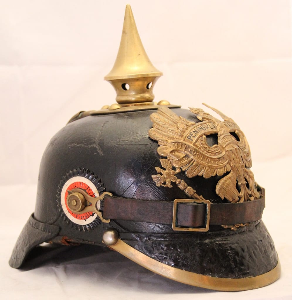
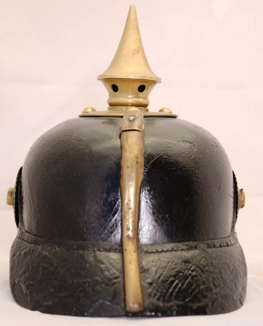
WW1 Imperial German Model 1895 pickelhaube. Fusilier Regiment 73, with PENINSULA WATERLOO bandeau. From my personal collection.

Model 1895 pickelhaube . Fusilier Regiment 73, with PENINSULA WATERLOO bandeau, original chinstrap. Ernst Junger Regiment


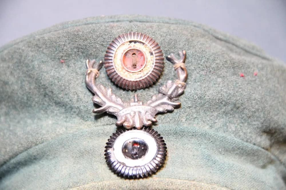
Extremely rare – WW1 Imperial German Model 1907/10 Kager Kratzchen Karpathenkorps. From my personal collection.

This exceptionally rare Model 1907/10 Krätzchen field cap is fitted with the distinctive antler badge of the German IV Reserve Corps, known as the Karpathenkorps, a formation created in 1915 for operations in the harsh mountain terrain of the Carpathians. The Krätzchen was widely worn by German troops in the early years of the war, valued for its practicality and comfort in field conditions. The antler emblem symbolised the corps’ mountain identity and elite status within the Imperial German Army. Surviving examples with original insignia are scarce, reflecting both wartime wear and the demanding operational environments in which these troops served.


WW1 Imperial German Model 1913 Feldgrau Fliegerhelm (pilot helmet). Marked Flieger Bekl Doberitz 1917. From my personal collection.

Model 1913. Feldgrau Fliegerhelm Marked Flieger Bekl Doberitz 1917


#1. WW1 Imperial German Model 1916 Camouflaged Stahlhelm. From my personal collection.

Model M1916. Jagged zig zag camo, vivid yellow ochre front, full M16 liner, three pads, dark sweatstained, no pull throughs, three pillows, original chinstrap,


#2. WW1 Imperial German Model 1917 Camouflaged Stahlhelm. From my personal collection.

M1917. zig zag camouflage, faded and worn colours, M17 liner ring, white pads, dark sweatstained, no pullthroughs, three pillows, remnant of drawstring, M1915 chinstrap chinstrap, BF64


#3. WW1 Imperial German Model 1916 Camouflaged Stahlhelm. From my personal collection.

M1916. Rectangular block camo, deep rich colours, very well preserved, three pads, one pad has both tongues broken off, no pillows, M91 chinstrap mounts, G62


#4. WW1 Imperial German Model 1916 Camouflaged Stahlhelm. From my personal collection.

Model 1916. Linear camo, M16 liner band, three brown pads, one pad has slightly cracked away and has old stitched string repair, no pillows, original M1895 chinstrap, BF62. evidence of mail home labels on front and on top


#5. WW1 Imperial German Model 1916 Camouflaged Stahlhelm. From my personal collection.

Model 1916. Camouflage, dull angular camo, mottled patina, M16 liner three pads, no tear throughs, drawstring, three pillows, original chinstrap, one liner pad loose, chinstrap, SI66


#6. WW1 Imperial German Model 1918 Camouflaged Stahlhelm. From my personal collection.

Model 1918. Dull angular canouflage, oil spot staining on right rear, M18 liner ring and chinstrap attachments, no liner, no chinstrap ET64.

Note that helmet #6 and helmet #7 were almost certainly painted by the same person, or at least by teh same German unit. The camouflage patterns are almost identical. I purchased these two helmets at least 10 years apart in different parts of the world.


#7. WW1 Imperial German Model 1916 Camouflaged Stahlhelm. From my personal collection.

Model 1916. Angular camouflage, all colours faded to dark patina, excellent M1916 liner band, three pads, no tearthroughs, drawstring, three pads, no chinstrap, marked ‘GULAWA’ ??? G62

Note that helmet #6 and helmet #7 were almost certainly painted by the same person, or at least by teh same German unit. The camouflage patterns are almost identical. I purchased these two helmets at least 10 years apart in different parts of the world.


#8. WW1 Imperial German Model 1918 Camouflaged Stahlhelm. From my personal collection.

Model 1918. Rich deep block camouflage, excellent preservation, chip on front, full liner, three white pads, no pullthroughs, three pillows, fitted with M91 chinstrap rather than M1918 chinstrap original drawstring TJ66


#9. WW1 Imperial German Model 1917 Camouflaged Stahlhelm. From my personal collection.

M1917. Angular camouflage, M17 liner band, two pads – one attached still with pillow, one loose, original drawstring, one pad attached, one loose, no chinstrap, SI66


#10. WW1 Imperial German Model 1917 Camouflaged Stahlhelm. From my personal collection.

Model 1917. Block camouflage, M1917 liner band, no pads or chinstrap, one M91 chinstrap loop SI66


#11. WW1 Imperial German Model 1916 Camouflaged Stahlhelm. From my personal collection.

Model 1916. Curved camouflage, vertical split front, no liner band or chinstrap, SI66, excellent condition


#12. WW1 Imperial German Model 1917 Camouflaged Stahlhelm. From my personal collection.

Model 1917. Angular diamond camouflage, full M1917 liner, with band, three white pads, three pillows, no pullthroughs, no chinstrap, ET62, Helmet is squashed laterally, particularly dented on right side


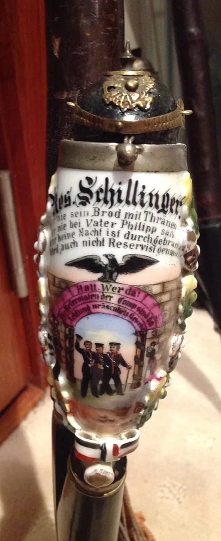
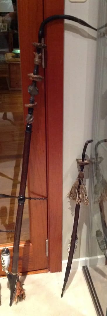
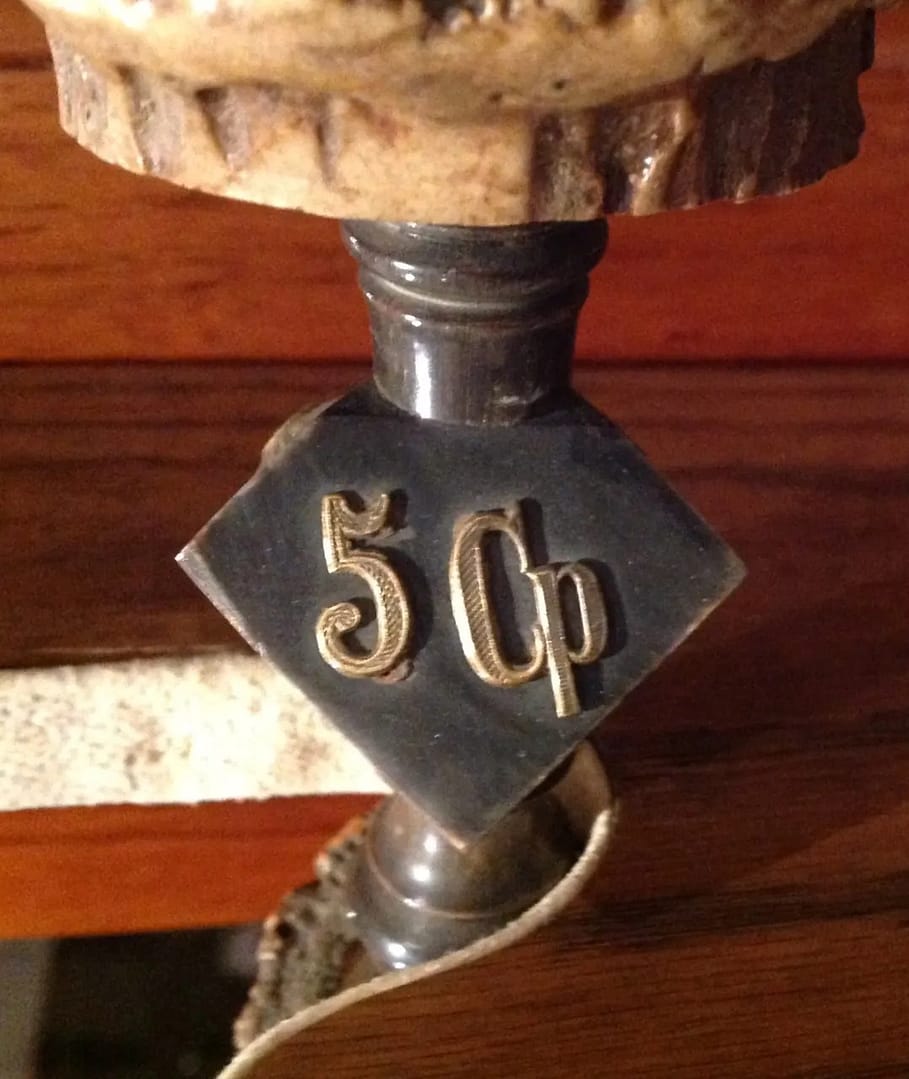
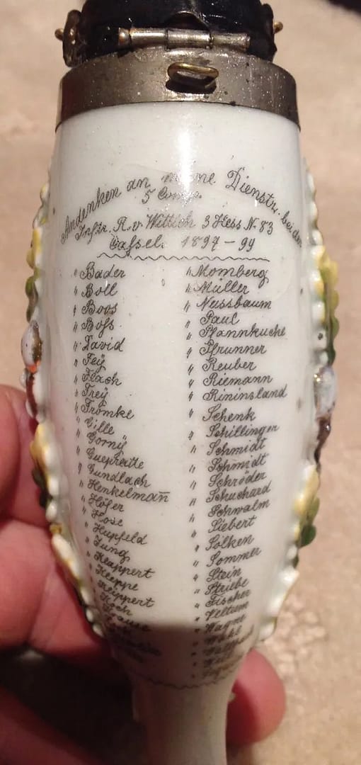
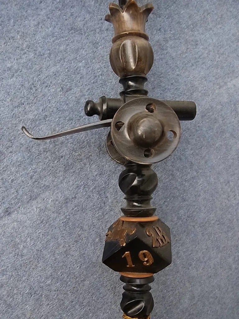
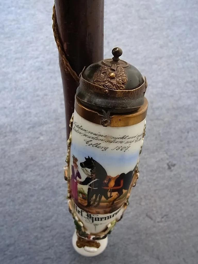
WW1 German Reservistenpfeife (Regimental pipe). Infanterie Regiment Nr 83 Hesse. Reservist Schillinger 5th Companie. From my personal collection.

German Regimental pipe provide a fabulous insight into the pre-war life of German Army reservists. German soldiers were particuafly fond of Regimental souvenirs like beer steins and elaborate tobacco pipes. These items were decorated with regimental elelents reflecting the type of unit, and bore complete details of the compaines, regiments, and names of the individuals in the companies. In this case: Reservist Schillinger of teh 5th Company , 83 Hesse Reserve Infantry Regiment.


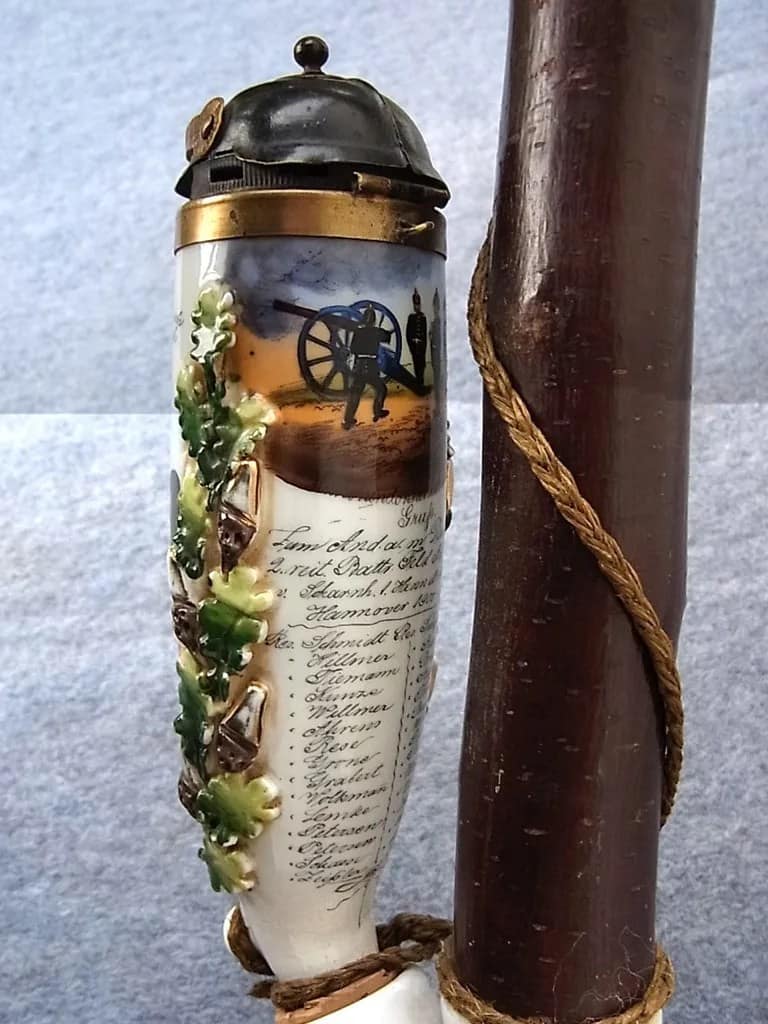
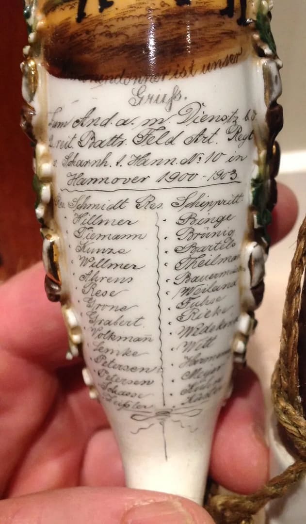
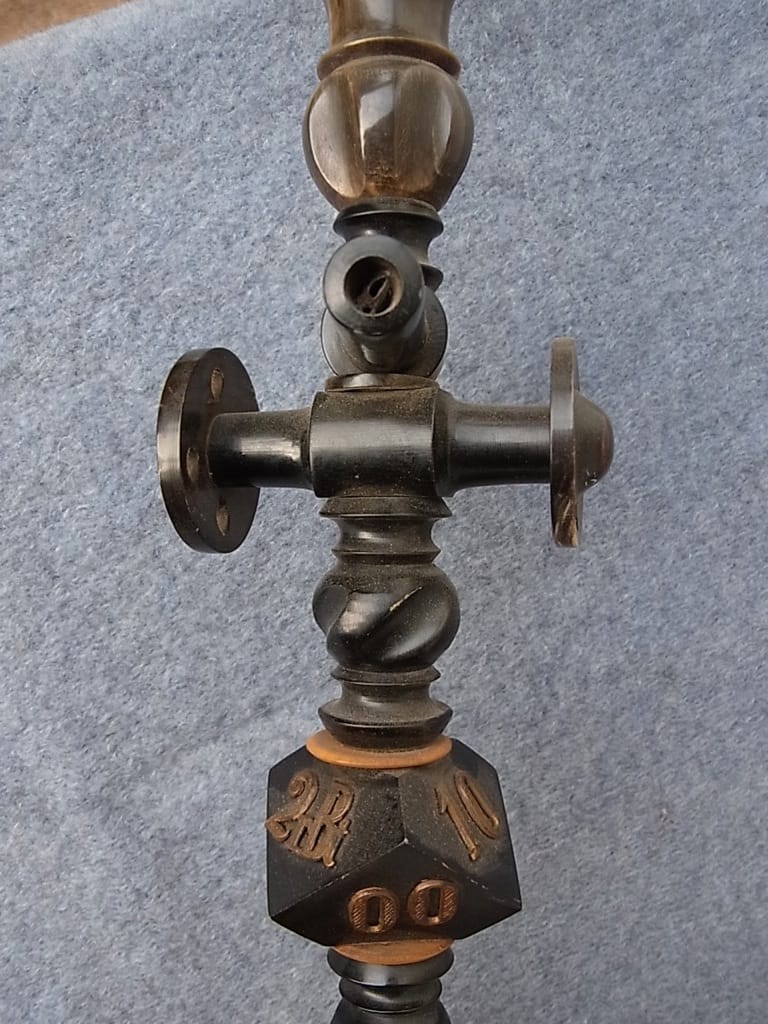
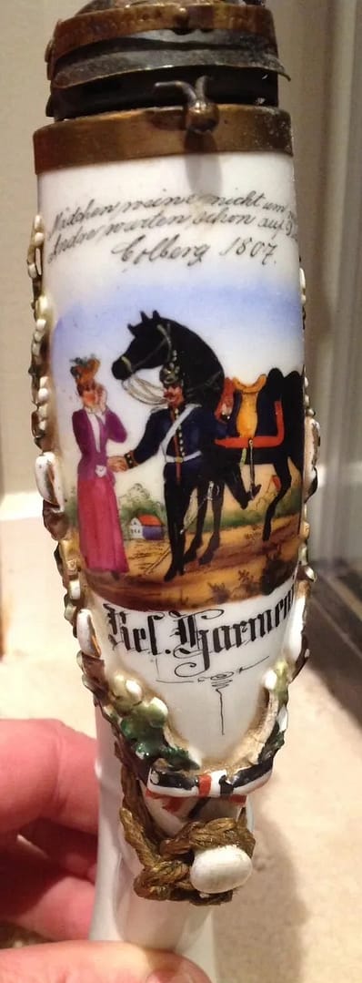
WW1 German Reservistenpfeife (Regimental pipe). 2nd Battery, Hannoverian 10th Artillery Regiment 1900-1903. From my personal collection.

German Regimental pipe provide a fabulous insight into the pre-war life of German Army reservists. German soldiers were particuafly fond of Regimental souvenirs like beer steins and elaborate tobacco pipes. These items were decorated with regimental elelents reflecting the type of unit, and bore complete details of the compaines, regiments, and names of the individuals in the companies. In this case: 2nd Battery, Hannoverian 10th Artillery Regiment 1900-1903.


AUSTRIA-HUNGARY


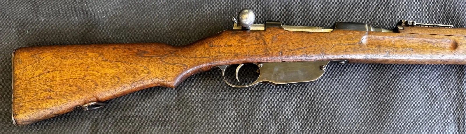
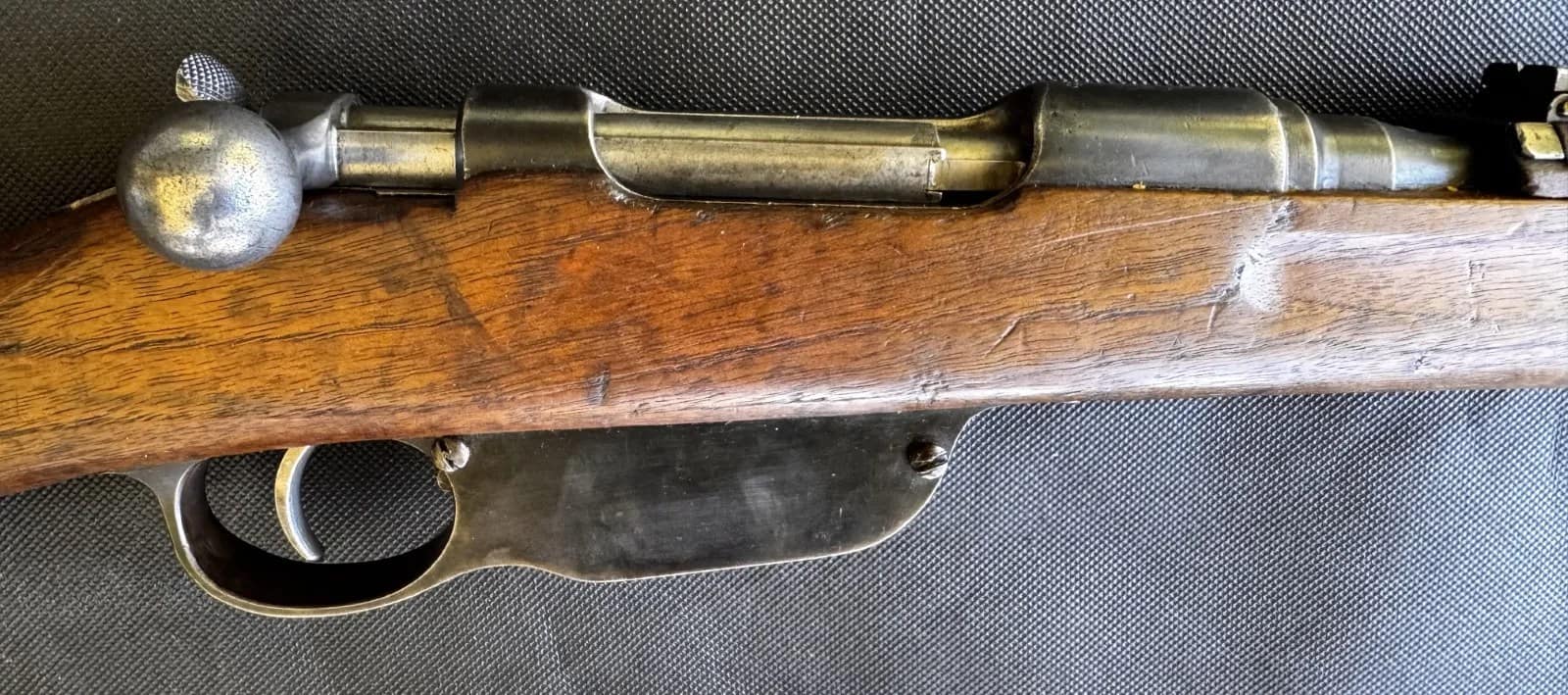
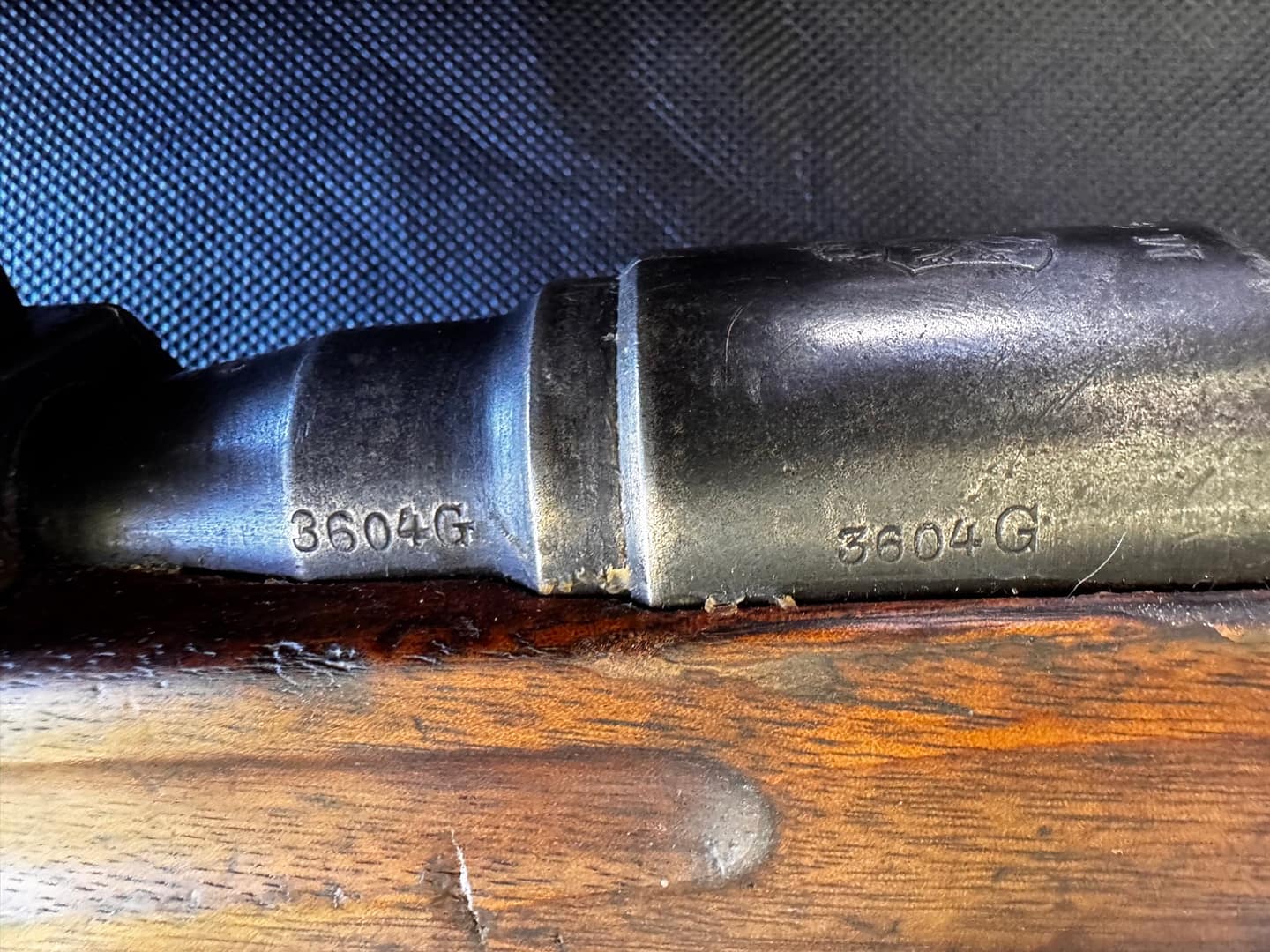
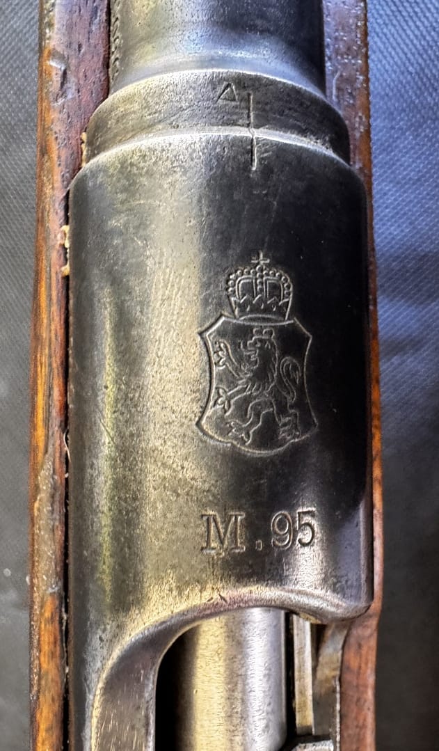
WW1 Austro-Hungarian Mannlicher Model 1895 Straight-Pull Rifle, From my personal collection

The Mannlicher Model 1895 was the standard service rifle of the Austro-Hungarian Army during the First World War. Designed by Ferdinand Mannlicher, it featured a distinctive straight-pull bolt action that allowed rapid cycling and was chambered in 8×50mmR, later updated to 8×56mmR. Widely issued to infantry and support troops, the rifle served on multiple fronts and became synonymous with Austro-Hungarian forces during the conflict.


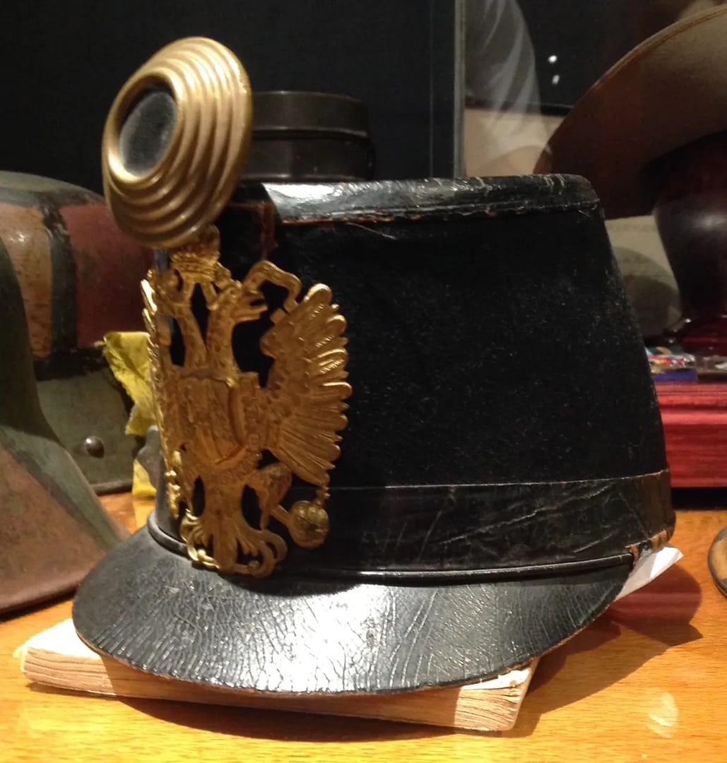
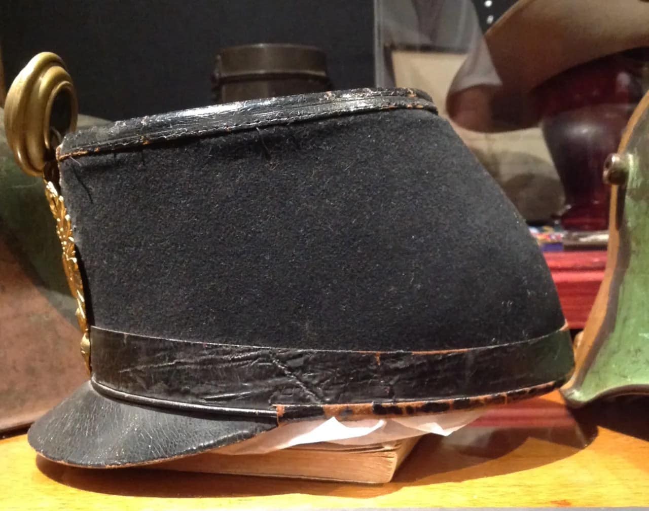
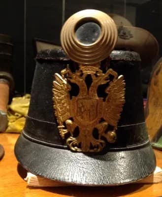
WW1 Austro-Hungarian Enlisted Mans Tschako, From my personal collection

The Austro-Hungarian enlisted man’s Tschako was a distinctive service headdress worn by infantry and other line troops in the early stages of the First World War. Derived from nineteenth-century parade and service dress, it combined traditional appearance with practical field use before widespread adoption of steel helmets. Constructed from stiffened cloth or felt with a front plate bearing imperial insignia, it identified branch and allegiance within the k.u.k. Army. As trench warfare intensified from 1915, the Tschako was increasingly replaced by the steel helmet, reflecting the shift toward modern battlefield protection requirements.


WW1 Austro-Hungarian M1917 helmet, From my personal collection

This Austro-Hungarian Model 1917 steel helmet represents the adoption of modern head protection by the Austro-Hungarian Army during the later stages of the First World War. Influenced by German helmet designs, it was introduced to protect soldiers from shell fragments and battlefield debris. The helmet reflects the broader shift toward steel protection across European armies as the realities of industrialised warfare reshaped equipment and soldier survivability.


WW1 Austro-Hungarian M1917 helmet, From my personal collection

Model 1917. Nice Austrian feldbrun, some rust staining across top, excellent liner, with pads and pillows, chinstrap stubs


WW1 Austro-Hungarian Model 1916 infantry tunic. Coarse feldgrau wool. From my personal collection.

This Austro-Hungarian Model 1916 infantry tunic, made from coarse feldgrau wool, represents the simplified field dress introduced during the later years of the First World War. Designed for practicality and mass production, the tunic reflects the material shortages and industrial pressures faced by the Austro-Hungarian Army. Its subdued colour and utilitarian construction illustrate the adaptation of uniforms to the demands of prolonged modern warfare.


WW1 Austro-Hungarian Model 1916 infantry tunic. Coarse feldgrau wool. From my personal collection.

Austro-Hungarian Model 1915 infantry tunic, EM feldgrau, 14th Infantry Regt, black collar tabs, white cellulose stars


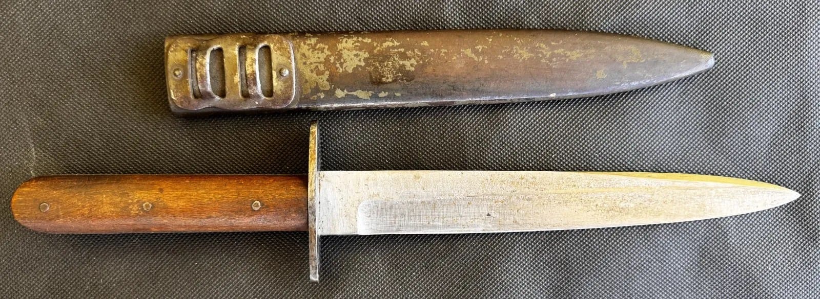
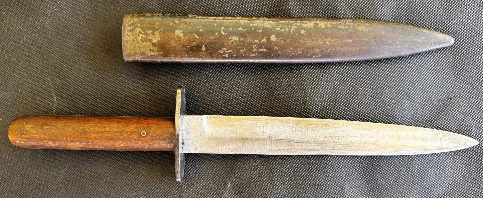
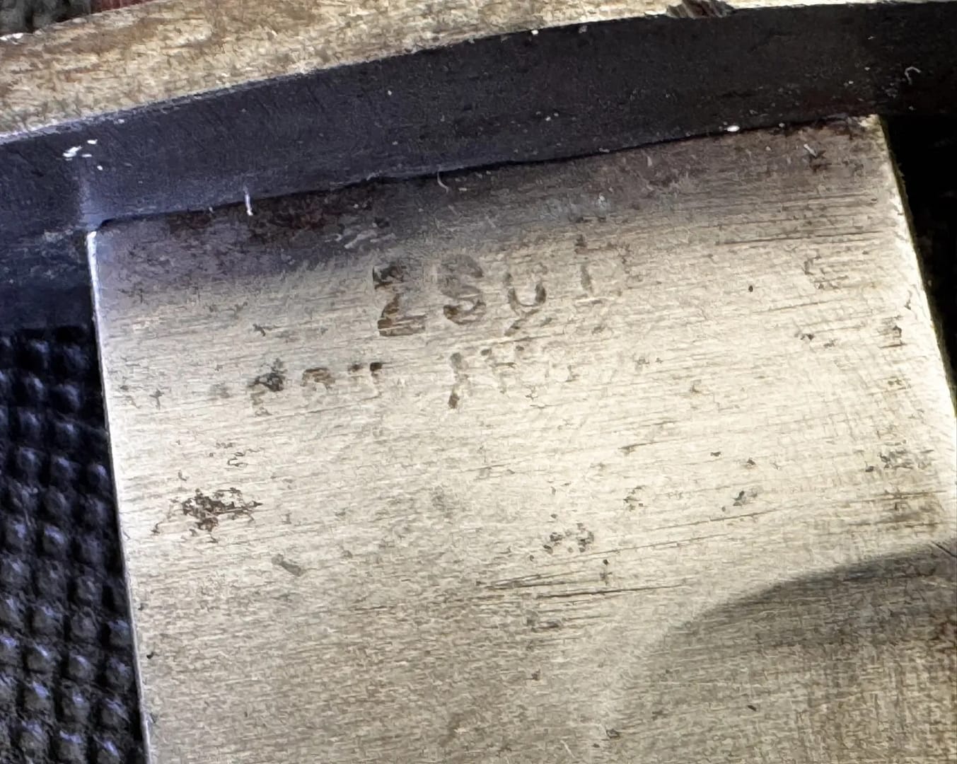
WW1 Austro-Hungarian trench dagger. From my personal collection.

This Austro-Hungarian trench fighting dagger reflects the brutal close-quarters combat that characterised much of the First World War. Designed as a compact stabbing weapon, it was intended for use in raids, patrols, and defensive fighting within trench systems. Such daggers were often privately purchased or locally produced and carried alongside standard equipment.


OTTOMAN EMPIRE


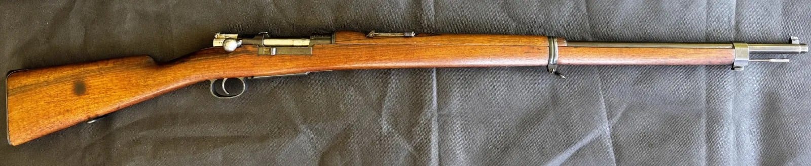
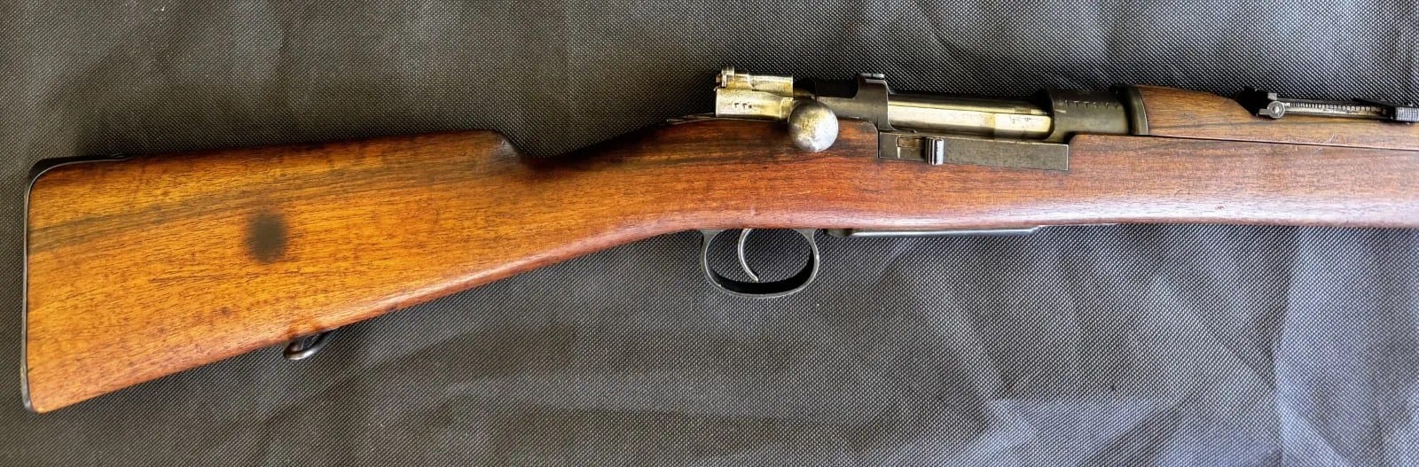
WW1 Ottoman Model 1893 Mauser Rifle.

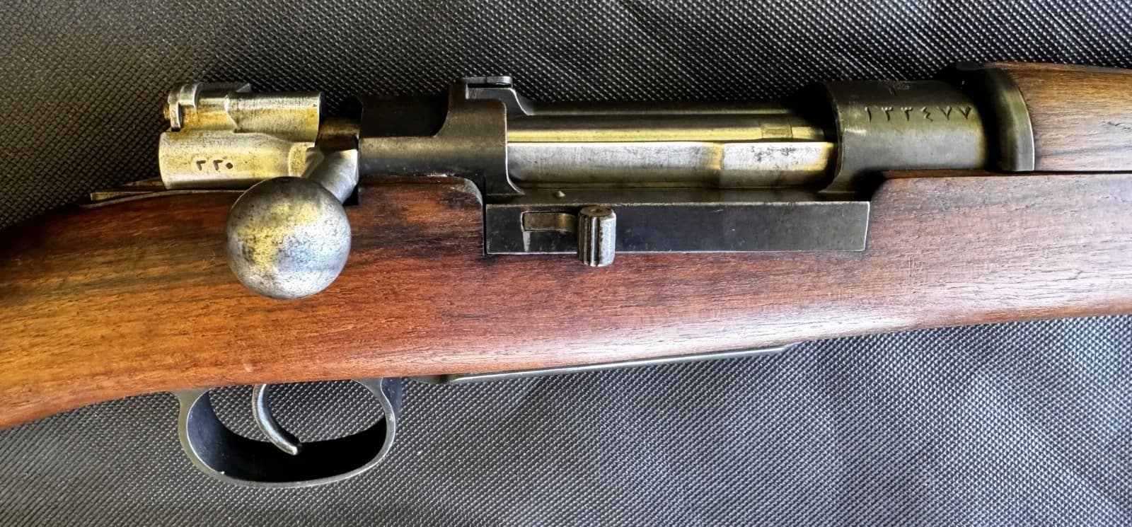
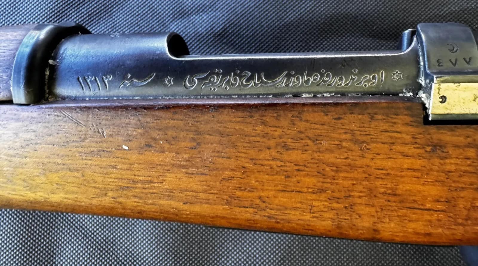
The Ottoman Model 1893 Mauser was a bolt-action infantry rifle produced by Mauser in Germany for the Ottoman Empire, chambered in 7.65×53mm. It represented a major step in modernising Ottoman infantry armament in the late nineteenth century, featuring a strong bolt system and smokeless powder cartridge. Rifles of this type saw extensive service in the Balkan Wars and the First World War, equipping Ottoman forces across multiple fronts.


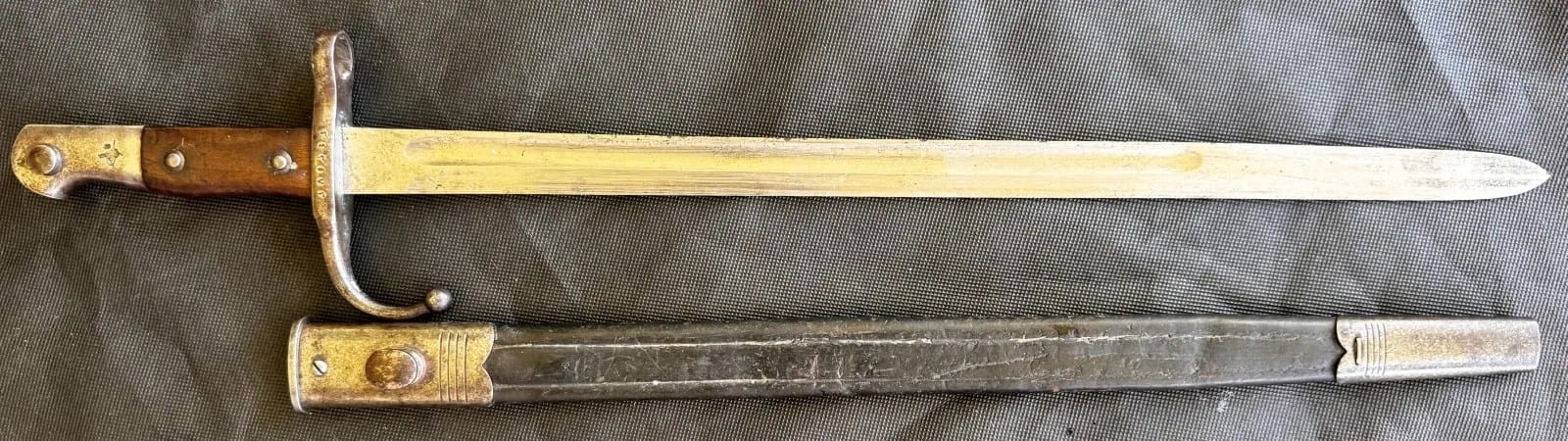
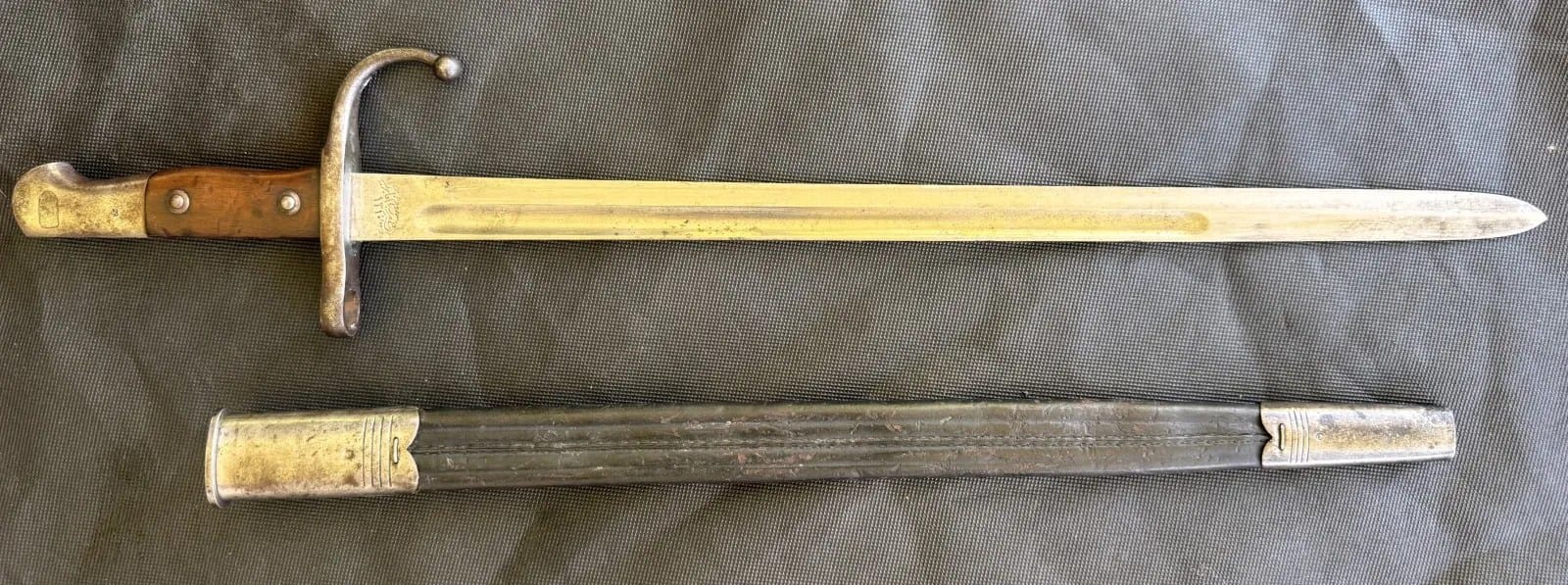
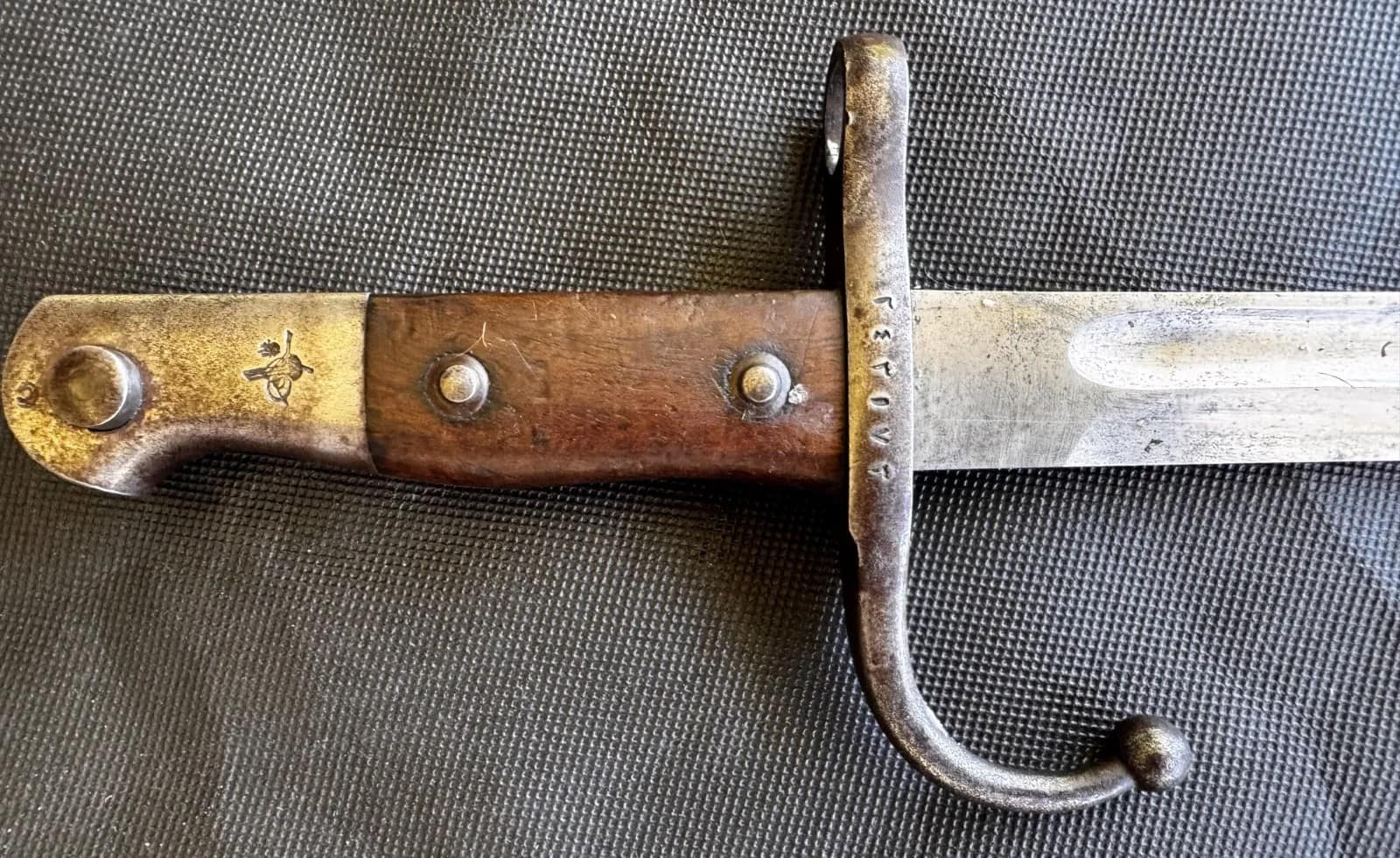
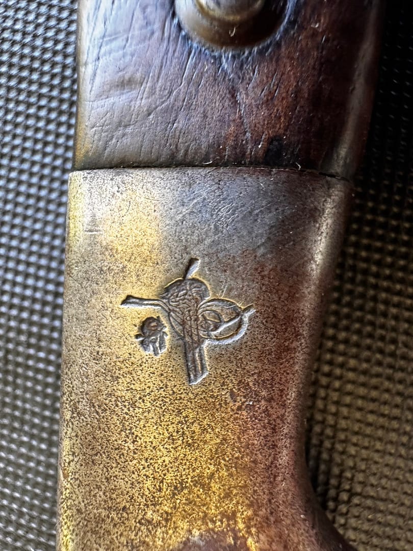
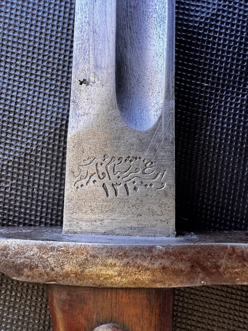
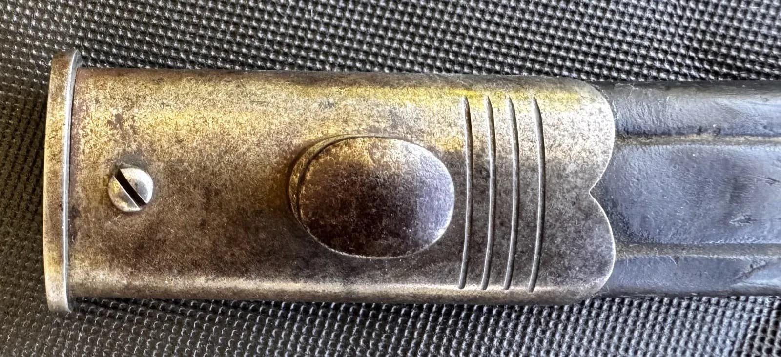
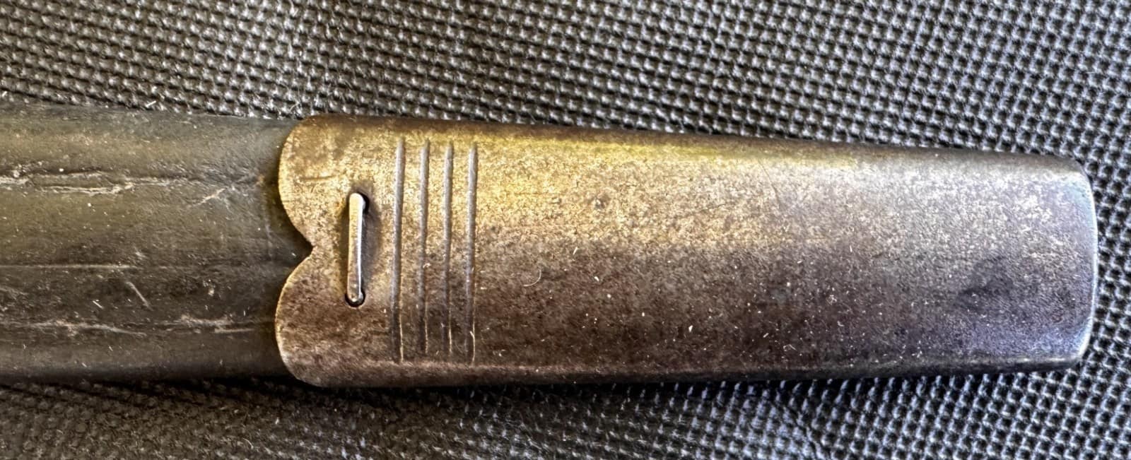
WW1 Ottoman Model 1893 Mauser bayonet. From my personal collection.

WW1 Ottoman Model 1893 Mauser bayonet


WW1 Ottoman Enlisted soldier belt. From my personal collection.

WW1 Ottoman Enlisted soldier belt, made to a similar pattern as the German soldier’s belt.


World War One weapons and equipment FAQ

What weapons were most commonly used during the First World War?

Infantry soldiers were primarily armed with bolt-action rifles such as the Lee-Enfield, Mauser, Mosin-Nagant, and Lebel. These were supported by machine guns, grenades, and bayonets. Artillery was the dominant weapon of the war, while new technologies such as tanks, aircraft, and chemical weapons transformed the battlefield.

Why was artillery so important in the First World War?

Artillery caused the majority of battlefield casualties and shaped operations across all fronts. Heavy guns, field artillery, and howitzers were used for bombardment, counter-battery fire, and defensive barrages. The scale of artillery firepower reflected the industrial nature of the conflict and the importance of fire support in trench warfare.

What role did machine guns play?

Machine guns such as the German MG08 and British Vickers provided sustained automatic fire and made frontal assaults extremely costly. Machine guns were sited to employ enfliade (along teh long axis of the target) grazing fire (close to teh ground so any human in the beaten zone will be hit) from a defilade position (covered from view and fire). Machine guns could also be fired from predictive tables, much like artillery is fired.

Why were steel helmets introduced?

Steel helmets were adopted to protect soldiers from shell fragments and debris, which became major causes of injury in trench warfare. Designs such as the French Adrian, British Brodie, and German Stahlhelm reflected different national approaches to battlefield protection.

What uniforms were worn during the war?

Uniforms evolved rapidly as armies adapted to modern warfare. Bright pre-war uniforms were replaced by more practical field dress in subdued colours such as khaki, feldgrau, and horizon blue. Uniforms reflected both national traditions and the need for concealment on the battlefield.

How did equipment change during the war?

Soldiers’ equipment evolved to meet the demands of trench warfare, including the introduction of steel helmets, improved webbing systems, gas masks, and specialised tools. These changes reflect the adaptation of armies to industrialised, high-intensity conflict.

Are the artefacts shown on this page original items?

All artefacts shown are from my personal collection and photographed firsthand. They represent original weapons and equipment used by soldiers during the First World War.


Subscribe to Battlefield Travels and receive a free E-Book Battlefield Guide

Unlock expert battlefield analysis, campaign reconstructions, and historical insights drawn from firsthand exploration and primary sources.

🗺️ You’ll receive:

🎖️ Exclusive historical insights you won’t find elsewhere

📘 A free eBook: 10 Tips for Exploring Historic Battlefields

📰 New battlefield studies straight to your inbox as they are published


Reconstructing Korean War battlefields through terrain analysis, primary sources and on-site research

Walking the battlefields of the Korean War (1950-1953)

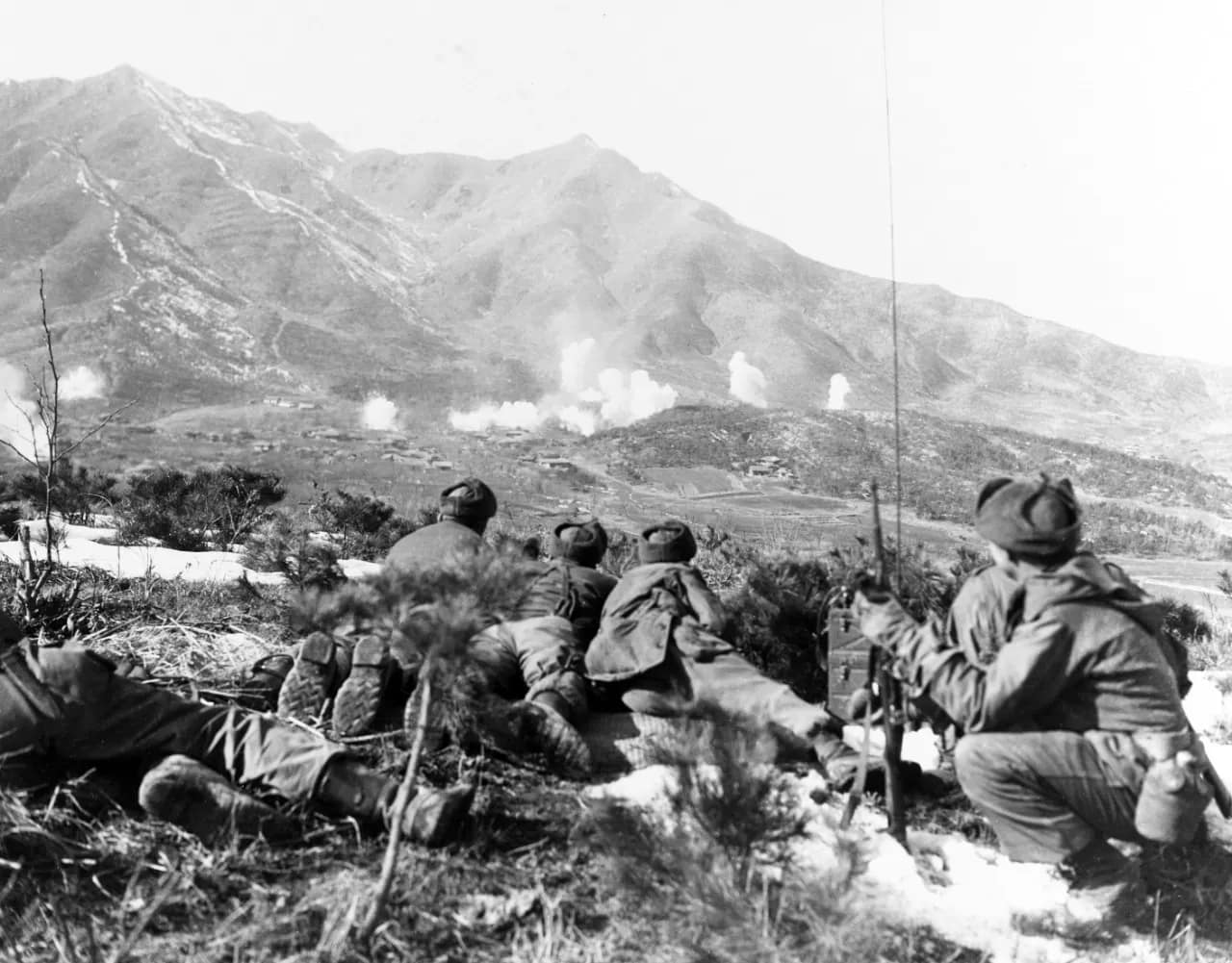
The Korean War was one of the most consequential conflicts of the 20th century. Fought across the Korean Peninsula between United Nations forces, the Democratic People’s Republic of Korea, and later the Chinese People’s Volunteer Army, the war combined periods of bold manoeuvre with brutal positional warfare in terrain that often favoured the defender.

1950: Dramatic opening moves

The war opened in June 1950 with the North Korean invasion, sweeping southwards and forcing South Korean and UN forces into the Pusan Perimeter, a defensive line anchored on ridges and river lines aroun dteh southern city of Pusan. General MacArthur’s daring Inchon landings shifted the strategic balance, allowing Allied forces to retake Seoul and push north towards the Yalu River. Massive intervention by Chinese forces transformed the war again, forcing UN units into a fighting withdrawal through snow-covered mountains, narrow valleys and harsh winter conditions.

1951-53: Positional warfare

By 1951, the conflict settled into a series of attritional battles along successive defensive belts — the Kansas Line, the Jamestown Line and the approaches to the Iron Triangle. Some of the war’s most famous engagements, such as Heartbreak Ridge, Bloody Ridge, Chipyong-ni, The Hook and Hill 266, were fought for control of high points, spurs and ridgelines that offered observation, artillery dominance and control of movement corridors.

Fighting in Korea was defined by the terrain’s harsh realities. Steep slopes, knife-edged ridges and narrow valleys restricted mechanised movement and required infantry-centric tactics. Weather extremes — from humid summers to −30°C winters — added another layer of difficulty. Every position, from isolated outposts to fortified ridgeline complexes, depended on logistics, engineering, and the ability to hold or seize ground under punishing conditions.

Armistice negotiations

Armistice negotiations commenced on 10 July 1951 in the North Korean town of Kaesong. In October 1951, the talks moved to the nearby village of Panmunjom, which remains the site of formal North Korea-South Korea interactions. An armistice ending hostilities was signed on 27 July 1953, although the war has never officially ended.

Methodology

This collection of battlefield studies examines the Korean War through a terrain-focused lens, combining period maps, unit narratives, aerial photography and on-site reconnaissance. The aim is not only to recount what happened across these battlefields, but to explain why each engagement unfolded the way it did, shaped by terrain, weather, doctrine and the decisions of commanders on both sides.


Battle Studies in the Korean War

Below are all current BattlefieldTravels studies for the Korean War, covering key battles, campaign phases and associated sites. New studies are added as further battlefields are walked and analysed.


Tactical Innovations

Over thousands of years of warfare, armies have sought ways to gain advantage on the battlefield. Sometimes the solution was a new weapon. Sometimes it was a radical new method. Often it was a combination of both. From the disciplined ranks of the Greek phalanx to pike-and-shot warfare to the interlocking machine-gun fire plans of the twentieth century, tactical innovations have repeatedly reshaped how battles are fought.

  • 💡 Tactical Innovations: Machine Gun Theory

    💡 Tactical Innovations: Machine Gun Theory

    This article explains how machine guns are employed on the battlefield, including the key concepts of cone of fire, beaten zone, grazing fire, enfilade fire, and mutually supporting machine-gun positions. The article forms part of the Tactical Innovations in Warfare series.

    Read the full Field Note….


Which phases of the Korean War are covered in this collection?

The landing page spans the North Korean invasion, the UN counteroffensive, Chinese intervention, and the static battles of 1951–53 along the central and western fronts.

Which battles are included or planned?

The collection includes Joint Security Area Panmunjom, and will expand to include Kapyong, Heartbreak Ridge, Chipyong-ni, Bloody Ridge, The Hook, the Pusan Perimeter and other major engagements.

Why is terrain so important in Korean War analysis?

Korea’s rugged mountains and steep ridges dominated manoeuvre, supply and defensive operations, making high ground and narrow corridors decisive in nearly every battle.

Did the Korean War involve trench warfare?

Yes. After 1951, the front stabilised, producing fortified lines, trench systems, outposts and repeated assaults reminiscent of WW1 but shaped by modern firepower.

Are these battlefield areas still accessible today?

Many ridgelines, memorials and preserved outposts along the DMZ and former frontlines are visitable, though some fall within restricted or heavily monitored areas.


Subscribe to Battlefield Travels and receive a free E-Book Battlefield Guide

Unlock expert battlefield analysis, campaign reconstructions, and historical insights drawn from firsthand exploration and primary sources.

🗺️ You’ll receive:

🎖️ Exclusive historical insights you won’t find elsewhere

📘 A free eBook: 10 Tips for Exploring Historic Battlefields

📰 New battlefield studies straight to your inbox as they are published


Reconstructing War of 1812 battlefields through terrain analysis, primary sources and on-site research

The Canadian Voltigeurs engaging US forces during the battle of Chateauguay, 26 October 1813.

Walking the battlefields of the War of 1812

Origins of the war

The War of 1812 (1812–1815) was a complex, multi-theatre conflict fought between the United States, the British Empire, Canadian militia forces and Indigenous nations whose alliances and strategic decisions shaped the course of the war. Often overshadowed by the Napoleonic Wars happening simultaneously in Europe, the War of 1812 unfolded across thousands of kilometres of forests, lakes, rivers and coastal regions in North America, where geography, small armies and rapid movements produced intensely contested campaigns.

Theatres of war

Along the Canadian–American frontier, the war opened with U.S. invasions aimed at securing Upper and Lower Canada. Early actions at Detroit, Queenston Heights and York highlighted the importance of river crossings, militia mobilisation and the decisive role played by Indigenous warriors under leaders such as Tecumseh. As the conflict intensified, battles around the Niagara Peninsula — including Stoney Creek, Chippawa, Lundy’s Lane and Fort Erie — developed into hard-fought engagements where both sides struggled for control of key roads, ridges and fortified positions. An 1813 American advance on Montreal was blunted at the battles of Chateauguay and Crysler’s Farm.

To the west, fighting spread across the Great Lakes and the vast interior regions between Lake Erie and the Mississippi River. Control of the lakes became a strategic priority, leading to major naval actions such as the Battle of Lake Erie, where American victory reshaped the theatre and enabled the recapture of Detroit and the pursuit of British and Indigenous forces into the Thames Valley.

On the Atlantic seaboard, the war took a different form. British naval supremacy allowed raids along the coast, culminating in the 1814 assault on Washington, including the burning of public buildings. Yet American forces successfully defended key positions such as Baltimore, where the stand at Fort McHenry inspired the Star-Spangled Banner.

Final battles

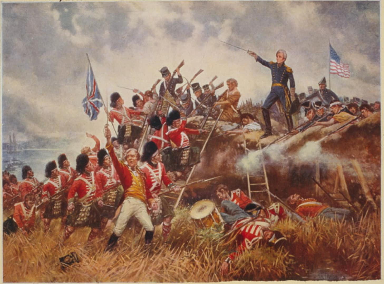
The war’s final major action occurred far to the south at New Orleans, where Andrew Jackson’s mixed force of regulars, militia, free men of colour and frontiersmen repelled a seasoned British army in one of the conflict’s most dramatic battles — fought after the peace treaty had already been signed.

This collection of battlefield studies examines these diverse campaigns through period maps, contemporary accounts and on-site exploration, revealing how geography, logistics, alliances and leadership shaped the war’s shifting fortunes.


Battle Studies in the War of 1812

Below are all current BattlefieldTravels studies for the War of 1812, covering key battles, campaign phases and associated sites. New studies are added as further battlefields are walked and analysed.


What major theatres are covered in the War of 1812 collection?

The page covers the Canadian–American frontier, Great Lakes naval campaigns, Atlantic coastal raids and southern battles such as New Orleans.

Which battles are included or planned?

Studies include New Orleans, with future coverage planned for Detroit, Queenston Heights, Lundy’s Lane, Fort Erie, Lake Erie, Baltimore and other key engagements.

Why was the War of 1812 significant?

It shaped national identities in the United States and Canada, influenced Indigenous sovereignty, and marked the final Anglo-American conflict before lasting peace.

How did terrain influence the War of 1812?

Dense forests, rivers, ridgelines and lakes dictated movement, supply and defensive positions, making local knowledge and naval control crucial.

Are these battlefields still visitable today?

Many sites — including Queenston Heights, Fort Erie, Baltimore and New Orleans — retain key features and are preserved as national parks or historic sites.


Subscribe to Battlefield Travels and receive a free E-Book Battlefield Guide

Unlock expert battlefield analysis, campaign reconstructions, and historical insights drawn from firsthand exploration and primary sources.

🗺️ You’ll receive:

🎖️ Exclusive historical insights you won’t find elsewhere

📘 A free eBook: 10 Tips for Exploring Historic Battlefields

📰 New battlefield studies straight to your inbox as they are published


Firsthand battlefield analysis of the campaigns and battles involving the legendary Easy Company, 506th PIR ‘Band of Brothers’

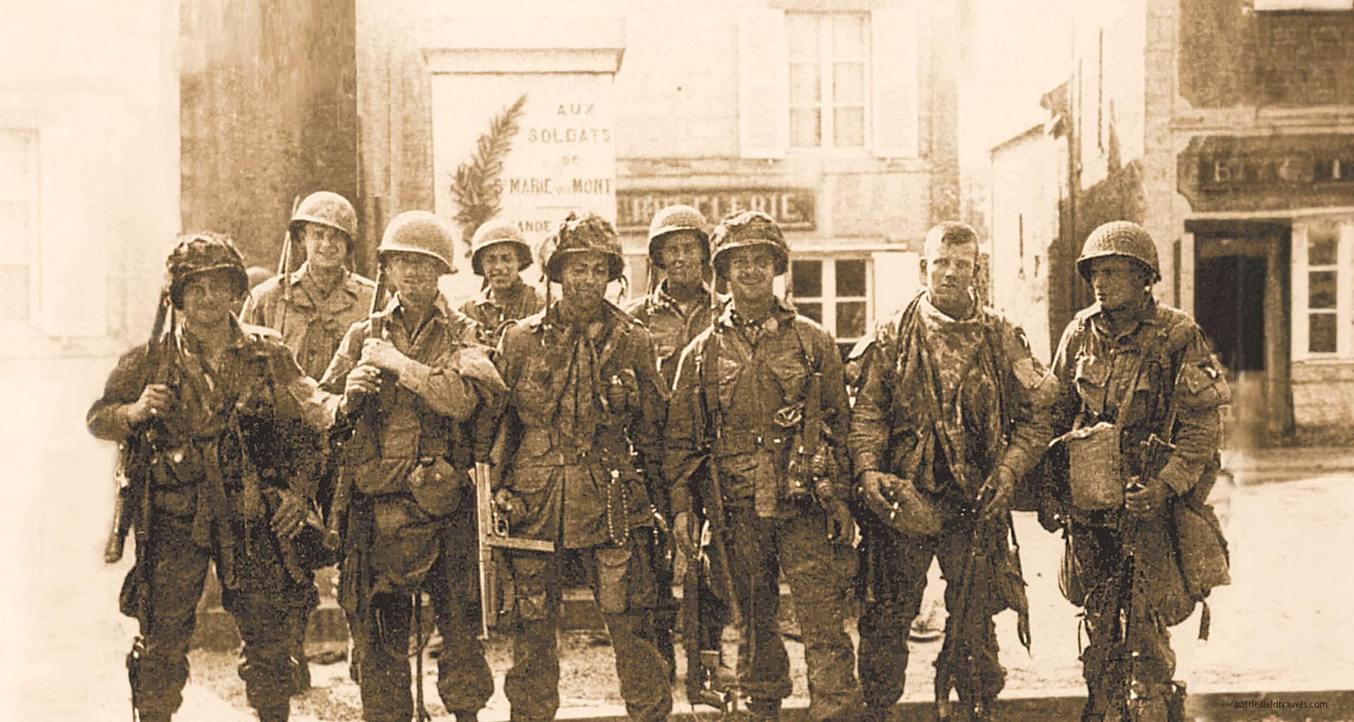
Members of Easy Company, 506th PIR 'Band of Brothers' in the main square of Sainte Marie du Mont on D-Day, 6 June 1944
Members of Easy Company, 506th PIR ‘Band of Brothers’ in the main square of Sainte Marie du Mont on D-Day, 6 June 1944
EXPLORE: BATTLES | WEAPONS & EQUIPMENT | READING | QUIZ

Walking the battlefields of Easy Company 506th PIR ‘Band of Brothers’ (1944-45)

Easy Company, 2nd Battalion, 506th Parachute Infantry Regiment, 101st Airborne Division, immortalised by Stephen Ambrose and the HBO miniseries Band of Brothers, fought its way through some of the most consequential battles of the Northwest European theatre. Easy Company’s combat history formed part of the much larger World War Two battlefield campaigns examined across Battlefield Travels. Its first combat operations began during the D-Day and Normandy landings, before the company later fought in the Netherlands, the Ardennes and Germany.

This collection of battlefield studies goes beyond the screen. I have walked every battlefield in Easy Company’s combat journey, from the hedgerows of Normandy and the bridges of Holland to the frozen woods around Bastogne and the mountain approaches of Bavaria, combining first-hand fieldwork, terrain analysis, period maps and primary accounts to reconstruct how these battles actually unfolded on the ground.

Normandy

Easy Company’s war began around Sainte-Mère-Église in the early hours of 6 June 1944. Dick Winters landed outside the town, not far from where the aircraft carrying Easy’s commander, Lieutenant Thomas Meehan, crashed, killing all on board. Winters and a Little Group of Paratroopers clashed with a German convoy just east of Sainte-Mère-Église before moving south to the 506th PIR rally point near Sainte-Marie-du-Mont. Easy Company’s first major actions were the celebrated assault on the Brecourt Manor gun battery and the subsequent push towards Carentan, where Easy Company fought through the causeways and streets to link the Utah and Omaha beachheads. The defensive battle at Bloody Gulch immediately afterwards tested them again as they held the line against German counterattacks.

Holland

Three months later, the 101st Airborne dropped into the Netherlands for Operation Market Garden, where Easy Company fought a very different campaign — a fast-moving, canal-lined, village-to-village battle across Eindhoven, Son Bridge, Helmond, Nuenen, Koevering and the defended dikes of ‘The Island’, fighting a small unit action against overwhelming odds at the Randwijk Crossroads. The terrain shifted again: open fields, raised roads, waterways, soft ground and long sightlines that favoured ambushes and defensive fire. At Son Bridge, Nuenen, and Koevering, I walked in the footsteps of Private David Webster, who so vividly described these actions in his memoir Parachute Infantry.

Ardennes

In December 1944, Easy Company entered the Ardennes to hold the line around Bastogne. Here, in the frozen woods of Bois Jacques overlooking Foy, they endured one of their harshest tests — days of bombardment, extreme cold, limited supplies and trench fighting under constant threat of German assault. Their advance into Foy in January 1945 became one of the 101st Airborne Division’s most lauded actions.

Bavaria and Austria

The final chapter carried Easy Company into Germany and Austria, through the collapsing Nazi heartland and ultimately to the symbolic heights of the Eagle’s Nest at Berchtesgaden.

This collection of Easy Company battlefield studies traces their combat path through detailed terrain analysis, field reconnaissance, period maps and first-hand accounts. I have walked the ground on every one of these battlefields, allowing readers to follow, step by step, one of the most celebrated combat journeys of the Second World War. New battlefield studies—from Bastogne and Foy to Nuenen, Veghel, Son Bridge, Koevering and Eagle’s Nest—will continue to expand the collection as they are completed.


🏛️Weapons & Equipment: World War Two

Helmet-US-MC1-front-seam-swivel-bail-06

Explore original weapons and equipment from the Second World War, drawn from my personal collection.

Uniforms, helmets, headgear, weapons, equipment from Australia, Britain, United States, Soviet Union, Germany, Japan, Italy, Romania, — personally handled, photographed and examined by me.


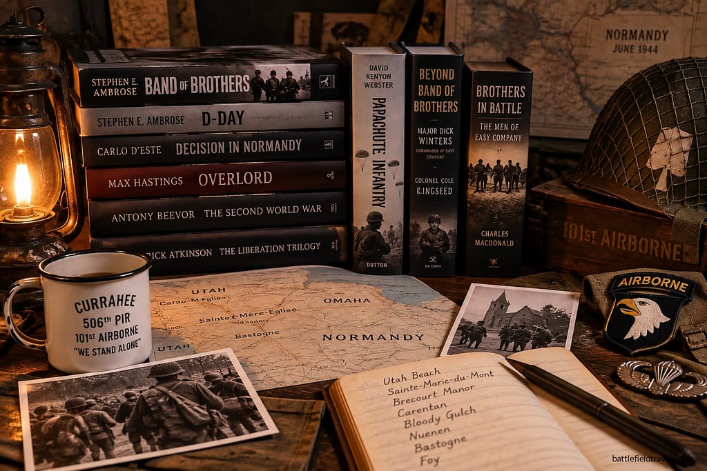
Easy Company books

A curated reading list covering the Second World War across all theatres. Explore campaign histories, battlefield studies, biographies, primary accounts and contemporary military writings used in the research behind Battlefield Travels. The list will continue to grow as I publish new studies and draw upon new resources.


❓Easy Company Quiz. Test your ‘Band of Brothers’ knowledge!

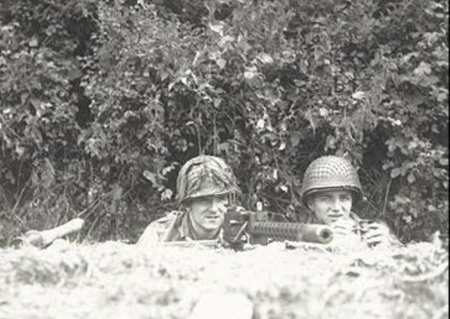
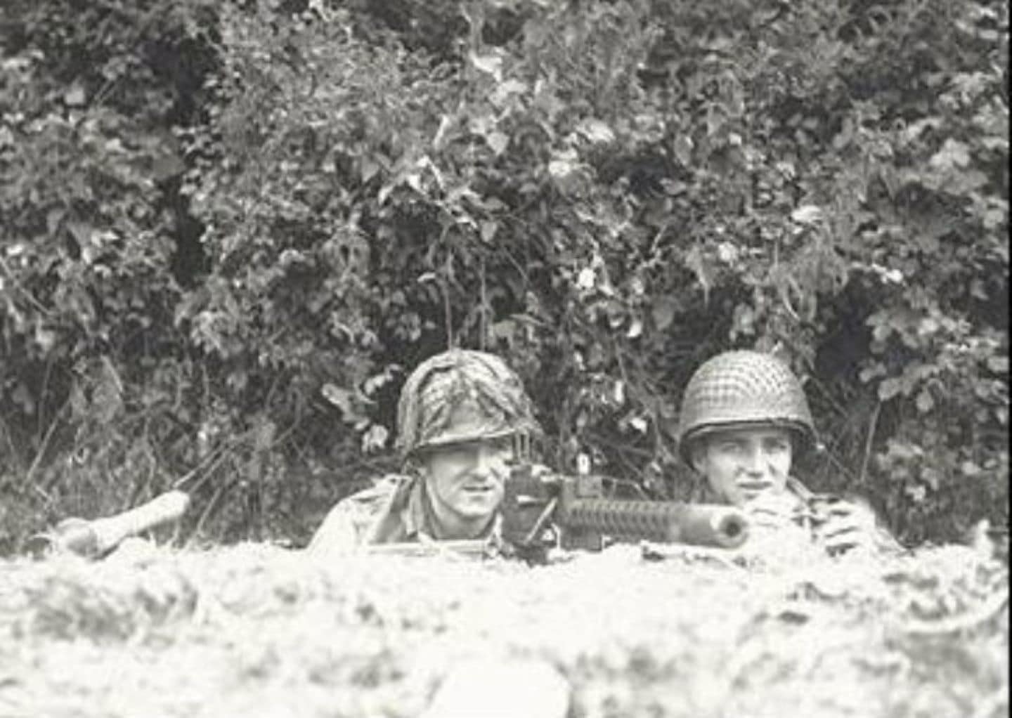
Corporal Walter 'Smoky' Gordon (left) and Corporal Francis 'Frank' Mellet (right), Easy Company 506th Parachute Infantry Regiment, manning their M1919 Browning .30 caliber machine gun in the hedgerow at Bloody Gulch, 13 June 1944.

Easy Company, 506th Parachute Infantry Regiment, fought from Normandy to the Netherlands, Bastogne and the final advance into Germany and Austria. Test your knowledge with 20 questions covering the men, battles, commanders and campaigns of the real Easy Company.


Battlefield Studies: Easy Company, 506th PIR ‘Band of Brothers’, 101st Airborne Division

In-depth battlefield analyses based on terrain, primary sources, and on-the-ground exploration.


Field Notes: Easy Company, 506th PIR ‘Band of Brothers’, 101st Airborne Division

Short-form observations, terrain insights, and working interpretations from the field. Some posts require access.


Easy Company 506th PIR, Brecourt Manor Assault


What battles and locations are covered in the Easy Company collection?

Published studies include Sainte-Mère-Église, Brecourt Manor, Carentan and Bloody Gulch. Forthcoming studies cover Eindhoven, Nuenen, Koevering, Market Garden approaches, “The Island,” Bastogne, Foy and Berchtesgaden.

How does this differ from other Band of Brothers resources?

These studies are grounded in on-site, terrain-focused fieldwork, supported by period maps, unit records and modern reconnaissance — allowing readers to understand the physical context of each battle.

Can readers follow Easy Company’s campaign chronologically?

Yes. The landing page and linked battle studies follow the unit’s real operational sequence from Normandy through Holland, the Ardennes and into Germany.

Are the battlefield locations accessible today?

Many sites — including Brecourt Manor, Carentan, Eindhoven, Bastogne and Foy — preserve key terrain features and can be visited in detail, with local museums and memorials along the route.

Will more Easy Company battlefield studies be added?

Yes. My 2025 and 2024 European reconnaissance trips will allow many additional locations to be documented and published, including Son Bridge, Nuenen, Koevering, the Crossroads, and Eagles Nest.


Subscribe to Battlefield Travels and receive a free E-Book Battlefield Guide

Unlock expert battlefield analysis, campaign reconstructions, and historical insights drawn from firsthand exploration and primary sources.

🗺️ You’ll receive:

🎖️ Exclusive historical insights you won’t find elsewhere

📘 A free eBook: 10 Tips for Exploring Historic Battlefields

📰 New battlefield studies straight to your inbox as they are published


Firsthand battlefield analysis of Vietnam War campaigns and battles

Vietnam War. American soldiers are dropped off by U.S.Army UH-1B 'Huey' helicopters to join South Vietnamese ground troops in an attack on a Viet Cong camp 18 miles north of Tay Ninh, March 1965.
Vietnam War. American soldiers are dropped off by U.S.Army UH-1B ‘Huey’ helicopters to join South Vietnamese ground troops in an attack on a Viet Cong camp 18 miles north of Tay Ninh, March 1965.

Walking the battlefields of the Vietnam War (1955-1975)

The Vietnam War (1955–1975) began as an effort to stabilise South Vietnam in the aftermath of the French Indochina War and the French withdrawal in 1955. The war escalated through the early advisory years, the deployment of major U.S. combat forces in 1965, the nationwide crises of 1968, and the gradual handover to South Vietnamese forces during the ‘Vietnamisation’ period from 1969 onwards. The war concluded with the final North Vietnamese offensives in 1975. Throughout, conventional battles, counter-insurgency operations, and strategic bombing campaigns intersected in a conflict defined by shifting strategies, multinational involvement, and competing political visions for Southeast Asia.

Escalation 1960-1968

In the early 1960s, the war centred on a Viet Cong insurgency in the south, and the struggle for control of rural provinces. By mid-1965, U.S. ground forces directly entered the fighting, leading to large-scale engagements such as LZ X-Ray in the Ia Drang Valley — the first major meeting of American and North Vietnamese regular forces. Over the next three years, the conflict expanded across the Central Highlands and the demilitarised zone, including the hard-fought battles of Dak To, Hill 875, and the bloody assaults on Khe Sanh.

The Tet Offensive of 1968 marked a turning point: a coordinated nationwide attack that included the brutal urban fighting at Hue, reshaping U.S. public opinion despite being a tactical failure for North Vietnam. In the south, Australian and New Zealand forces conducted counter-insurgency operations across Phuoc Tuy province, exemplified by the intense battle of Long Tan in 1966. Special operations units also played a critical role, culminating in missions such as the Son Tay Raid — an audacious 1970 attempt to rescue American POWs deep inside North Vietnam.

Vietnamisation 1969-1975

From 1969 onward, the war shifted again as U.S. forces gradually drew down and the Army of the Republic of Vietnam (ARVN) assumed greater responsibility. Despite local successes, ARVN struggled to counter major offensives such as the Easter Offensive (1972). In 1975, with American support no longer forthcoming, a rapid conventional campaign by the People’s Army of Vietnam overran South Vietnam, culminating in the fall of Saigon.

This collection of Vietnam War battlefield studies explores these campaigns through a clear, historically grounded lens — drawing on contemporary accounts, operational records, period mapping and on-site field exploration to explain not only what occurred during the conflict, but how key battles shaped its course.


Vietnam War Battlefield Studies

In-depth battlefield analyses based on terrain, primary sources, and on-the-ground exploration.


Vietnam War Field Notes

Short-form observations, terrain insights, and working interpretations from the field. Some posts require access.


What makes these Vietnam War battlefield studies unique?

Each study uses a blend of operational history, eyewitness accounts and on-ground field reconnaissance to explain how key battles shaped the wider course of the Vietnam War.

Which Vietnam War battles are included or planned?

Published studies include the Son Tay Raid, with Hue, Long Tan, and major Central Highlands battles such as LZ X-Ray, Dak To, Hill 875, Hamburger Hill, Khe Sanh and Mang Yang Pass in development.

Does this page cover the major phases of the war?

Yes. The narrative spans the advisory period, escalation, Tet Offensive, Vietnamisation, and the final North Vietnamese offensives that concluded the war in 1975.

How were different nations involved in the Vietnam War?

Alongside U.S. and South Vietnamese forces, the war included contributions from Australia, New Zealand, South Korea, Thailand and special operations units, each operating in distinct tactical and geographic contexts.

Are these battlefields still accessible today?

Many key sites — including Hue, Long Tan, Khe Sanh and locations across the Central Highlands — remain accessible and retain important historical features.


Subscribe to Battlefield Travels and receive a free E-Book Battlefield Guide

Unlock expert battlefield analysis, campaign reconstructions, and historical insights drawn from firsthand exploration and primary sources.

🗺️ You’ll receive:

🎖️ Exclusive historical insights you won’t find elsewhere

📘 A free eBook: 10 Tips for Exploring Historic Battlefields

📰 New battlefield studies straight to your inbox as they are published


Reconstructing World War One battles through terrain analysis, primary sources and on-site research

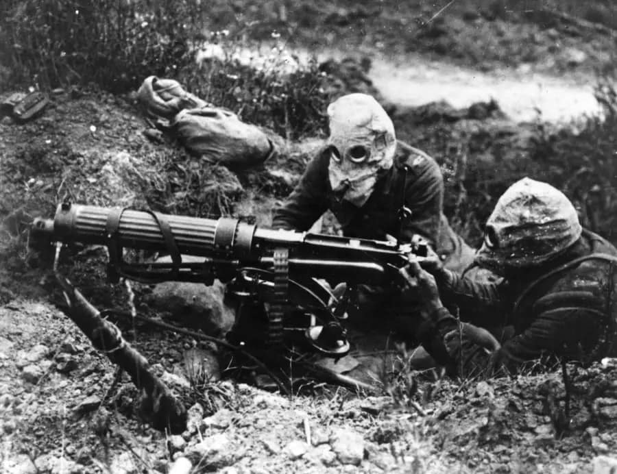
World War One. British machine gun team manning their Vickers water-cooled machine gun, and wearing PH-type anti-gas helmets near Ovillers, July 1916

Walking the battlefields of the First World War

Western Front – crucible for adaptation

World War One (1914–1918) was a truly global conflict fought across multiple theatres, each shaped by its own terrain, climate and operational pressures. On the Western Front, the combination of immense troop density, fortified trench systems and narrow avenues for manoeuvre produced a form of attritional warfare unprecedented in scale. The colossal battles of the Somme and Verdun in 1916, the mud-choked offensives around Ypres in 1917, and the seismic shifts brought about by the German Spring Offensive and the Allied Hundred Days in 1918 all unfolded on a landscape dominated by artillery, machine guns, barbed wire, dugouts and observation posts.

Yet even in this seemingly static environment, armies were constantly adapting. The British and Dominion forces refined the set-piece, limited-objective attack seen at Polygon Wood; the Germans developed infiltration and stormtroop tactics to strike at weak points during their 1918 offensives; and the first massed combined-arms mechanised operations were trialled at Cambrai and perfected during the breakthrough at Amiens. The Western Front was not a stagnant line—it was a laboratory of tactical innovation forged under immense pressure and in the face of unforgiving ground.

Eastern Front – enormous space and never enough troops

In the East, the problem was the inverse: vast distances and too few troops to hold front lines stretching across forest, marsh and steppe. The opening campaigns in East Prussia and Galicia brought sweeping manoeuvre, catastrophic casualties and wild oscillations in momentum. The 1916 Brusilov Offensive showed how coordination, surprise and careful exploitation of terrain could rupture an entire defensive system, while the Russian Revolution in 1917 fractured the Eastern Front from within, triggering political collapse, military disintegration and Allied interventions in the north and Siberia.

The southern theatres – Italy, Gallipoli and Salonika

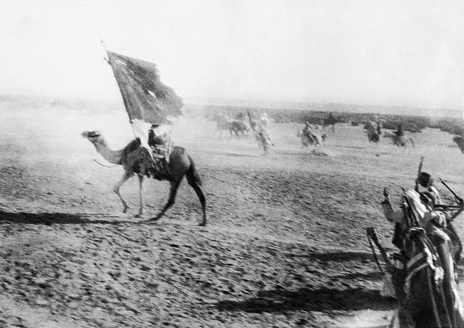
In the southern theatres, the search for a strategic “back door” led to campaigns on the Gallipoli Peninsula, through the mountains of Salonika, and across the deserts of the Sinai and Palestine, where the Arab Northern Army—supported by British advisers like T. E. Lawrence—conducted deep operations behind Ottoman lines. On the Italian Front, the narrow confines of the Isonzo valley became the setting for eleven costly Italian offensives before the dramatic collapse at Caporetto, where terrain, weather and infiltration tactics combined to shatter an entire army.

The peripheral theatres – Asia, Pacific, Middle East

Beyond Europe, the war extended into Africa, the Middle East, China, and the Pacific. German East Africa saw a mobile guerrilla campaign across mountains, rivers and savannah; Japan and Australia seized German colonies across the Pacific; and even after the 1918 armistice, fighting continued as Allied forces intervened in the Russian Civil War.

This collection of World War One battlefield studies examines these campaigns through a terrain-focused, ground-truth perspective—combining period maps, aerial photographs, personal accounts and modern field reconnaissance to explain not only what happened, but why events unfolded as they did in the landscape itself.


First World War Battlefield Studies

In-depth battlefield analyses based on terrain, primary sources, and on-the-ground exploration.


First World War Field Notes

Short-form observations, terrain insights, and working interpretations from the field. Some posts require access.


  • 📝🔒Field Note: Battle for Verdun, France, Feb – Dec 1916

    📝🔒Field Note: Battle for Verdun, France, Feb – Dec 1916

    November 2024. Verdun, northeastern France. This is my second time exploring the battlefields of Verdun. The first impression is the massive scale of the fortification complex. Large and small forts with interlocking and mutually supporting fields of fire cover several hundred square kilometres. The ground is still broken by overlapping shell craters, stretching in all…

    Read the full Field Note…


  • 📝🔒Field Note: Belleau Wood, France, June 1918

    📝🔒Field Note: Belleau Wood, France, June 1918

    July 2012,  Belleau Wood, near Château-Thierry, France. I am exploring the site of the legendary US Marine battle in June 1918. The first impression of ‘Bois Belleau’ is confinement. The ground is enclosed by dense woodland, with limited lines of sight and little sense of distance.

    Read the full Field Note…


  • 📝🔒Field Note: Liege Forts, Belgium, August 1914

    📝🔒Field Note: Liege Forts, Belgium, August 1914

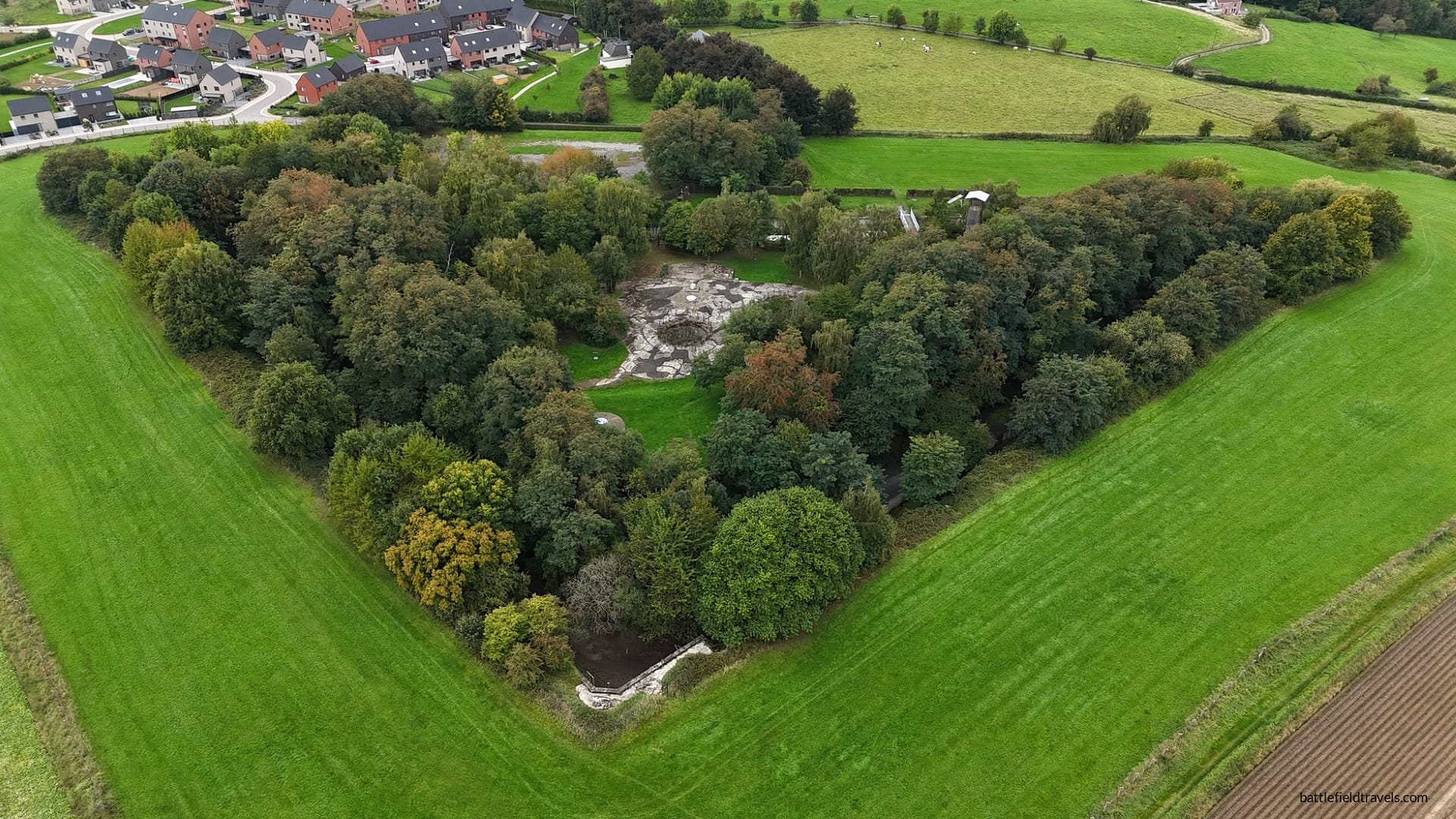
    October 2025, Liege, Belgium. I am visiting the ring of great forts that once protected the Belgian city of Liège. In the 1880s, the Belgians constructed a series of forts to protect Liège against a potential German attack. The twelve forts of Liege could cover the approaches and support the neighbouring forts. The forts are:…

    Read the full Field Note…


Tactical Innovations

Over thousands of years of warfare, armies have sought ways to gain advantage on the battlefield. Sometimes the solution was a new weapon. Sometimes it was a radical new method. Often it was a combination of both. From the disciplined ranks of the Greek phalanx to pike-and-shot warfare to the interlocking machine-gun fire plans of the twentieth century, tactical innovations have repeatedly reshaped how battles are fought.


  • 💡 Tactical Innovations: Machine Gun Theory

    💡 Tactical Innovations: Machine Gun Theory

    This article explains how machine guns are employed on the battlefield, including the key concepts of cone of fire, beaten zone, grazing fire, enfilade fire, and mutually supporting machine-gun positions. The article forms part of the Tactical Innovations in Warfare series.

    Read the full Field Note….


What makes these World War One battlefield studies different?

Each study uses terrain analysis, period maps, aerial photographs and on-site field reconnaissance to explain how ground, movement and command decisions shaped key battles across the Western Front, Eastern Front, Gallipoli, Italy and beyond.

Which theatres of WW1 are covered in this collection?

The landing page spans all major fronts — the Western Front, Eastern Front, Italian Front, Gallipoli, the Middle Eastern campaigns and the wider global conflict in Africa and the Pacific — with individual battle studies expanding on each theatre in detail.

Does this include analysis of major battles like the Somme, Verdun and Ypres?

Yes. The page introduces the major battles and campaigns of the war, and individual studies examine selected battles through a terrain-focused, evidence-based approach.

How does terrain influence the interpretation of World War One battles?

Terrain shaped everything from trench placement and artillery positions to infiltration routes, observation points and the viability of breakthroughs. Analysing ground truth is essential for understanding why battles unfolded the way they did.

Will more WW1 battlefield studies be added?

Yes. I have personally explored dozens of WW1 battlefields, and the studies are in various states of draft. SO many more battlefield studies to come.


Subscribe to Battlefield Travels and receive a free E-Book Battlefield Guide

Unlock expert battlefield analysis, campaign reconstructions, and historical insights drawn from firsthand exploration and primary sources.

🗺️ You’ll receive:

🎖️ Exclusive historical insights you won’t find elsewhere

📘 A free eBook: 10 Tips for Exploring Historic Battlefields

📰 New battlefield studies straight to your inbox as they are published