Utah Beach: America’s first step into Fortress Europe!
On D-Day, 6 June 1944, US forces landed at Utah Beach, the westernmost invasion sector in Normandy. Despite strong German defences and tidal mislandings, the assault was a success, securing the beachhead with relatively light casualties and linking up with US Airborne forces inland.
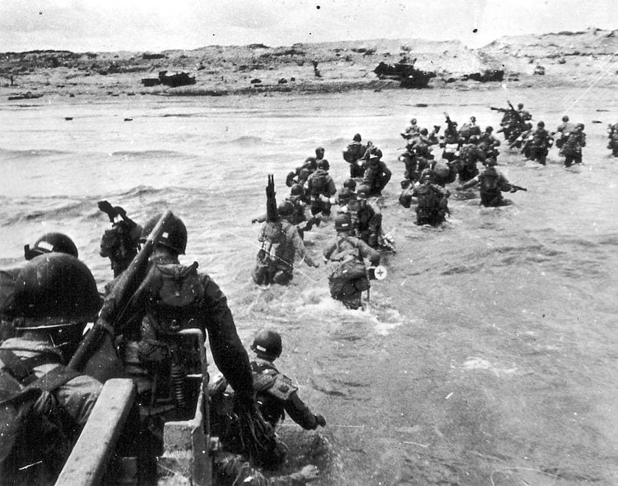
Key facts
Google Map: Location of Utah Beach
🧭🥾 Walking the Utah Beach battlefield
I visited the Normandy Beaches, including Utah Beach, in October/November 2024. I was equipped with unit histories, copies of original operations orders, maps and sketches, dozens of photographs taken at Utah Beach on D-Day or soon afterwards, and my own digital GIS overlays to align historical data with modern terrain.
Utah Beach is remarkably unchanged since 1944. Unlike Omaha, Juno, or Gold, there has been very little modern development along the shoreline. No large towns or holiday resorts break the view, leaving the dunes, sands, and wide skies very much as they appeared to the first waves of the 4th Infantry Division on D-Day.
The most striking difference is inland. In June 1944, German engineers had flooded the low-lying hinterland to create a defensive barrier. That meant there were only four causeways linking the beach to objectives such as Sainte-Mère-Église and Carentan. Securing those causeways — and the vital road junctions beyond — was the mission of the US 82nd and 101st Airborne Divisions, who dropped into Normandy in the early hours before the landings.
Today, visitors can still follow the line of those causeways and trace how the beachhead linked up with the paratroopers inland. Utah remains one of the most atmospheric and unspoiled of the D-Day beaches, a landscape where the past feels immediate.
Normandy series of battlefield studies
This article is part of a series exploring the D-Day airborne and amphibious battlefields on 6 June 1944 and the immediate aftermath. Click on the hotlinks to open the battlefield study.
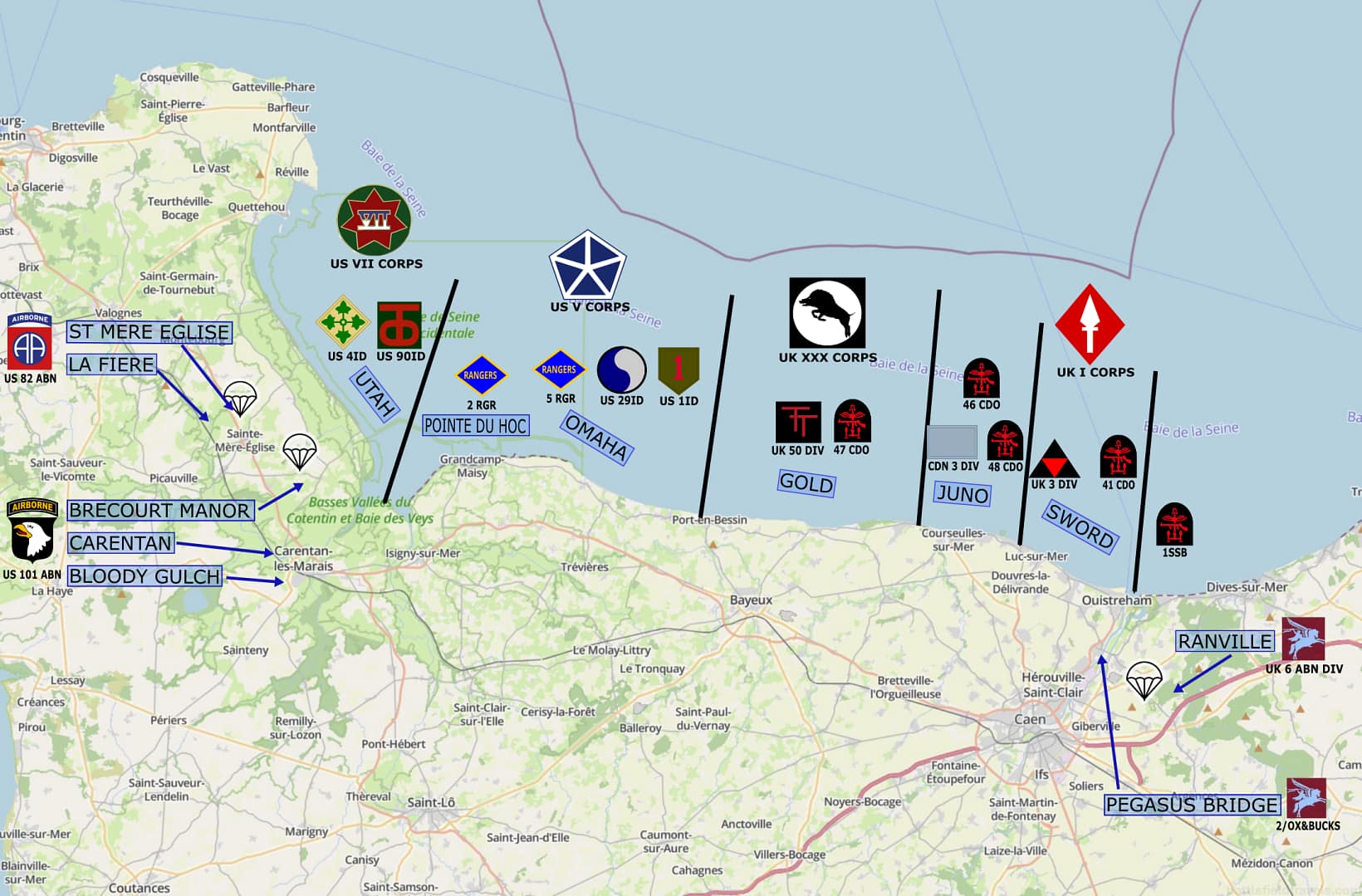
Strategic Context: Why Utah Beach was important
The Allied plan for Operation OVERLORD was to establish a second front in Western Europe, relieve pressure on the Soviet Union, and strike a decisive blow against Nazi Germany. Four contiguous landing beaches were originally identified (later named Omaha, Gold, Juno and Sword). Utah was added to the plan in December 1943 to widen the invasion frontage, and speed up the capture of Cherbourg’s deep-water port.
The landings at Utah Beach, and the airborne operations behind the beach, were intended to establish a lodgement on the Cotentin Peninsula. The aim was to seize key transport hubs, cut off the peninsula from German interference, and then capture the deep-water port of Cherbourg. Until they got Cherbourg, the allies would have to rely on temporary harbours like the Mulberrys at Omaha and Gold Beaches.
In anticipation of an allied landing on the Cotentin Peninsula, the Germans destroyed the drainage system behind Utah Beach. Consequently, the flat open plains behind the beach were flooded, and could only be crossed via four raised causeways; numbered from south to north Exits 1,2,3,4. For the allies, it was vital to secure these four beach exits to avoid being trapped on Utah Beach.
Opposing forces: US 4th Infantry Division vs German Defenders
 American forces
 American forces
US VII Corps, commanded by Major General J. Lawton Collins, was tasked with the Utah Beach assault. The initial landing waves involved the 4th Infantry Division, followed by the US 90th Division later that day. The US 82nd and 101st Airborne Divisions supported the beach landings by capturing key road and rail junctions, defending the approaches to Utah Beach, and seizing the four beach exit points.
 German forces
 German forces
The German defences along the Atlantic Wall were formidable. They comprised a system of beach obstacles, concrete bunkers, artillery positions, barbed wire, and extensive minefields. The defences were grouped as mutually supporting ‘Widerstandsnest’ (Resistance Nests). The Utah Beach area was defended by the German 709th Infantry Division, composed largely of Georgians and former Soviet prisoners-of-war.
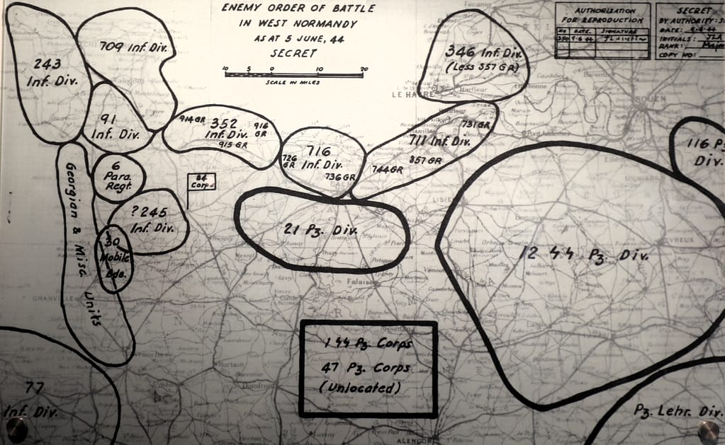
History Underground also provides a great review on the Utah Beach defences.
Planning and Preparation for Utah Beach
The Utah Beach operation required close coordination of air, naval, airborne and amphibious operations. Over the days and weeks prior to D-Day, the allies conducted an aerial bombing and interdiction campaign to disrupt German defences and restrict German movement throughout Normandy. The airborne operation would commence at 00:50hrs on D-Day to allow time for the airborne forces to secure their objectives before the amphibious landings began. Immediately prior to the beach landings, Naval Force U (for Utah), composed of US, British and French warships, would bombard the German defences and clear the beach obstacles. The first waves of the landing force would hit the beach at 06:30hrs.
The 4th Infantry Division, commanded by Major General Raymond O. Barton, was tasked to lead the amphibious assault. The Divisional objectives included securing the beachhead, advancing inland, and linking with the airborne divisions. Engineers and specialized units were tasked with clearing beach obstacles and breaching the sea wall to allow access to the beach exits.
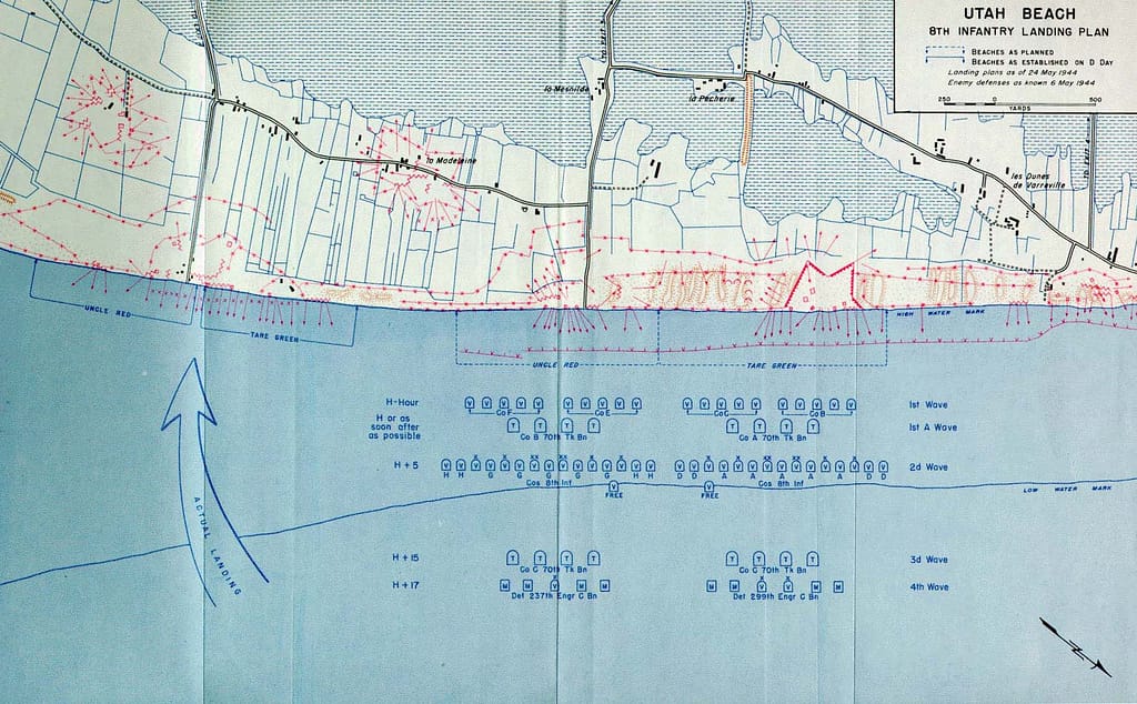
The landings at Utah Beach, 6 June 1944
Airborne operations
The success of the Utah Beach landings depended heavily on the airborne operations in the hinterland behind the beach. The paratroopers faced significant challenges, including scattered drops due to cloud cover and heavy anti-aircraft fire. Despite the chaos, the airborne troops achieved most of their objectives. The scattered airborne drops worked in the allies’ favour by disrupting German responses throughout the Cotentin Peninsula. German reinforcements were largely prevented from reaching Utah Beach.
By the time the first amphibious waves landed, the paratroopers were securing the beach exits, and largely prevented German reinforcements interfering with the beach landing sites. They had also neutralised or were in the process of neutralising the German artillery batteries that could affect the landings.
⚔️ Go deeper — Members get exclusive access to the Deep Research Collection, Field Notes, and monthly Research Dispatches. Try membership free for 7 days, cancel anytime. From $9/month.
Beach landings
The amphibious assault on Utah Beach began at 0630hrs on 6 June 1944, with 8th Infantry Regiment comprising the first assault wave. Due to strong tidal currents, the first wave of landing craft drifted nearly 2,000 yards south of the designated landing zone. While this deviation could have disrupted the operation, it proved advantageous. The new landing site was less heavily defended, thereby reducing potential allied losses.
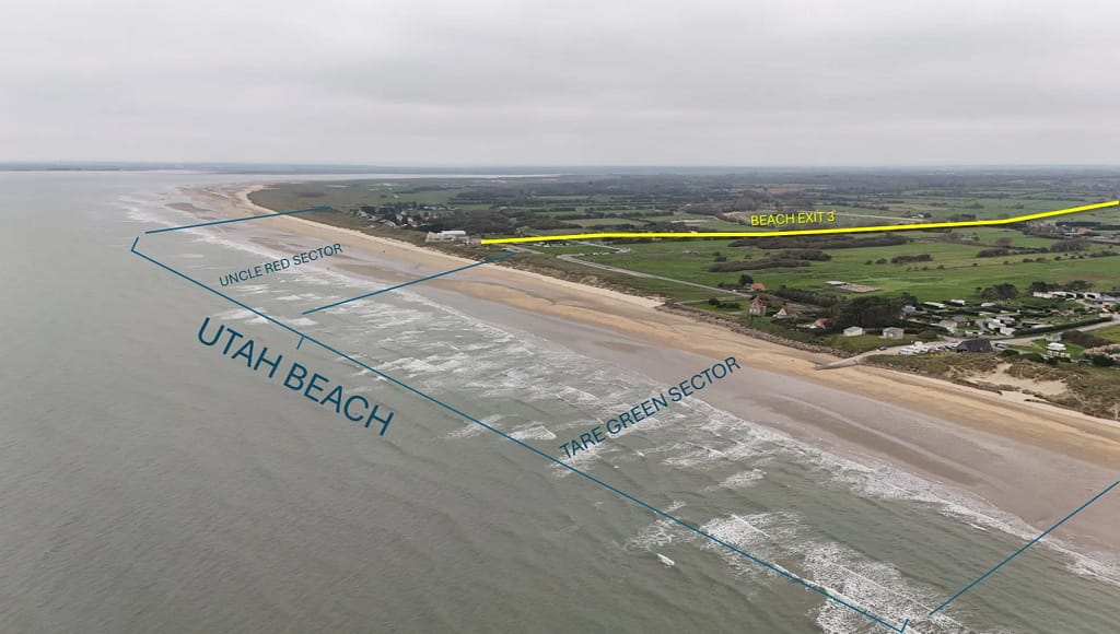
“We’ll start the war from here!”
Brigadier General Theodore Roosevelt Jr, the 4th Infantry Division assistant division commander, played a pivotal role in the assault. When he realised the error at the landing point, Roosevelt famously declared, “We’ll start the war from here!” His leadership ensured that the troops adapted quickly to the changed circumstances.

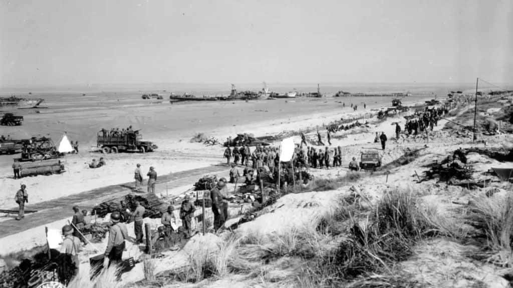
The first wave of infantry encountered minimal resistance, as the pre-invasion bombardment had effectively neutralised many German defences. Engineers cleared obstacles and mines, enabling subsequent waves of troops, tanks, and vehicles to come ashore. The rapid establishment of a beachhead allowed 4th Infantry Division to advance inland without significant delay.
The advance inland from Utah
German 709th Division overwhelmed
German forces at Utah Beach were ill-prepared to repel the assault. The 709th Infantry Division, composed largely of second-line Eastern European troops or former Soviet prisoners, lacked the training and mobility to respond effectively. Many of their defensive positions were destroyed by the pre-invasion bombardment, and the rapid advance of the 4th Infantry Division overwhelmed the remaining defenders.
German counterattacks on D-Day were limited and largely unsuccessful, as Allied naval and air superiority prevented reinforcements from reaching the area.
Crossing the Causeways
The next phase for the 4th Infantry Division was to move off the beach via the four raised causeways through the flooded plains behind the beach. Elements of 2nd Battalion, 8th Infantry Regiment plus several tanks advanced along Causeway 1 towards Pouppeville, which had already been seized by 501st PIR (Parachute Infantry Regiment).
Link-up with the Airborne Divisions
Causeway 2, directly behind La Grande Dune, was being interdicted by a German artillery battery firing from near Brecourt Manor, north of Saint-Marie-du-Mont. Lieutenant Dick Winters, commanding Easy Company ‘Band of Brothers’ 506th PIR, led an assault that successfully silenced this artillery battery. Other elements of 506th PIR fought a tough battle against German paratroopers of 6th Fallschirmjäger Regiment defending Saint-Marie-du-Mont.
Elements of 22nd Infantry Regiment, supported by tanks, turned northwards and rolled up the German defences along the originally planned Utah Beach landing site. By the end of D-Day, 4th Infantry Division and the critical Sherman tanks of 70th and 746th Tank Battalions had linked up with the 101st Airborne Division. On the following day, elements of 4th Infantry Division and 746th Tank Battalion reached the 82nd Airborne Division positions around Sainte-Mere-Eglise. They provided critical support at the Battle for La Fiere Bridge.
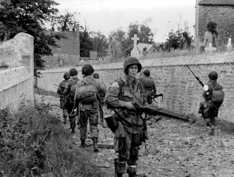
Outcomes of the Utah Beach operation
Casualties
By the end of D-Day, 6 June 1944, approximately 13,200 paratroopers of the 82nd and 101st Airborne Divisions and 21,000 soldiers of 4th Infantry Division had landed on the Cotentin Peninsula. 90th Infantry Division followed on 7 June. The 4th Infantry Division had advanced several miles inland, linking up with the airborne divisions and consolidating their gains. The establishment of a secure beachhead allowed the Allies to rapidly bring in reinforcements and supplies, paving the way for the capture of Cherbourg in late-June.
Assessment
The Utah Beach landings were among the least costly of the D-Day assaults. The airborne divisions (82nd and 101st) suffered about 2,500 casualties on D-Day. The amphibious force (primarily 4th Infantry Division) suffered about 200 casualties, a stark contrast to the heavy losses incurred at Omaha Beach. This disparity may be attributed partly to the very different terrain on the beaches – open plains at Utah versus steep cliffs at Omaha. The chaotic airborne landings behind the beach created numerous dilemmas for the Germans and paralysed their ability to respond. Finally, the southwards drift of the initial waves fortuitously resulted in the landing force facing less resistance at the beach.
Utah Beach battlefield today
The Normandy landing beaches differ greatly from each other. Omaha Beach and parts of Gold Beach are lined with cliffs that restrict the exit points to a few very defendable locations. Further east, Juno and Sword Beaches are densely-populated coastal resort towns. Utah Beach, by contrast, is sparsely populated, and the terrain is very flat. Only the flooded farmlands behind the beach imposed mobility restrictions on the allied landings.
Utah Beach is notable for the impact of micro-terrain (small scale terrain features that often do not appear on maps and can only be seen when you are standing on the ground) on the battle outcomes. The low sea wall provided a covered rally point, from where Brigadier General Roosevelt. made his assessment of the situation. The flooded plains and barely perceptible rises along the few causeway exits made these the key terrain over upon which the battle hinged. The concept of exploiting small scale terrain features in battle is examined further in the Micro-Terrain and Battlefield Decision-Making research hub.
The beaches are largely unchanged from 1944. Many of the German bunker systems have survived and can be explored. Plus there are several German Artillery positions (Batterie d’Azeville and Batterie Crisbecq) further inland that are very well preserved with accompanying visitors centres.
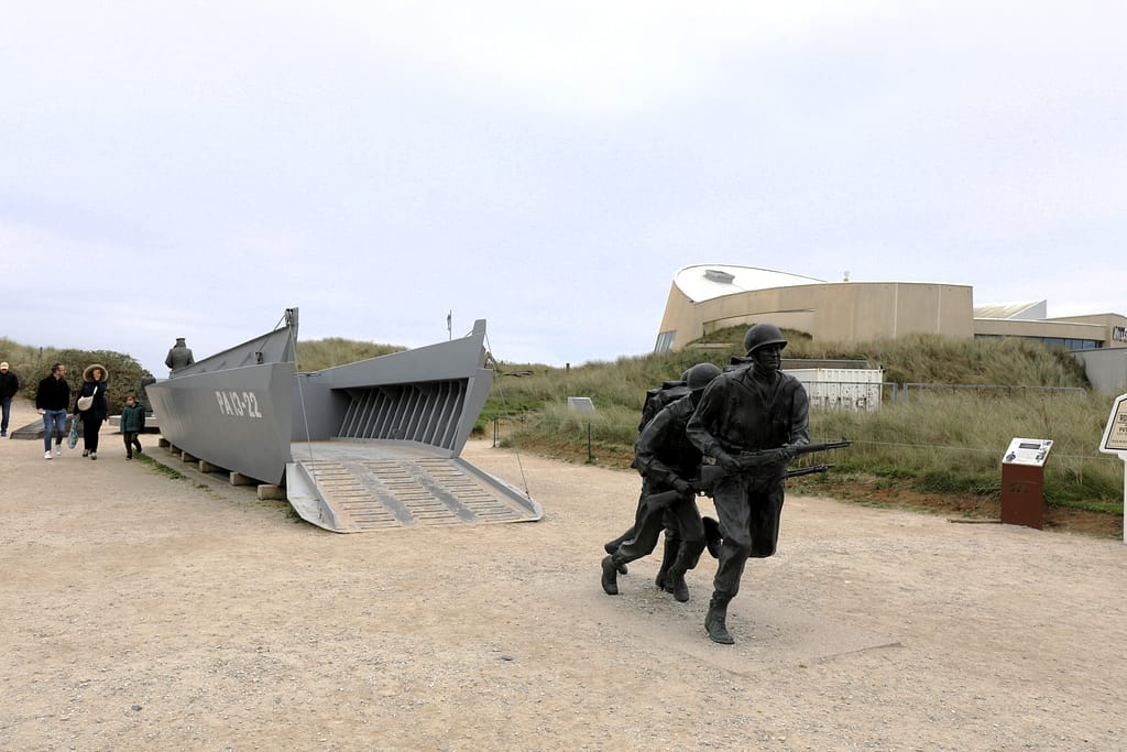
The Utah Beach Landing Museum (Musée du Débarquement de Utah Beach) is located at La Grande Dune, right in the centre of the actual landing beach. The museum is superb and not to be missed. Interestingly, the Museum was created in 1962 by then Mayor of Saint-Marie-du-Mont, Michel de Vallavieille. Michel de Vallavieille was also the owner of Brecourt Manor, where Easy Company conducted their legendary assault on the German artillery battery. M. Vallavieille was wounded on D-Day by American gunfire. His son, Charles de Vallavieille, is the current Mayor of Saint-Marie-du-Mont, and owner of Brecourt Manor. I met with Monsieur Vallavieille to explore the Brecourt Manor battlefield.
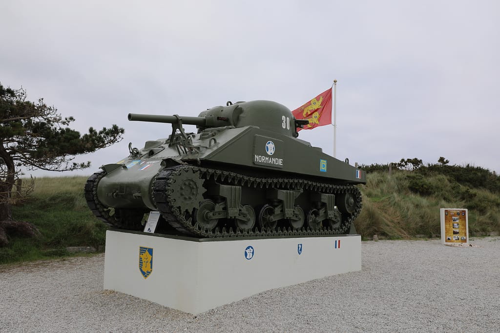
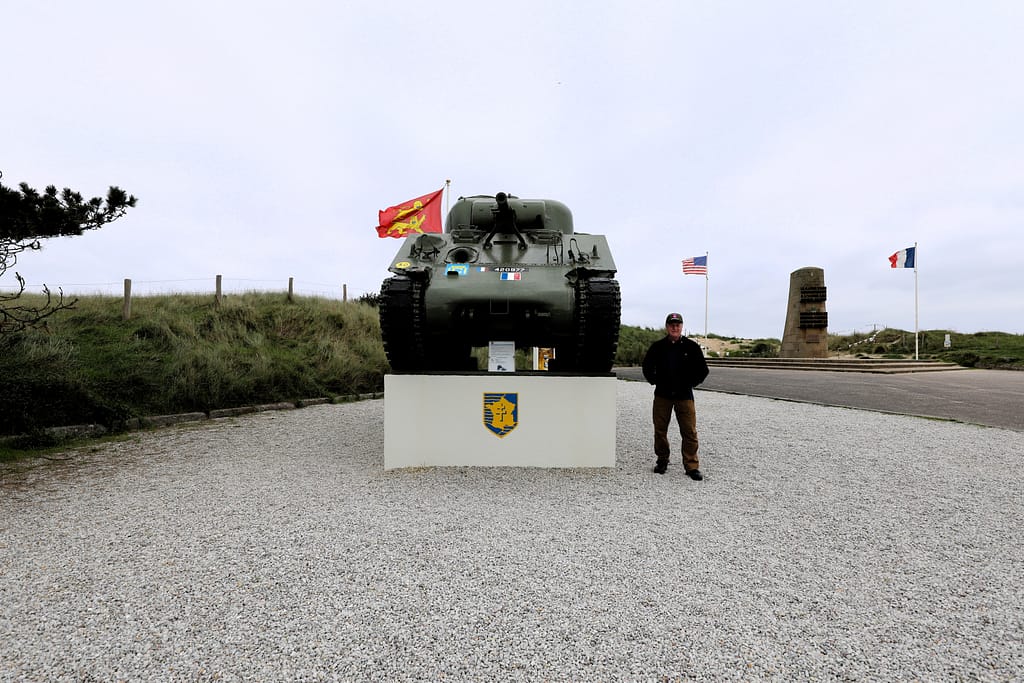
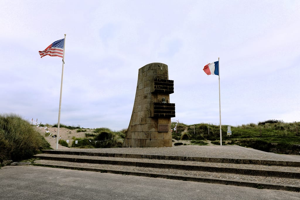
About 5km north of the Utah Beach Museum are monuments to the French 2nd Armored Division that landed here after D-Day. Further north are numerous bunkers and command posts of Hitler’s ‘Atlantic Wall’; many untouched since WW2.
For the full story of the airborne operations behind Utah Beach, you should visit the Airborne Museum at Sainte-Mere-Eglise. Other key sites relating to the airborne operations include La Fiere Bridge, Cauquigny, Amfreville, Chef du Pont, Marmion Farm, Brecourt Manor, Saint-Marie-du-Mont, and Carentan.
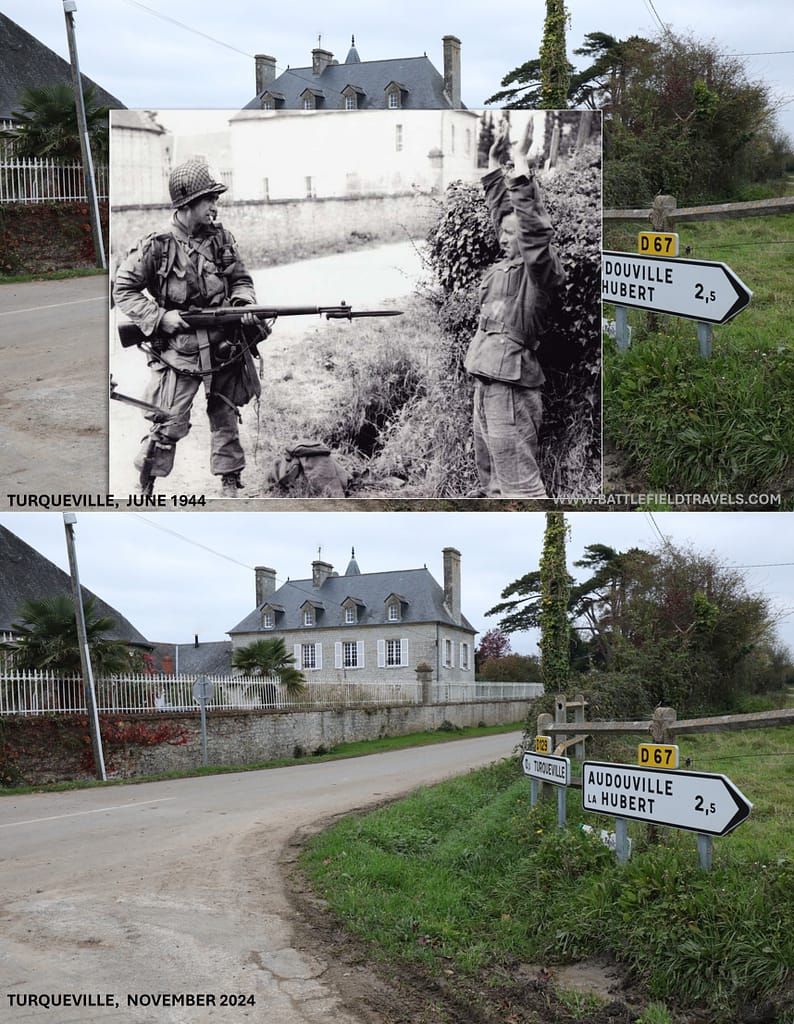
Additional images of Utah Beach
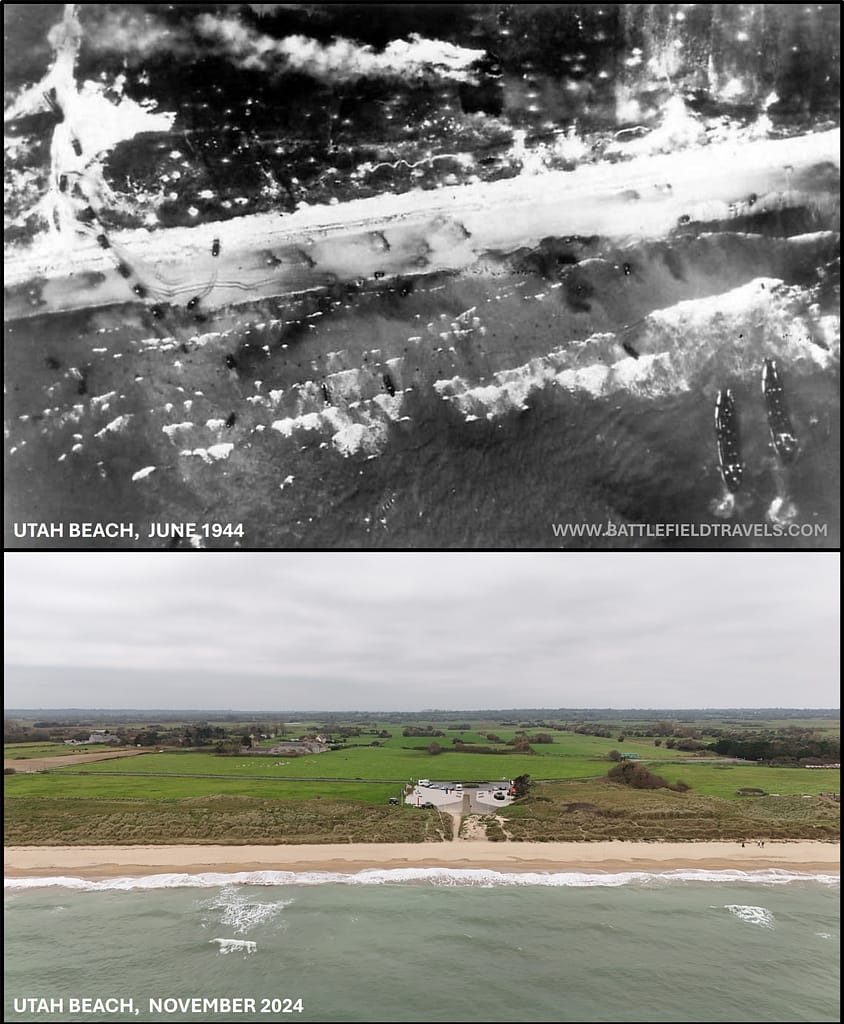
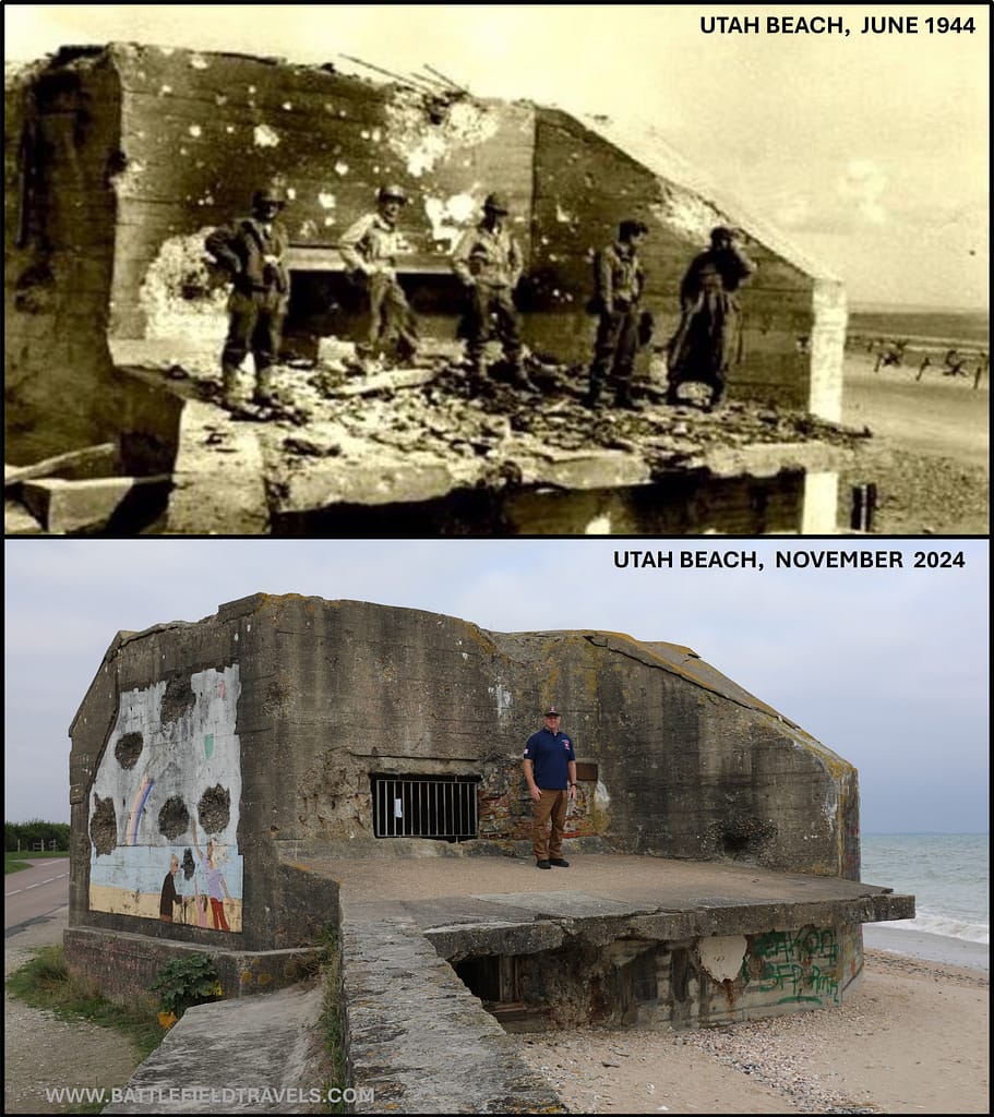

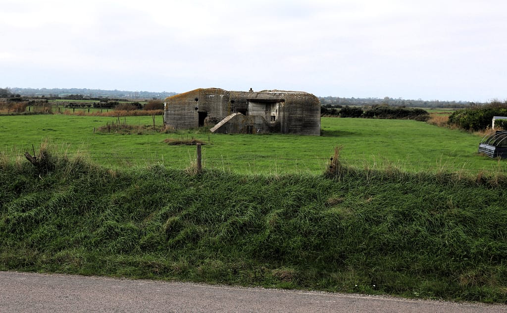
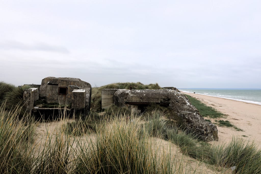
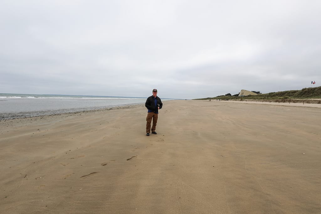
Utah Beach Landing Museum
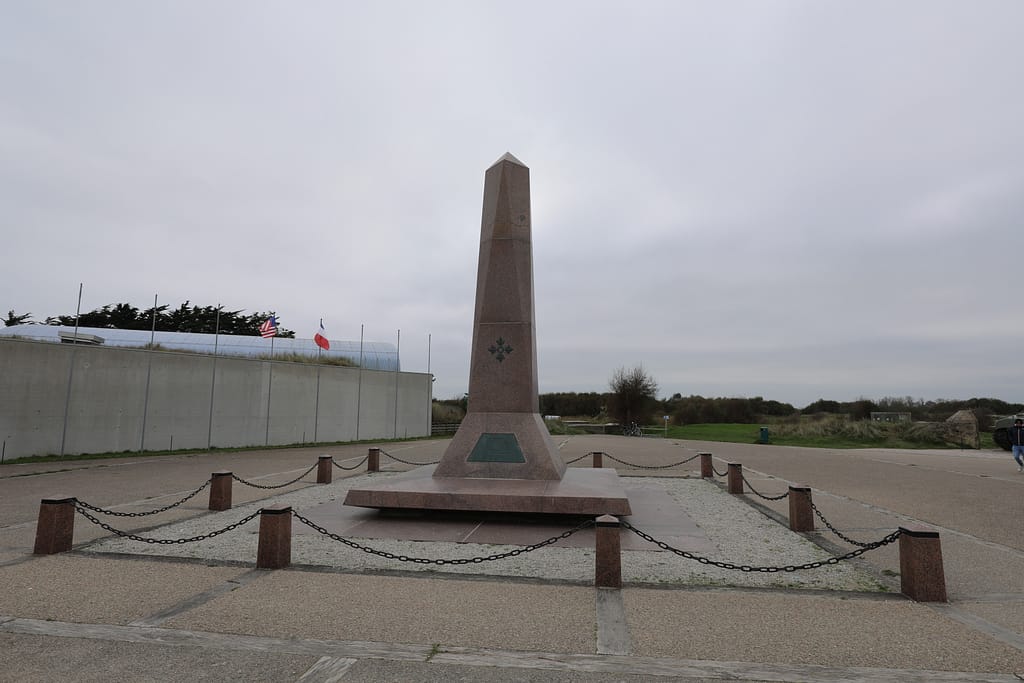
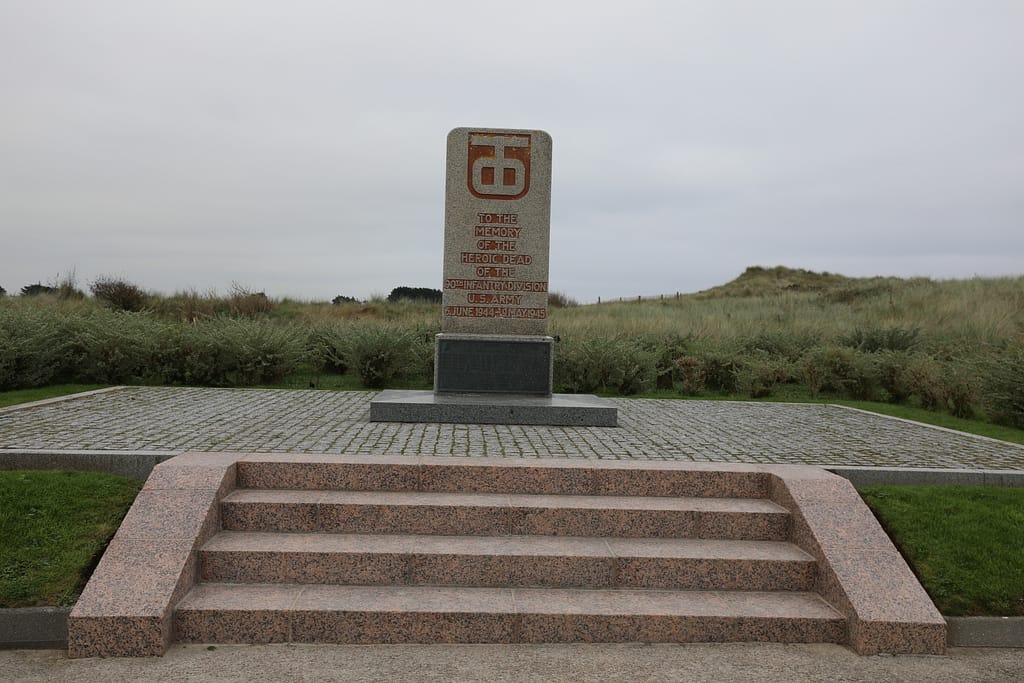
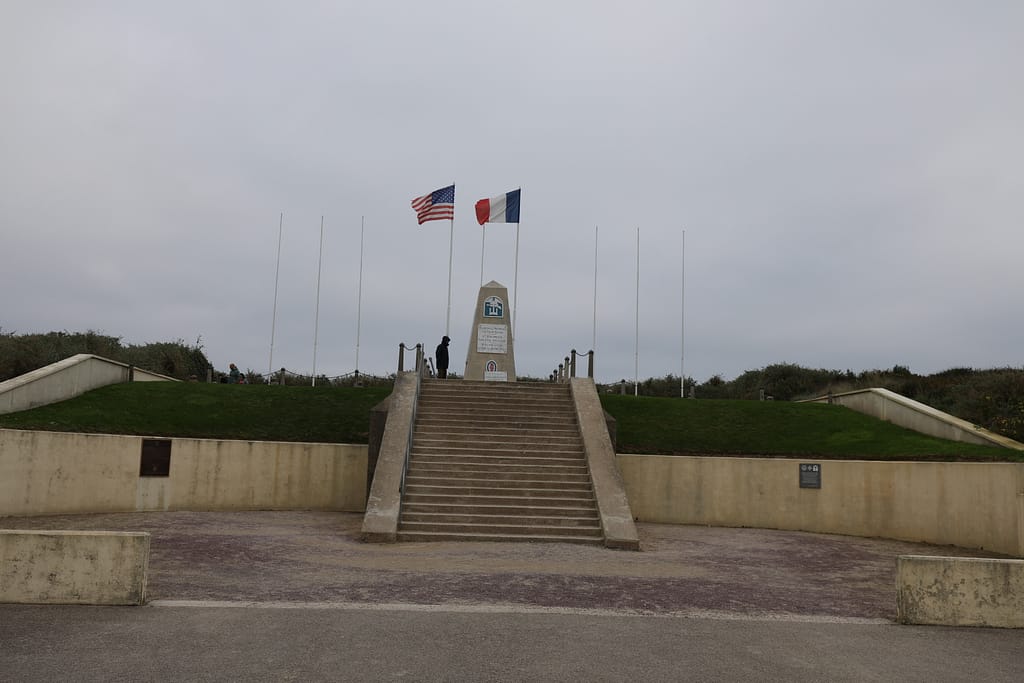
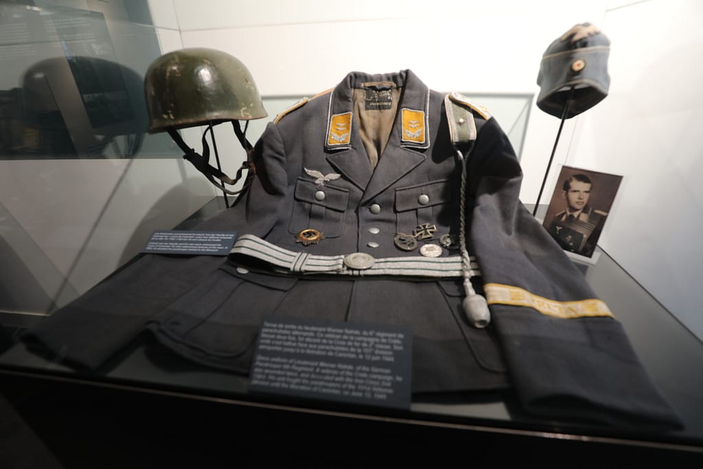
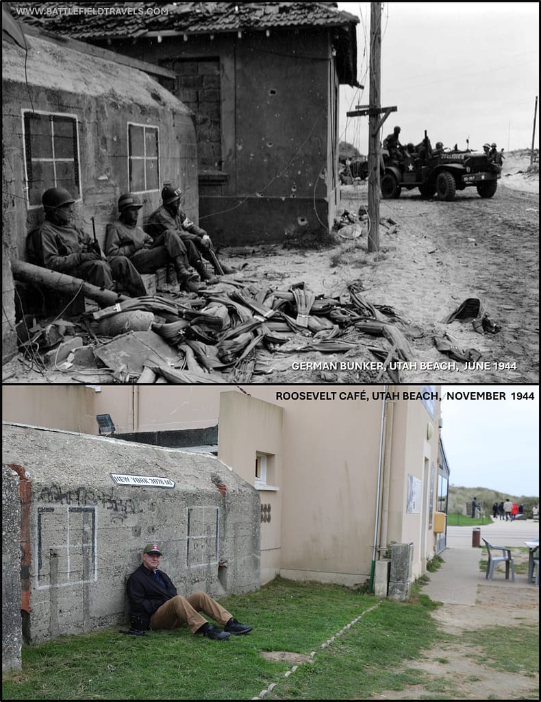
Airborne operations behind Utah Beach
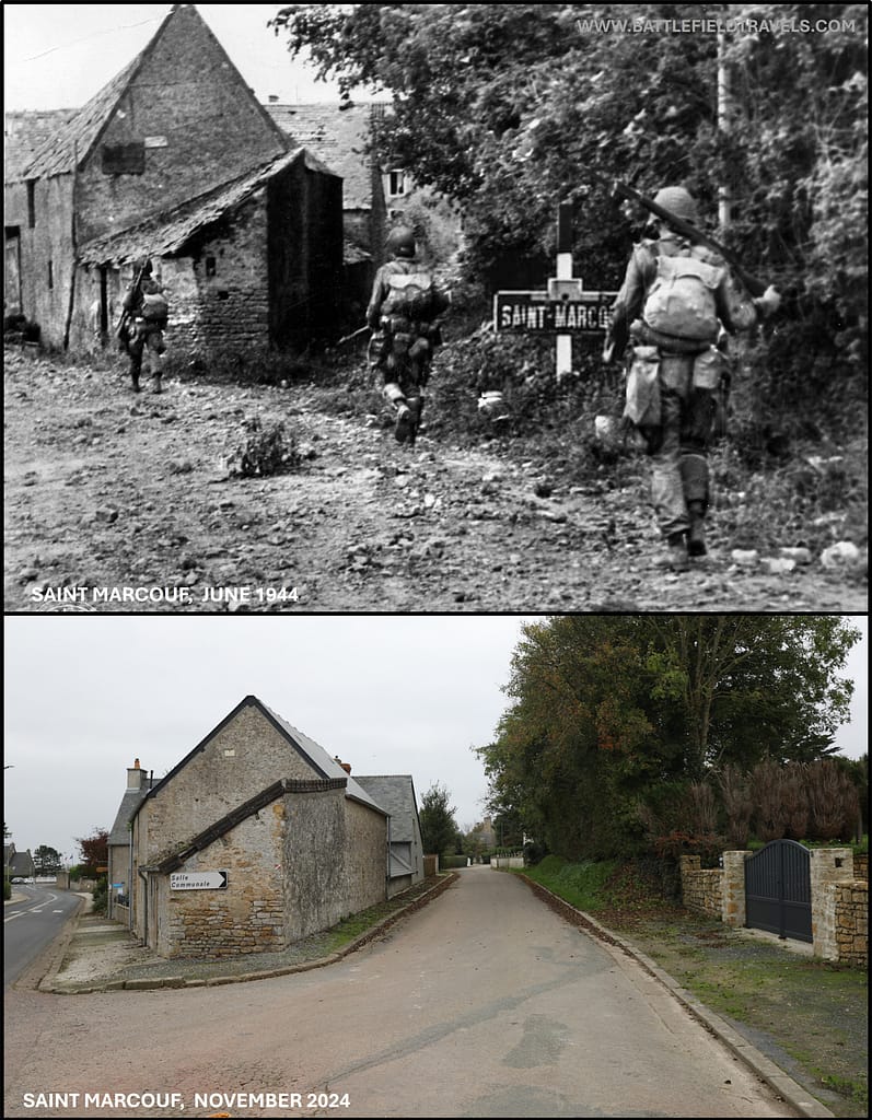
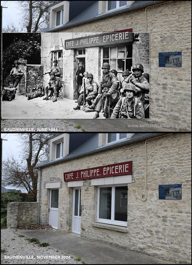
Link to the Utah Beach Landing Museum
Found this useful? Buy me a coffee — it helps fund future battlefield research


Authored by Mick Prictor, a retired military officer with 40 years’ service, and a military historian specialising in terrain-focused analysis of tactics, doctrine, and command decision-making in land warfare. His work draws on extensive battlefield fieldwork—more than 280 sites worldwide—and one of the world’s largest private collections of historic military arms, uniforms, and equipment. About me
❓ Test Your D-Day Knowledge
Twenty questions covering the airborne operations, invasion beaches, commanders, forces and fighting of 6 June 1944.
20 questions · 60% to pass · expect a challenge
Sources – Utah Beach
- L. F. Ellis, Victory in the West, Vol. I: The Battle of Normandy (London: HMSO, 1962).
Secondary Sources (Cited in Footnotes)
- Ambrose, S. E. (1999). D-day, June 6, 1944: the climactic battle of World War II. Thorndike.
- Beevor, Antony. (2009). D-Day: The Battle for Normandy. Penguin Books
- Ryan, Cornelius (1959). The Longest Day: June 6, 1944. Simon and Schuster, New York.
- Hastings, Max (1984). Overlord : D-Day and the battle for Normandy. Simon and Schuster, New York.
- John C. McManus, The Dead and Those About to Die: D-Day: The Big Red One at Omaha Beach (Penguin, 2015).
- Georges Bernage, D-Day Landing Beaches: The Guide (Bayeux: Heimdal, 2009).
- Niklas Zetterling, Normandy 1944: German Military Organisation, Combat Power and Organisational Effectiveness (Winnipeg: J.J. Fedorowicz, 2000).
📚 Further Reading: D-Day landings
This battle study nests within the broader analytical framework explored in the Research Hub, where operational methods, operating environments, armies, commanders, and weapons are examined across conflicts and eras. The links below connect related studies across the wider body of battlefield analysis on the BattlefieldTravels site.
⚔️ Explore all battle studies from World War Two 1939-1945
🏛️Explore the museum of World War Two historic artefacts
The book list for this conflict includes the finest campaign studies, memoirs, and operational analyses available on the D-Day landings, selected specifically to complement this battlefield study.
📚World War Two – Recommended Reading
🗞️ For updates on new battlefield studies and research insights, you can subscribe to the Newsletter.
Related Battle Studies, Museum Pieces & Reading Resources
 ⚔️ D-Day: Brecourt Manor assault, Easy Company, 506th PIR,
6 June 1944
 ⚔️ D-Day: Sword Beach landings,
6 June 1944
 ⚔️ D-Day: 101st Airborne Division and the Battle of Bloody Gulch,
13 June 1944
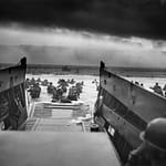 ⚔️ D-Day: Omaha Beach landings,
6 June 1944
 📝 🔒Field Note: XXX Corps Orders, Leopoldsburg, Belgium, 15 Sep 1944
 ⚔️ D-Day: US Airborne Operations, Sainte-Mere-Eglise,
6 June 1944
🧭 Battlefield Travel Guide: Utah Beach
Getting There
- Nearest Towns: Sainte-Marie-du-Mont (inland hub), Sainte-Mère-Église (~12 km northwest).
- Access: From Carentan or Sainte-Mère-Église, follow D913/D67 to the seafront at La Madeleine (Utah Beach Museum).
- Parking: Large free lots at the Utah Beach Museum and along the seafront accesses.
Site Orientation
- Sectors: TARE GREEN and UNCLE RED around La Madeleine, with causeways leading inland across the flooded lowlands.
- Key Landmarks: Utah Beach Museum, memorials to the 4th Infantry Division and Navy, German WN sites, and the beach causeways to Sainte-Marie-du-Mont.
- Best Vantage Points: Dune edge near the museum for a full view of the tidal flat; inland along Causeway #2 toward Les Forges to understand the exit fight.
- Walking Routes: Seafront paths with interpretive panels; short inland drives/walks to causeway bridges, markers, and monuments.
Museums & Visitor Centres
- On-site: Utah Beach Museum — comprehensive coverage of the amphibious assault, with aircraft, landing craft, and a preserved German bunker.
- Nearby: Airborne Museum (Sainte-Mère-Église); Dead Man’s Corner Museum (Saint-Côme-du-Mont) for 101st Airborne context; monuments at La Fière and Chef-du-Pont causeways (82nd Airborne).
On-Site Experience
- Interpretive Signage: Clear outdoor panels at the museum and along the beach; inland plaques at causeways and unit memorials.
- Atmosphere: Broad, low dunes and wide tidal flats; the flooded lowlands inland make the airborne–amphibious linkage tangible.
- Photography: Low tide and early light highlight the distance from surf to dunes and the alignment of causeways.
Nearby Points of Interest
- Airborne Sites: Sainte-Mère-Église church and museum; La Fière causeway and “Iron Mike” memorial; Chef-du-Pont bridge area.
- 101st Focus: Marmion Farm, Angoville-au-Plain church, Ravenoville — all linked to the division’s D-Day fights.
- Broader: Carentan and the causeway battlefields leading toward “Bloody Gulch.”
Practical Tips
- When to Visit: Quieter than Omaha; anniversary week is busy across the sector.
- Facilities: Museum restrooms, café, and shop; services in Sainte-Marie-du-Mont and Sainte-Mère-Église.
- Notes: Inland sites are on narrow rural lanes — park considerately; fields are private property unless signed otherwise.
Subscribe to Battlefield Travels and receive a free E-Book Battlefield Guide
Unlock expert battlefield analysis, campaign reconstructions, and historical insights drawn from firsthand exploration and primary sources.
🗺️ You’ll receive:
🎖️ Exclusive historical insights you won’t find elsewhere
📘 A free eBook: 10 Tips for Exploring Historic Battlefields
📰 New battlefield studies straight to your inbox as they are published

⚔️ Go deeper — Members get exclusive access to the Deep Research Collection, Field Notes, and monthly Research Dispatches. Try membership free for 7 days, cancel anytime. From $9/month.